How does artificial intelligence improve mapmaking?
&w=256&q=90)
How many roads lead to Rome? The ancient parable says all of them, although this is not quite correct. Our estimates say there are a hundred quadrillion routes (that’s a figure with 26 zeros) that could make that journey, and that is just in Europe alone.
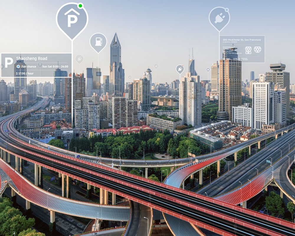
We’ve been busy driving and mapping the roads for many years. Our maps move the world forward every day. They cover over 68 million kilometers of navigable roads in 164 countries and 35 territories.
More than three million kilometers are driven by mobile mapping vans each year. Each of those vehicles has the capability to capture images at 5 million pixels per km at a speed of 700,000 data points per second, to an accuracy of 2cm per km.
Vehicles cannot rely on sensors alone; they need accurate images of the road to improve safety. We use these images, along with lidar systems to help autonomous vehicles to get around unaided.
The images we take are shot at one particular point in time, with one particular type of weather. Of course, we can’t repeat the same process for when it is raining, or dark, or foggy, or for any other weather pattern that Mother Nature may throw at us.
We can’t possibly remap the terrain to demonstrate all these parameters. For that reason, we’re increasingly turning to artificial intelligence (AI) to recreate those conditions for us. Artificial intelligence is key factor for autonomous vehicle development.
Lidar is a laser that is constantly measuring its surroundings by the time taken for a light beam to return to the sensor. In that way it can build up a model of streets and obstructions that along a pre-mapped route.
When obstructions get in the way, such as another vehicle, or bad weather obscures the view, then AI needs to take over to anticipate what could be around the corner or how the road is going to behave.
“Pierluigi Casale
Group Data Scientist, TomTom
Using generative adversarial networks to make better maps
To do this, we literally set one AI system up against the other to create images that are real or fake. It’s a grand game of Call My Bluff, where the AI system has to decide whether the image is genuine. By playing and replaying the process, the algorithm rapidly improves until it can automatically create believable images that were never actually photographed in the first place.
These systems are known as generative adversarial networks (GAN). At TomTom, we started using this technique to create all-weather imagery of all the roads, so we know how to turn sun into showers and day into night. We are creating all weather images for 400,000 km of roads across the world.
But while AI provides an elegant solution to the enormous challenges of mapping the world’s roads in every conceivable condition, we still need to keep the actual images of the road and the physical environment up to date.
Nowadays, devices also have to take into account real-time information about the traffic situation, weather or detours. Modern navigation systems can constantly readjust the route if the traffic situation changes or a traffic jam blocks a major road. Machine learning techniques can anticipate what a traffic jam can do to anticipated journey times, for example.
For future generations of vehicles, navigation will become even more complex. Guidance systems will have to take into account whether the battery charge on an electric vehicle is sufficient to reach the intended destination.
Learning algorithms can also adapt to a driver’s style behind the wheel and get better at understanding it with every journey. A more aggressive style of driving can shorten the range of a journey by up to a third, for example.
Of course, this needs a huge amount of computing power, but we are partnering with Microsoft and utilising the cloud to ensure we capture large amounts of data that can be used in real-time driving conditions.
The wisdom of crowds in creating high-quality maps
It’s almost impossible to map every square inch of the globe manually. Besides, as soon as it is done, then it needs to be redone. Nothing stands still. Road layouts change, new buildings are erected and even the topography can change.
For that reason, we turn to crowdsourcing to ask the general population to keep us updated on any changes. People can use our TomTom apps to send pictures of where reality doesn’t match what we have recorded on our maps, alerting us to send someone out to check and accurately record it.
This is much more effective than ad-funded maps. How can we trust these service providers will always send us the quickest route or if they’ll send us on a detour past one of their advertiser’s drive-thru restaurants?
Paid-for, ad-free mapping providers have the advantage of trust. People know that if they take images of the road and send them to a company that doesn’t advertise, they will be actively taking part in a community that helps everyone – much like Wikipedia.
But we don’t just rely on the community – the team at TomTom also crawl the web on a daily basis to find announcements about changes to the road infrastructure, new building developments etc. It’s the key to how we detect changes and improve maps by using multiple trusted sources.
Keeping data secure
Because of the amount of data we handle, we also have to be very aware of security issues too. One of the biggest challenges with AI is keeping data secure.
We ensure we can anonymize data, so individuals can’t be identified on their location or journeys. It helps prevent knowing when somebody is away from their premises, for example.
AI algorithms can still learn from anonymized data. Once trained, the models can be shared and we can continue to train and enhance the full pool of shared models with new ones. It means the continuous virtual circle of uninterrupted learning continue.
It helps to secure our vision for a safe, connected, autonomous world, free of congestion and emissions. Our mission is to create the most powerful technologies to help shape and solve tomorrow’s mobility issues – and AI is a powerful tool to help us along that path.
“The ultimate aim is to provide the data and information needed for Level 5 autonomous vehicles – those that can drive and operate independently of a human driver. The more information we can gather, collect and utilize, then the closer we will get to achieving that goal and witness a truly autonomous future for vehicles.Pierluigi Casale
Group Data Scientist, TomTom
Which map works for you?
Whether you’re a developer creating the next big location-based app, a city going greener or an automaker producing self-driving cars, we have a map for you.
People also read
)
Behind the map: how we keep our maps up to date
)
Maps only matter if they matter to you
)
How to make HD maps better with AI: EL-GAN for lane detection
* Required field. By submitting your contact details to TomTom, you agree that we can contact you about marketing offers, newsletters, or to invite you to webinars and events. We could further personalize the content that you receive via cookies. You can unsubscribe at any time by the link included in our emails. Review our privacy policy.