)

We rarely pause to think about how navigation apps in our cars and phones find the best route and travel time to our destination. Routing has become so ubiquitous in modern life that we don’t even think about it. Despite expecting the highest levels of accuracy, we never really “look under the hood” to appreciate the complexity of the algorithms that make it possible.
Over a decade ago, TomTom began expanding its business from mapping to cover real-time traffic. The goal was to understand how vehicles move on the world’s roads and then use this knowledge to decrease pollution, improve travel times for drivers by providing them with the most efficient routes and make the roads safer.
Fast forward 15 years and a lot has changed: vehicles are safer thanks to automatic driver assistance systems, road infrastructure has been expanded, navigation systems have become increasingly sophisticated, public transport has increased frequency to cater for the ever-growing daily commuting needs of an increasingly urban population and ride hailing services have grown in popularity.
Crucially, though, the number of vehicles on the road has increased. Even though infrastructure is being expanded, roads are no less congested. Real-time and predictive traffic information has never been more valuable.
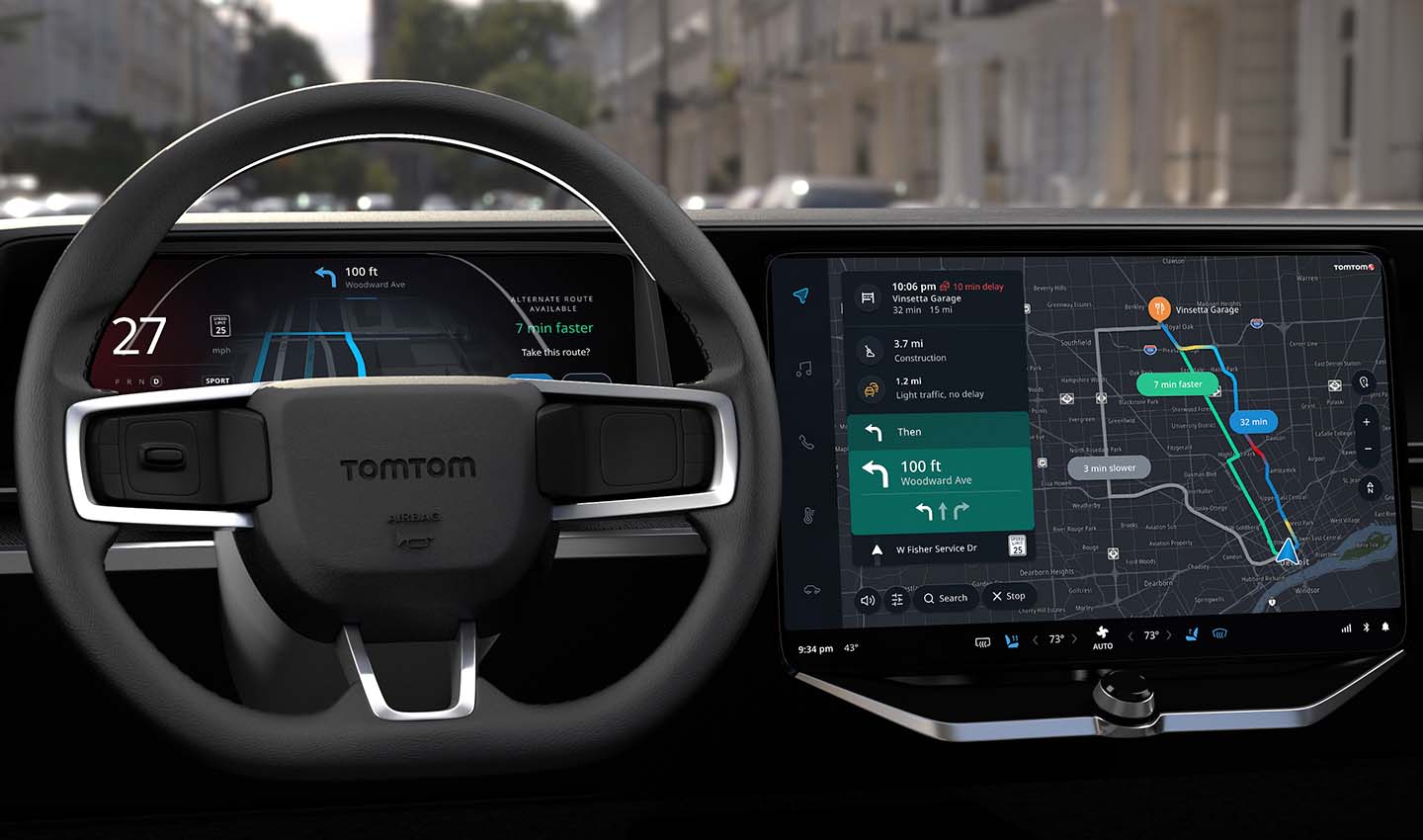
Real-Time Traffic is the result of a combination of two key datasets: Traffic flow, the overall number of vehicles on the road and traffic incidents, the number of “events” on the road.
Predicting traffic flows and events is no easy feat. TomTom observes trillions of data from over 600 million connected, and completely anonymous devices, to see in real time what’s happening on the roads. By combining Sensor Derived Observation (SDO) data, journalistic information such as governmental and other 3rd party data, weather data and Active Community Input (ACI) we can construct an accurate picture of the traffic situation on the road.
On top of this, historical data of traffic flows, further increases the accuracy of predictions. Think of rush hour: we know with some certainty that specific roads will be busy at the same time every week due to the mass morning commute.
The trilogy of predicting traffic incidents
INPUT
The journey to deliver meaningful and incredibly precise traffic predictions starts with data – a lot of data from a wide array of sources.
To provide reliable traffic incident data on 100% of major roads in 81 countries we need data collected from GPS devices in connected cars, trucks, and consumer devices like smartphones. Overall, 61 billion GPS data points from smartphones, in-car systems, personal navigation devices (PNDs) and fleets are collected every day over 3.5 billion km of roads worldwide. Another key input source is SDO, for example for traffic sign recognition to improve the detection of traffic incidents, such as roadworks.
24/7 traffic moderation further helps our drivers to safely navigate in unforeseen events such as wildfires and flooding, as these events result in highly dynamic and challenging road conditions.
Using this data, we can paint a picture of traffic flow and density in real-time and predict not only traffic jams but also road closures, roadworks and detect accidents.
Alongside sensor and GPS data, Active Community Input (ACI), where drivers report and (in)validate road events, can confirm and correct map content with direct feedback from the real world. Data from government sources like scheduled road maintenance, weather forecasts and current road speed limits can further enhance the detail and effectiveness of traffic incident prediction.
On top of those data sources, contextual information helps to sharpen automatic incident detection and make it more conscious of events that can affect travel times and road closures such as sports matches, road-closing marathons, hurricanes, border closures and other natural events.
Increasingly, data with accuracy down to a single carriageway will be added to support the next generation of traffic services, including lane level navigation and advanced driver assistance systems (ADAS/AD).
FUSION
All this data, however, is meaning-less if it’s not analyzed and interpreted to extract knowledge that can be used by its consumer – the everyday driver. Modelling traffic using 15 years of experience, state of the art AI and machine learning is what does the trick here – especially when rapid changes happen, as was the case of last year’s border closures in the EU and US due to COVID-19.
Traffic models use historic data, contemporary data and real-time information to produce a new overview of traffic flows and incidents at the very latest every 30 seconds. In other words, every 30 seconds, TomTom’s algorithms take into consideration current and historic traffic and road speed profiles and process them to predict the likelihood of incidents and impacts on drive times.
DELIVERED VALUE
When all this data is collected, analyzed and provided to drivers, they are provided with meaningful, actionable and reliable insights into the road ahead. It solves a very real challenge: How to navigate when faced with changing traffic conditions.
Think of the following example: a driver regularly travels from A to B. They travel at different times of the day year around. How can they ensure they’re always on time regardless of traffic?
Every time this journey is taken, TomTom’s traffic technology suggests a different solution based on the changing state of the roads traveled on. That solution will be built around three key elements: route planning, route selection, and route completion.
Route planning considers when the best time to leave will be. Even for routes planned weeks or months in advance. Scheduled events such as marathons, sports events or festivals that will affect traffic flows and travel times are also taken into consideration.
Route selection decides the optimal way to get from A to B. This ensures that the most appropriate roads are taken to guide drivers around traffic jams, road works and predicted delays to ensure smooth passage to the destination.
Route completion takes an active look at the conditions the current driver is experiencing while driving. Considering if they are still taking the best route and what can be expected ahead.
In this solution, TomTom technology constantly updates travel times and predicted delays to inform the driver and ensure they reach their destination with as little disruption as possible.
In all cases though, TomTom’s Traffic APIs can service a multitude use cases from mobile apps and in-dash navigation to traffic centers and infrastructure operators.
Technological development is also further contributing to making our roads safer, and with that the need for relevant, lane-granular, traffic incident information is increasing. One thing is for sure, for now, traffic is here to stay, but the burdens it creates can be eased by using location technologies to increase safety, efficiency, and the timeliness of every drive.
Learn more about TomTom Traffic APIs for navigation, download End-User Traffic product sheet and contact us
People also read
)
How to gain back time: The mystery of travel time accuracy debunked
)
How traffic impacts navigation: 4 insights on real-time and predictive flow
)
How TomTom and its partners help road authorities solve traffic challenges
* Required field. By submitting your contact details to TomTom, you agree that we can contact you about marketing offers, newsletters, or to invite you to webinars and events. We could further personalize the content that you receive via cookies. You can unsubscribe at any time by the link included in our emails. Review our privacy policy. You can also browse our newsletter archive here.