)
Satellite imagery gives real-world context to geographical information, so it’s no surprise that fleet operators, and their software development teams, find it extremely useful. The extra detail increases efficiency, saves money and gets deliveries where they need to be, on time. TomTom now offers satellite imagery as part of its Maps APIs.
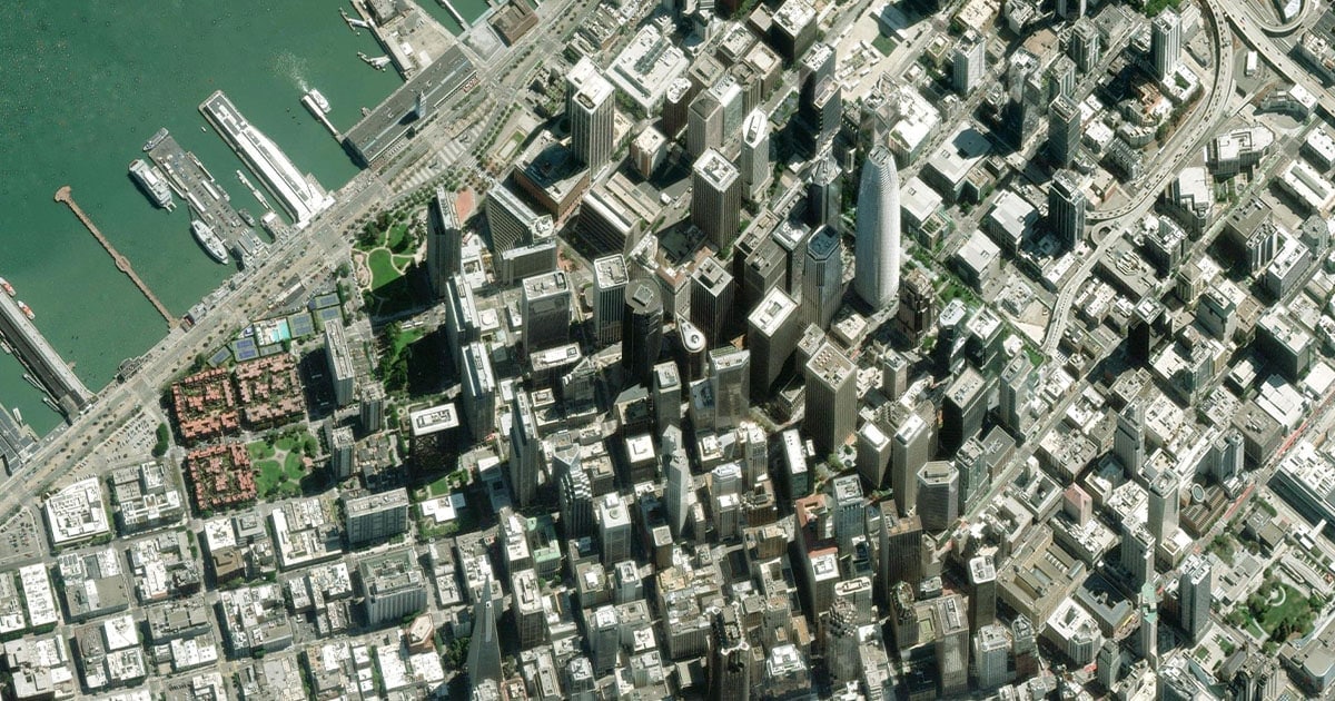
TomTom’s satellite image tiles, powered by Maxar — a company known for its Earth observation and satellite data technology — were captured in 2021 or later. With a 30 cm resolution, they bring vivid detail to roads, buildings, loading bays and other fine details often not visible in other map views.
Naturally, satellite imagery brings extra layers of contextual insights into what drivers face when out on the road. For fleet and logistics companies, this presents a massive advantage, as understanding the real-world context of locations leads to smarter, more informed decisions.
Fleet managers will be able to use satellite views to preempt possible hazards or obstructions on their drivers’ journeys before they set off. Alongside historical traffic data and road network overlays, fleet operators can then plan safer, faster and more efficient routes for their vehicles. Once trips are complete, satellite imagery can inform more detailed post-trip analysis, too.
The high-level of resolution also allows delivery companies to plan routes not just to distribution hubs, but to specific loading bays. They can choose the best entry route to the hub, avoiding narrow streets and sparse driveway access. The driver can be given exact and precise instructions to complete their delivery, eliminating wasted time and unnecessary frustration.
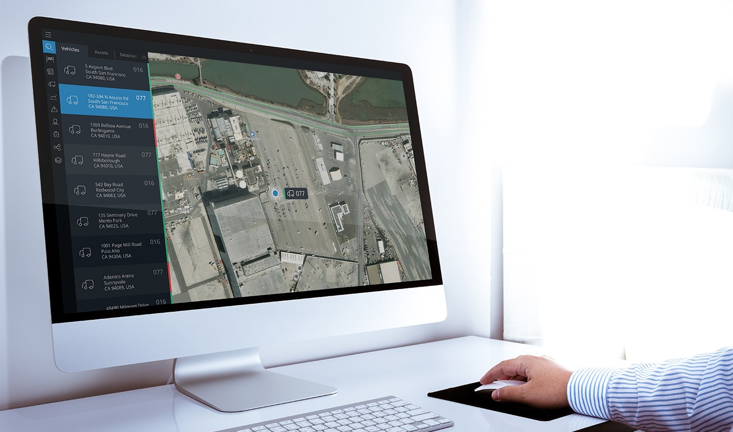
Zooming in with satellite imagery. Fleet operators are able to see exactly what drivers are dealing with. If they break down, or get stuck behind another vehicle, fleet support can direct them around obstacles and remain conscious of the real-world challenges the driver faces.
In extreme cases, where drivers are stranded due to unexpected hazards, diversions or if they’ve broken down, support staff can use physical reference points -- ones that the driver will be able to see too – to understand the problem and solve it faster.
Delivery networks in the UK, Europe and the U.S. are strained by driver shortages. Increasing trip efficiency, then, is paramount — not just for fleet companies but also the people waiting for their packages. Using satellite imagery as part of trip planning and analysis is crucial to realizing that.
Satellite imagery as part of a mapping solution brings real-world detail that’s otherwise not seen.
TomTom is making satellite image tiles available as part of its Raster Tile service, accessible within the Map Display API. They can be used on their own or can be combined with other vector tiles to overlay road networks, map labels and points of interest, to help developers create specialist location-based fleet tools.
Are you a developer? Or do you work in fleet and logistics? Click here to learn more about how to integrate satellite tiles into your mapping setup with Map Display API. Or head over to our Dev Forum if you’ve got more technical questions.
People also read
)
The Boise boom: How mapmakers keep on top of boomtowns
)
Navigation: How did we get here and where are we heading next?
)
How to make ETAs accurate for your business
* Required field. By submitting your contact details to TomTom, you agree that we can contact you about marketing offers, newsletters, or to invite you to webinars and events. We could further personalize the content that you receive via cookies. You can unsubscribe at any time by the link included in our emails. Review our privacy policy. You can also browse our newsletter archive here.