


)

The business of insurance is a business of balance. If insurers price policies too high, they risk losing customers. At the same time, if policies are priced too low, losses pile up and profitability suffers. How do insurers strike the right balance?
For years, auto insurers have resorted to increasing prices to ensure profitability stays high. But price competition is rising, customers are increasingly price sensitive and regulators are monitoring pricing practices very closely, which means maintaining profitability while staying competitive is more challenging than ever.
“It's widely known that commercial auto insurance is brutally, brutally hard,” says Vinod Poomalai, TomTom’s Head of Product Marketing, Insurtech, “Out of the top 20 commercial auto insurance providers in the U.S., 14 make losses today.”
In an industry known for its low margins, charging more isn’t the answer. Instead, insurers need a better understanding of risk, which will improve policy decisions across the entire value chain.
How insurance works
At its core, insurance is about predicting and managing risk — from pricing and underwriting policies to assessing and paying claims. In auto insurance, this starts with estimating how likely a driver is to be involved in an accident. To do this, insurers rely on historical claims data, statistical models and a set of proxy variables about the driver — age, vehicle type, postcode, education level — to estimate how likely it is that the driver makes a claim.
This estimate defines everything from the premium a customer pays to how losses are absorbed in case of claims. If insurers get this right, they can price policies competitively while keeping loss ratios under control. On the other hand, failure to estimate risk accurately leads to mispriced premiums, higher claims costs and reduced profits.
That’s exactly what happens with traditional pricing models. But now, insurers can move on from the broad, generalized models that rely heavily on static assumptions and take real-world, dynamic complexity into account, with location analytics.
 Contextual data helps auto insurers go beyond broad criteria such as postcodes and estimate risk based on more granular details such as junction complexity.A single postcode might include a quiet residential street and a congested arterial road with complex junctions. From a driving risk perspective, those environments are significantly different. Yet in many traditional models, they’re treated the same. This lack of granularity costs the insurers valuable profits. An ability to differentiate the risk across these granularities is where success in modern insurance lies.
How do you move beyond proxies?
Today, insurers are waking up to the potential of data that reflects real risk to help them move beyond static proxies. For many, finding the right data remains a problem, though.
“Speaking to a variety of insurers and insurtech companies, we’ve found that more than half of them report poor-quality data and incomplete data and analytics as their main challenge,” says Vinod.
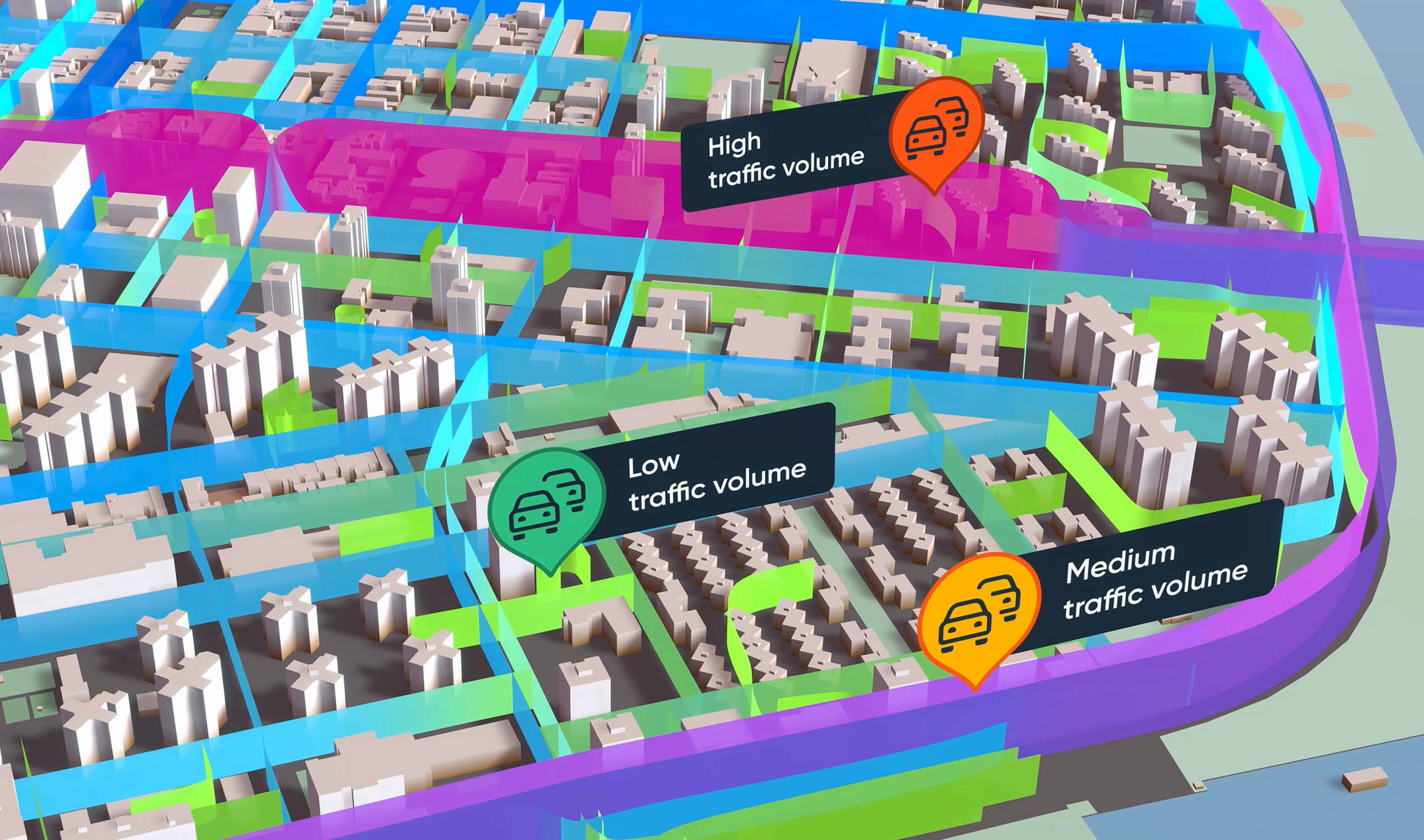
In-depth location analytics and traffic data arms insurers with insights on traffic volumes, congestion patterns, speed variability, the slope or curvature of the road, how busy it gets at different times of day and more, adding a crucial layer of context to their risk assessment models. This allows them to assess the risk of a road or area much more accurately and offer coverage that reflects reality.
Why precision matters
When risk is only partially understood, low-risk drivers can end up subsidizing higher-risk ones, which can cause customer churn. This makes pricing less competitive and insurers are forced to rely on premium increases to protect margins, which are highly sensitive in the industry.
Vinod says that customers who incorporate TomTom’s data in their territory risk scoring see over 2% improvement in their loss ratios. While this number may seem small, considering the scale at which insurers operate, it leads to significant gains in loss ratio performance and more resilient profitability.
Better data, smarter insurance
This shift toward real-world, contextual data is also accelerating new insurance models, such as usage‑based insurance (UBI) policies. Usage‑based auto insurance aims to price drivers based on how they drive. Traditionally, telematics data captures behavior — acceleration, braking, speed — but that alone doesn’t tell the full story. Location data adds crucial context about where the behavior occurred, and what else was happening when the incident occurred.
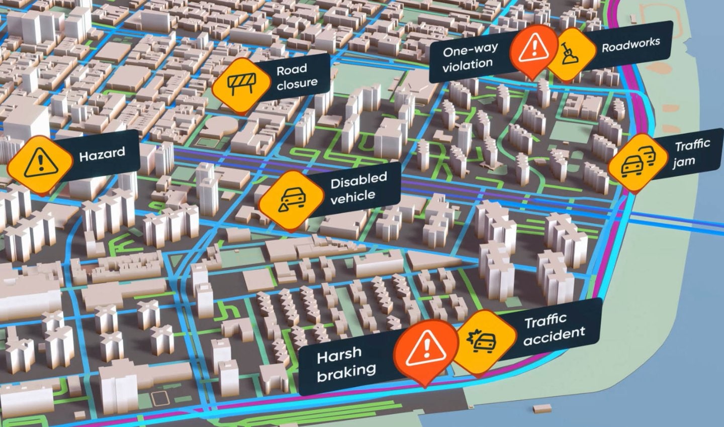
A harsh brake in an empty parking lot could simply mean avoiding a rogue shopping cart. But when it happens on a busy road, where there are well sign-posted roadworks and tailbacks, it could signal risky driving behavior. Without that additional context, both look the same.
“Location data adds context to certain driver events and, when paired with telematics, it becomes super important for driver scoring. Simply using telematics data without this context can lead to incorrect assumptions about why your driver is acting a certain way,” says Vinod.
By enriching telematics with traffic and road intelligence and points-of-interest data, insurers can distinguish between genuinely risky driving behavior and responsible reactions to external conditions. This important distinction can help them score drivers more accurately, price policies fairer and even generate greater trust in UBI programmes.
Claims are another area of the value chain where precision pays off. Traditionally, claims validation relies on a patchwork of inputs: statements, reports, telematics (when available) and, increasingly, video. These sources can be incomplete, delayed or contradictory. Location analytics adds an independent layer of verification.
For example, if a claim tagged at a certain location says there was heavy traffic, customers can look at historical data and check if that was actually the case.
By analyzing traffic conditions and road context at the time and place of an incident, insurers can answer critical questions:
Were the roads congested or was traffic flowing freely?
What was the road layout?
Do the circumstances illustrated by the data align with the claim?
With these answers, claims assessment goes beyond determining plausibility and is instead able to verify with data-backed evidence, helping insurers reduce fraud, resolve claims faster and improve customer experience for legitimate cases.
Adopting real-world data: From awareness to action
Insurers today are beginning to recognize the value of better data, but few know how to use it to improve their pricing, underwriting and claims workflows.
At the same time, insurers face pressure from tight margins, intensifying competition and regulatory demands for greater fairness and transparency. With data availability and analytics capabilities advancing rapidly, those who can keep up with the speed of technology have a competitive edge in the industry.
A granular understanding of risk can help insurers rebuild their processes from the ground up — so they no longer have to raise prices as a way of improving loss ratios. Instead, they can now price better and create a more profitable business model that stands the test of time.
People also read
)
Is your neighborhood restaurant driving up your premium? How location data shapes insurance pricing
)
Turning uncertainty into evidence: How contextual data transforms insurance claims validation
)
Technology to reshape road safety for everyone
)
Traffic data: The key to effective road traffic management
* Required field. By submitting your contact details to TomTom, you agree that we can contact you about marketing offers, newsletters, or to invite you to webinars and events. We could further personalize the content that you receive via cookies. You can unsubscribe at any time by the link included in our emails. Review our privacy policy. You can also browse our newsletter archive here.