)

It takes the world to map the world. TomTom believes in the strategy of collaborative mapmaking, and this has resulted in our mapping solution – Orbis Maps. We've continued to work on creating the most accurate map with continued partnerships, ingestion of data sources as well as the support from thriving mapping communities across the world.
At TomTom, our mission extends beyond providing accurate navigation and state-of-the-art mapping services; the members of the Community & Partnerships Team are dedicated to collaborating with our partners and open mapping communities globally.Empowering communities through OpenStreetMap
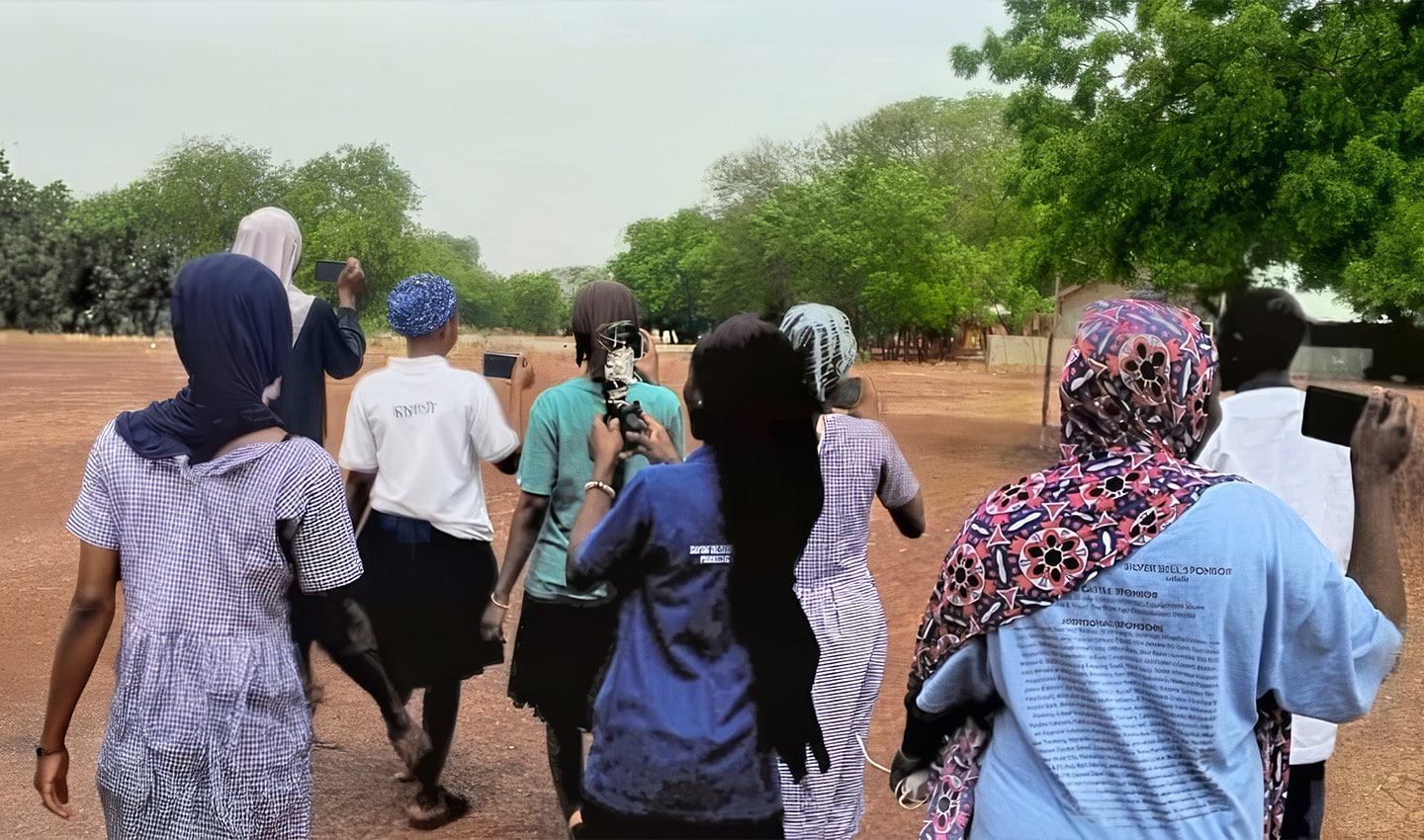
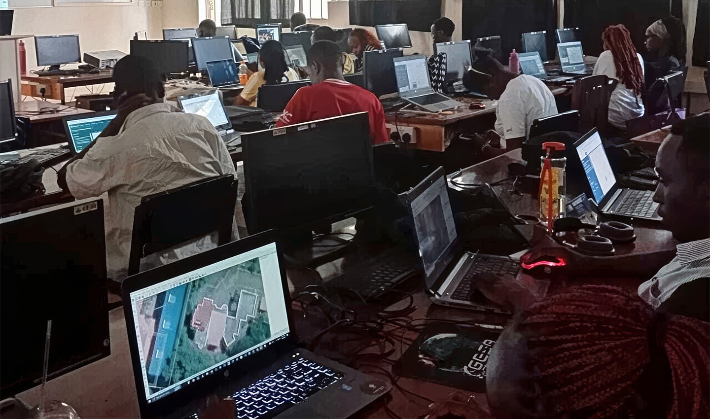
One of the key pillars of our commitment is our active involvement with OpenStreetMap (OSM) communities worldwide. By collaborating with OSM contributors, TomTom helps to ensure that available map data is not only accurate but also reflective of the local needs and priorities of their respective communities.
Initiatives like road network data improvements, mapping public and commercial services, buildings and critical infrastructure are efforts on OpenStreetMap that improve the quality and the currency of TomTom products. At the same time, these datasets also play instrumental roles in initiatives focused on community resiliency, public safety and awareness and preparedness against potential hazards. These open datasets assist local governments and organizations in identifying potential risks, thereby allowing for preventive measures to be implemented before incidents occur, resulting in strong and resilient communities with access to crucial information towards public safety.
We are actively collaborating with local communities in Ghana, Zambia and the Netherlands Antilles on mapping projects to support resilience building, smart city development initiatives and disaster preparedness.
“Shaundrea Kenyon
Director of Community & Partnerships, Maps at TomTom
OpenStreetMap communities worldwide, since the start of 2025, have contributed to more than eight million edits in OpenStreetMap through TomTom’s engagement program. With the support of TomTom towards improving the overall quality of the data and the community contributions, OpenStreetMap datasets have seen major quality improvements in 2025 at countries like India, South Korea, Japan, Nigeria, Kenya and Indonesia. 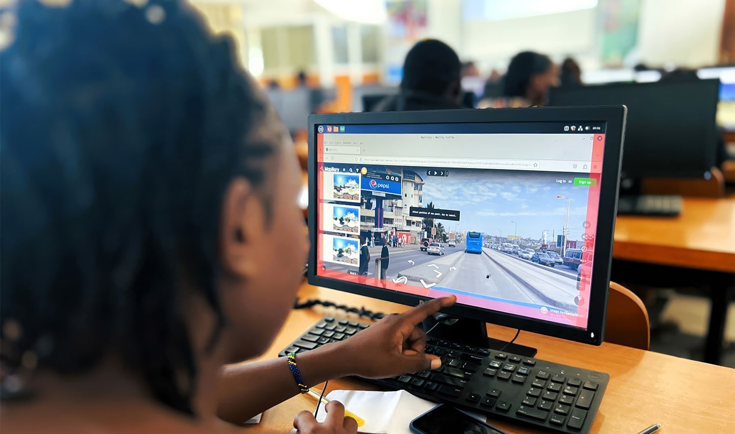
Supporting public safety and resiliency with advanced technology
In addition to our contribution to the development of open datasets for humanitarian context, the potential impact of these efforts and initiatives can be furthered with TomTom’s advanced products and services. With TomTom Traffic and the comprehensive datasets within TomTom Orbis, communities can be empowered to anticipate and respond to emergencies faster, manage and allocate resources using real-time data-driven decision making and gain a clearer view of the flow on the ground.
These together would give planners and responders valuable situational awareness, resulting in faster and smarter critical decisions taken during emergencies. These tools assist local governments and organizations in identifying potential risks, thereby allowing for preventive measures to be implemented before incidents occur.
Even after the incidents occur, these solutions still can provide invaluable support. In 2023, following the major earthquakes that struck the Southeastern parts of Türkiye on February 6, TomTom Traffic services provided grounds for the decision makers to identify functional or blocked roads, valuable insights on alternative routes for access or evacuation, and much needed information for organization in the logistical planning of aid and relief efforts.
TomTom has become the largest corporate contributor to the post-earthquake mapping efforts on OpenStreetMap during this period. You can read more about the efforts and initiatives here and the details of our partnership with the Humanitarian OSM team here.
Join us in enhancing safety
At TomTom, we believe that empowering communities is a shared responsibility, and we invite our customers and partners to join us in addressing these critical issues. By partnering with TomTom, you will become part of a collective effort to create safer environments for everyone. Whether through leveraging our mapping services, integrating real-time data solutions or collaborating on community initiatives, your involvement can make a significant difference.
Together, let's prioritize resilient communities with better data and work towards a future where individuals and communities can thrive in secure and supportive environments. With TomTom by your side, we can navigate together the path to a safer world.
For more information on our activities and to explore ways to partner with us, please visit our Community & Partnerships page.
People also read
)
The latest on Orbis Maps: Zooming in on the largest map database in the world
)
Maps are the unsung hero of modern tech
)
Why are there so few global mapmakers?
)
Mapping for a better world: How YouthMappers helps in crisis and development
* Required field. By submitting your contact details to TomTom, you agree that we can contact you about marketing offers, newsletters, or to invite you to webinars and events. We could further personalize the content that you receive via cookies. You can unsubscribe at any time by the link included in our emails. Review our privacy policy. You can also browse our newsletter archive here.