)
Cities are alive. They are the beating hearts of society, centers of culture, commerce and connection, and yet, we are failing to strengthen their pulse. As urban areas grow, so do their challenges: congestion, pollution, inefficiency, stress, and the broader issues of mobility, efficiency and sustainability. But it doesn’t have to be that way.
With advancements in technology, we have the opportunity to create the city of the future, where space is more accessible and designed to enhance quality of life, and where movement is seamless and adaptable. However, it’s us, the people, who must make conscious and concerted efforts to change our cities. We have the technology, the maps, the data, the understanding, but now it's time to put them into action. We need to start trying things, embracing trial and error: test, measure, react and test again. We must be bold in our decision-making.
As we at TomTom map the cities of the world our maps begin to show something beyond simply streets; we uncover possibilities. As a result, a vision of progress is emerging where transportation networks operate efficiently, roads respond dynamically to demand and data-driven insights uncover unexpected insights for urban planning. This vision becomes the objective — to create cities that function in harmony with residents, businesses and visitors alike, instead of becoming massive car parks. No longer are we left wondering what we must do to improve traffic flow, reduce congestion and make our cities more livable. For the first time in history, we can make changes and see their impact immediately. The tools have never been better for making swift, impactful change backed by data that challenges our own biases and beliefs.
Watch Carlos Moreno, Professor and creator of the 15-minute city explain the concept
Where do we start designing the city of the future?
There are several design theories proving popular with city planners and governments around the world, the smart city and the 15-minute city. As foundational principles, they begin to guide decision-making and provide benchmarks for cities of the future. These ideas offer practical frameworks for creating more connected, efficient and livable urban spaces.
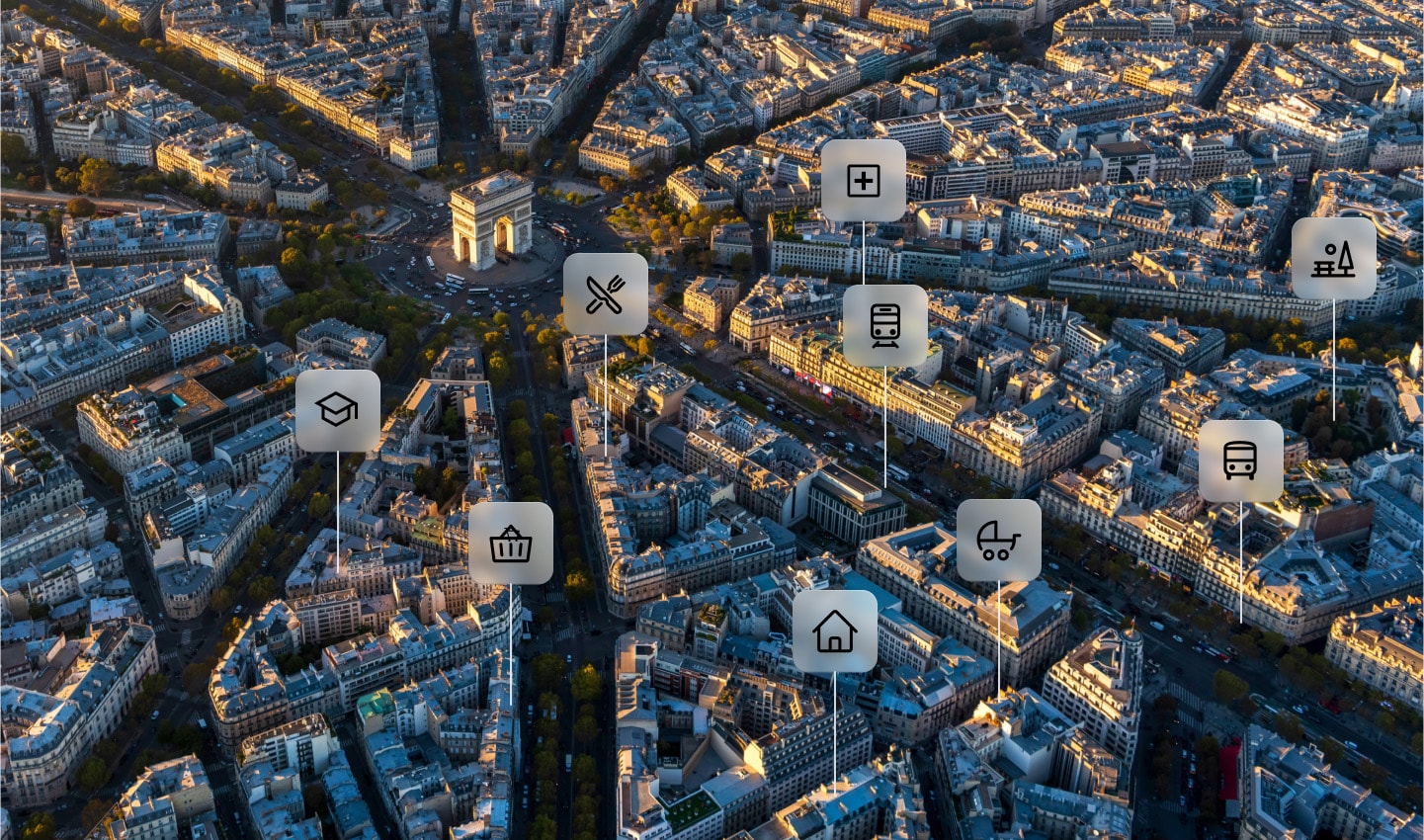
A Smart City is more than just technology. It’s a philosophical mindset, an approach to urban development that commits to rational improvement and data-backed choices. A truly smart city doesn’t just add technology for the sake of it, rather it uses insights derived from tech to make intentional meaningful changes. It efficiently manages traffic, optimizes space allocation and ensures that all modes of transportation are integrated to maximize accessibility and convenience.
The 15-minute city builds on this vision from a structural perspective. It offers a concrete approach to city design where essential services, workplaces and leisure activities are all within easy reach. This reduces unnecessary travel time and the separation between life, work and leisure. The result is a higher quality of life for all residents and closer communities.
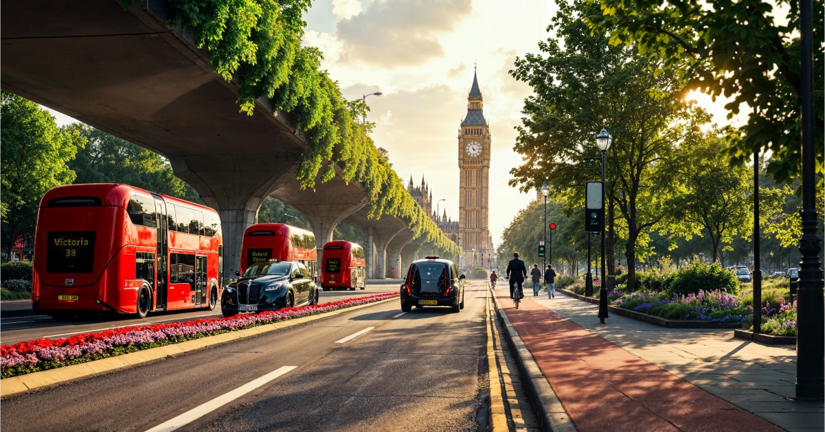
These visions are not distant, utopian dreams. They are already in motion. Cities like Amsterdam, Copenhagen and Paris are rethinking how space is used and demonstrating how bold and intelligent urban planning can lead to more efficient mobility and a better quality of life. But it takes time.
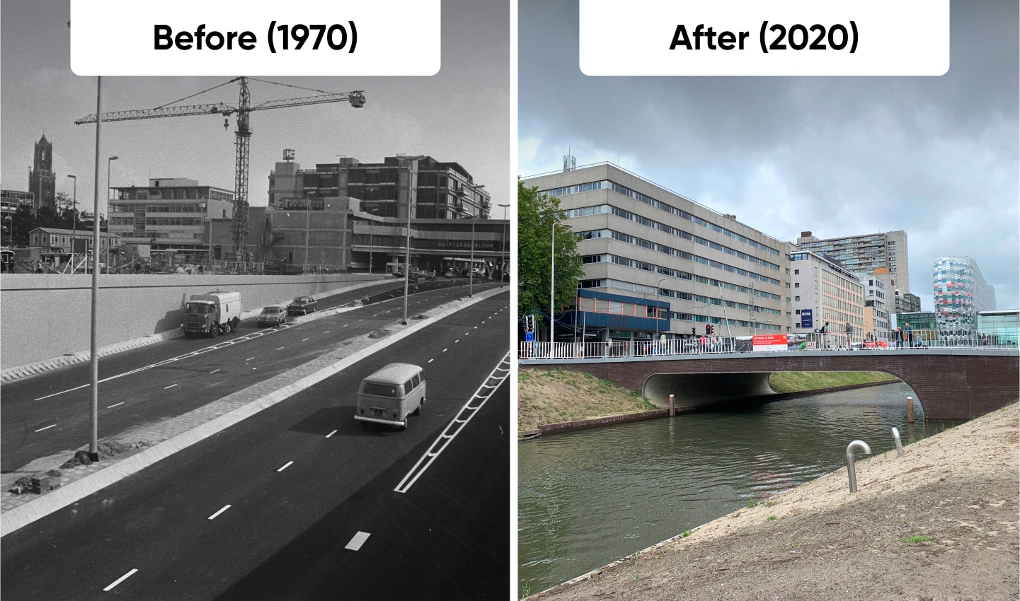
The Dutch have been redesigning cities to make them less car centric since the Kindermoord protests of the 1960s, when public outrage over child traffic deaths forced change. Streets once ruled by cars were rebuilt for cyclists and pedestrians. Presumed liability and other legal frameworks were put in place to further protect the most vulnerable road users. And dedicated bike lanes, car-free zones and investment in public transport put people at the center of city life.
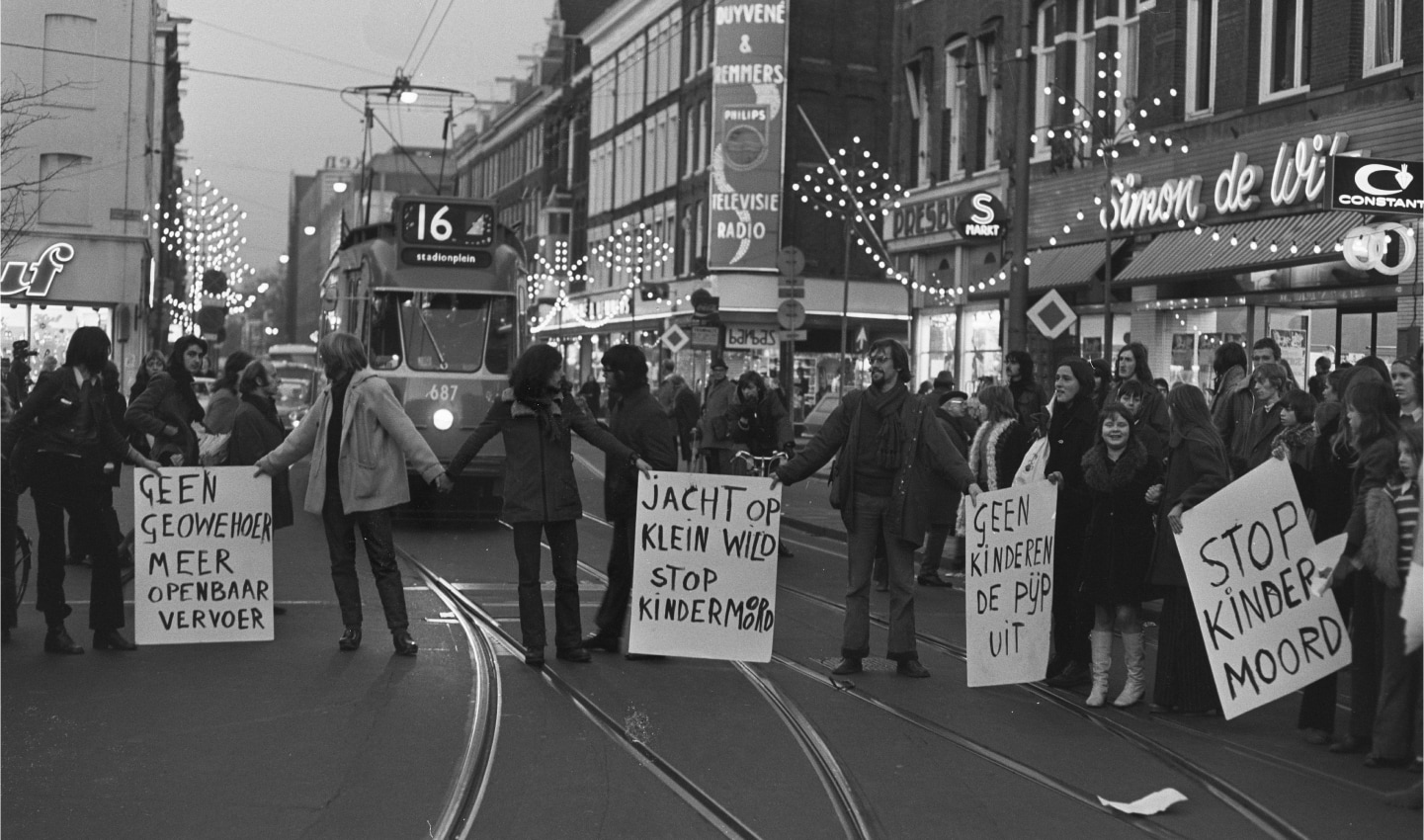
Change didn’t come easy. It took decades of advocacy and regulation, and lobbying against resistance. Now, most Dutch people see driving short distances as unnecessary, even ridiculous — bikes, buses and trams are the norm, and driving is a useful luxury. The result is cleaner air, safer streets and a city designed for movement, not congestion.
Lowered congestion, less noise, less chaos and ultimately less stress is what people want. To get there, we must first understand the status quo — what are our cities like now and what are the most pressing problems to address.
Understanding traffic and congestion
Traffic congestion is a persistent challenge in cities worldwide, influenced by infrastructure, human behavior, weather and policy decisions. By its simplest definition, congestion is caused when the number of vehicles on a road exceeds that road’s capacity — delays increase, commutes lengthen and emissions rise. Congestion manifests in different ways — regular rush hour slowdowns, unexpected bottlenecks from accidents or construction and inefficiencies caused by outdated traffic management systems — but its negative impact is always the same.
Ralf-Peter Schäfer, TomTom’s expert in traffic and mobility, explains that congestion isn’t just about the number of cars on the road, though. External factors such as weather conditions, road incidents and shifting work patterns also play a role. The rise of remote work, for instance, has altered traffic dynamics, reducing congestion in some areas while intensifying it in others. Effective traffic management requires a nuanced approach — one that moves beyond traditional road sensors and embraces real-time data to monitor and respond to shifting patterns.
[Read: In 2024, the single worst day of traffic was the result of bad weather. Find out more here.]
Growing our understanding of road conditions is increasingly important and traditional road sensors aren’t enough, as they only focus on one location and typically track only how many cars pass over them.
This has downsides, particularly when traffic is gridlocked — the number of cars passing a sensor may be low because traffic is moving so slowly, which gives the impression that there’s not much traffic. To provide deeper insights real-time data is needed to monitor traffic patterns across entire road networks in real time. Doing so we can uncover trends, analyze traffic patterns and measure the impact of changes in traffic management over an entire city.
Schäfer also points out that while some cities have successfully reduced congestion through measures like congestion pricing and improved public transport, traffic remains a global issue. And simply reducing the number of vehicles won’t solve the whole problem. Cities need to make better use of existing road space and employ adaptive traffic management strategies that adjust as needed. Smart traffic signals, dynamic lane usage and improved multimodal integration can all help optimize urban mobility. But how these should be applied varies from city to city and must consider the location’s unique challenges.
Traffic data plays a crucial role in understanding and addressing these challenges. Ralf-Peter speaks on the importance of scalable, data-driven approaches to traffic monitoring. "Where you have no sensor, there's no data, this is the fundamental challenge."
Ralf-Peter also highlights that, despite some cities managing change effectively, "congestion is still a problem, to begin to change you need to understand the status quo.” By analyzing congestion trends and peak travel times, cities can make informed decisions on how to improve infrastructure and policy interventions. “Start with the data,” Ralf-Peter says.
[Read: From manual counts to big data and beyond, the limitless possibilities of traffic data.]
The TomTom Traffic Index: A window into urban mobility
At TomTom, we’ve been measuring and reporting on the status quo for 14 years in the TomTom Traffic Index.
The TomTom Traffic Index provides a comprehensive look at traffic patterns worldwide, offering valuable insights into congestion trends across major cities. The index reveals key metrics such as time lost in traffic, peak congestion hours and the impact of interventions like low-emission zones and speed limit reductions.
Recent data has shown that cities implementing intelligent traffic management solutions and reconfiguring urban spaces are making measurable progress in reducing congestion and improving overall mobility. Put simply, we know what we need to do to change and improve our cities, the biggest challenge is doing it.
“Ralf-Peter Schäfer
VP Product Management Traffic and Travel
Combining traffic data with predictive modeling alongside mapping tools like TomTom’s Orbis Maps city planners can gain a clearer spatial understanding of traffic flows and characteristics. With that, they are empowered to make informed decisions that enhance mobility, improve air quality and create more livable spaces.
Every city is unique. Changes that reduce traffic in one city won’t necessarily work elsewhere. But we can still learn from cities that are succeeding and understand how they addressed challenges to replicate their progress.
So, what can be learned from cities that have successfully reimagined their mobility systems? How can urban design be optimized to accommodate a growing population while maintaining fluid movement? The answers lie in innovative planning, smarter infrastructure and a commitment to building cities that work for everyone.
When asked how we can begin to beat traffic, shifting human behavior through a mix of passive and active strategies is something Ralf-Peter discusses at length. Passive methods such as optimizing traffic light timing or reducing speed limits create conditions where drivers are forced to adjust their habits. These don’t demand conscious choice because drivers must comply with the new system.
Active methods, on the other hand, involve persuasion, motivation and nudging people towards desirable behaviors. These include initiatives such as incentivizing public transit use with reduced fares or improved service or building bike lanes to make cycling more desirable.
The balance between incentives (encouragement) and disincentives (penalties) is crucial in city planning as it determines whether people feel pushed or instead guided toward change. Rather than a strict binary of reward vs. punishment, Ralf-Peter suggests a considered approach balances approach, one that recognizes how urban design itself can subtly influence choices, rather than reducing speed limits, design the road so people naturally drive slower.
Urban design has always been shaped by the needs of its time. Ancient cities like Rome and Athens were built for walkability, with markets, homes and public spaces clustered together. The industrial revolution brought rapid urban expansion, leading to more structured road networks and the rise of mass transit systems. The 20th century, however, saw cities increasingly designed around cars, with highways, sprawling suburbs, and commercial centers accessible primarily by automobile, cities sacrificed their life for tarmac and their green space for parking.
According to the United Nations, 55% of the world's population currently resides in urban areas, and this figure is expected to rise to 68% by 2050. This emphasizes a massive global shift towards urban living, highlighting the importance that urban planning and infrastructure development should focus on people and movement to be able to accommodate such growth.
As urban populations grow, the discourse around city development increasingly centers on sustainability and inclusivity. A city’s success should not be measured solely on economic output but also on livability, accessibility and equity in mobility. Smart city innovations, including real-time traffic monitoring and predictive modeling, offer new tools to manage vehicles. But it’s the human experience at the center of it all. It’s about how a city feels, how its spaces are used and whether its infrastructure serves all its residents.
[Read: How the reallocation of space is driving urban change.]
This evolution of cities has long been shaped by the interplay between infrastructure, technology and human behavior. No matter the size, urban centers have continuously adapted to shifting economic, social and environmental demands. Urban planners like Jane Jacobs have emphasized the importance of vibrant, mixed-use spaces that foster community interaction.
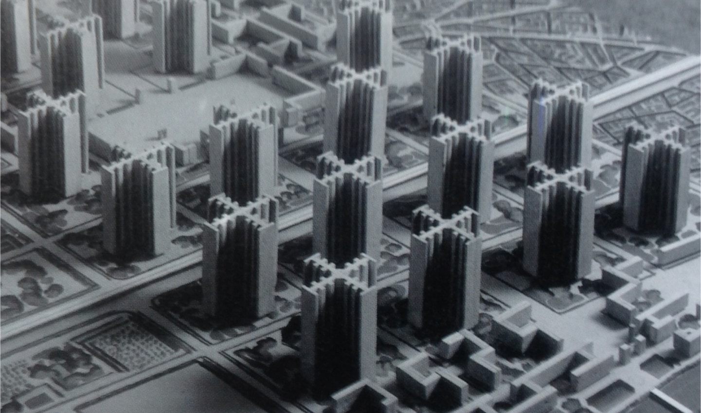
Le Corbusier, a renowned Swiss-French architect and designer, proposes a vision of highly structured, high-efficiency urban planning sought to streamline movement and maximize functionality. Today, the challenge lies in balancing these perspectives — creating cities that are both dynamic and efficient, resilient yet adaptable.
As cities evolve, finding a balance between different modes of transportation is a priority. Some urban areas have adapted by integrating multiple mobility solutions to enhance accessibility and efficiency. Amsterdam and Copenhagen, for example, restructured their road networks to support cycling and public transit alongside traditional highways. Investments in dedicated bike lanes, pedestrian-friendly zones and well-connected transit systems have improved mobility while maintaining vibrant, accessible cityscapes.
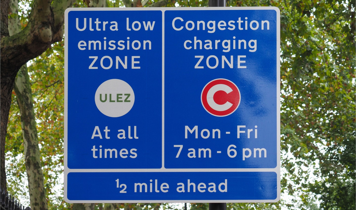
One significant trend reshaping urban spaces is the adoption of Low Emission Zones (LEZs). Restricting high-pollution vehicles in designated areas has proven to quickly reduce congestion and improve air quality. For instance, the implementation of congestion pricing in New York City led to a 7.5% reduction in traffic, equating to 43,000 fewer cars daily.
London has implemented congestion pricing to manage traffic flow and encourage alternative transport options, while Singapore’s road-pricing system dynamically adjusts fees based on congestion levels. Tokyo, with its high-density urban planning and world-class public transport, offers another model for efficient mobility in megacities.
The city of Tokyo makes car ownership intentionally expensive through high taxes and fees, discouraging unnecessary vehicle use. Prospective car owners must obtain a "garage certificate" (shako shomeisho), proving they have access to off-street parking within 2 kilometers of their residence, before purchasing a vehicle. Additionally, overnight street parking is illegal and parking fees in Tokyo are among the highest globally, with hourly rates around 1,000 yen (approximately $8.50) This just goes to show how diverse solutions to traffic can be.
Another example is when cities lower speed limits. While drivers often claim, anecdotally, that these interventions double their journey time, the data tells a different story. In most places, reducing speed limits from 50 kph (30 mph) to 30 kph (19 mph) adds less than a minute to the average trip while dramatically increasing vehicle flow and safety. Survival rates in pedestrian casualties are nearly 10 times greater at 30 kph than 50 kph.
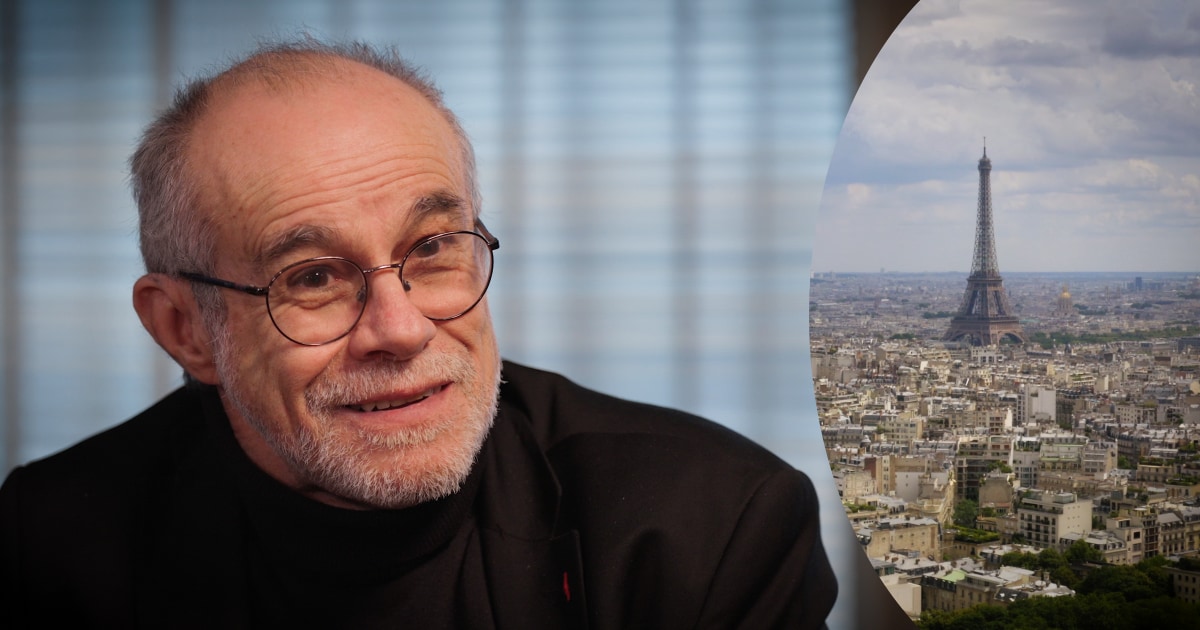
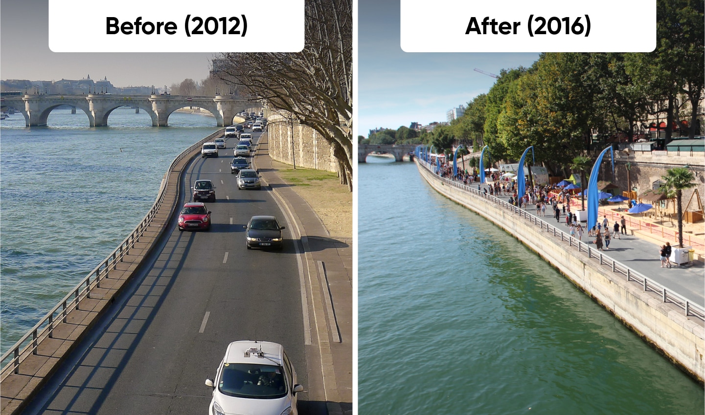
Paris is already embracing the 15-minute city model, ensuring that essential services, workplaces and leisure activities are within a short walk or bike ride, to tackle traffic and improve livability.
Pioneered by Professor and scientist Carlos Moreno, this concept rethinks urban life by reducing dependence on long commutes and prioritizing proximity, density and mixed-use spaces. “The goal is to give cities back to the people,” Moreno explains, stressing that 20th-century planning prioritized cars over livability and it’s time for change.
Carlos, who has worked closely with Paris’ mayor, Anne Hidalgo, argues that truly sustainable cities must move beyond just adding bike lanes or transit options — they must decentralize services, reshape local economies and create pedestrian-friendly environments. Despite its benefits, the 15-minute city faces resistance and requires steadfast government and corporate commitment. Utrecht, for example, is actively working with Carlos to implement these principles, proving that this model can be a realistic framework for future urban design.
By looking at the successes of cities like Amsterdam, Copenhagen and Paris, it’s clear that urban transformation is possible. The challenge now is scaling traffic management innovations globally and ensuring that city design balances efficiency, sustainability and inclusivity, while appreciating its unique local challenges.
The next step is to explore how these visions can be realized through technology, policy and urban planning to create the city of the future that we all can love.
The city, envisioned by TomTom
Imagine stepping out of your front door in the city of the future. The morning air is crisp, and the streets are alive with movement but not in the chaotic, congested way seen in so many urban centers today.
Instead of cars jostling for space, the roads are carefully designed to prioritize people. Movement is smooth and elegant. Wide, tree-lined sidewalks invite walking, seamlessly connected bike lanes offer safe and efficient riding and dedicated bus lanes ensure stress-free public transport journeys.
Even for those who still drive, the experience is transformed as automated vehicles glide effortlessly through optimized traffic flow, reducing stress and freeing up time for catching up on work or simply enjoying the ride. There’s no need to worry about parking as the vehicle will head to the next pick up.
The entire transportation network of cars, pedestrians, cyclists and public transit is a harmonious ecosystem making movement through the city effortless and even enjoyable.
This vision isn’t a distant fantasy, nor does it require radical reinvention. It just requires a shift in how we design and use urban spaces. By separating personal biases from practical solutions and embracing collective change, cities can evolve into places where efficiency, sustainability and accessibility naturally coexist.
A day in the life in the perfect city
For a commuter, the day begins with a choice. The well-connected transit network means that rather than sitting in traffic, a quick tram ride or bike commute offers a stress-free way to start the morning. On the tram or bus, the commuter listens to a podcast or reads a book. Real-time mobility apps suggest the best route, taking into account traffic flow, weather and public transport availability.
A parent taking their child to school enjoys a safe and pleasant walk along tree-lined paths unbothered by aggressive traffic. Urban ecologist Nadina Galle highlights how these green corridors do more than beautify a city — they provide shade, lower summer temperatures, purify the air and contribute to mental well-being by creating calmer, more peaceful and healthier environments.
At midday a tourist explores the city effortlessly, hopping between cultural sites using a combination of shared bikes, light rail and pedestrian-friendly streets.
As evening approaches, the city shifts gears. Commuters returning home benefit from dynamic road changes with multi-purpose lanes that now serve outbound traffic, reducing delays without the need for extra road space. They’re home quickly, without stress ready to reconnect with their family. Smart street lighting enhances visibility for cyclists and pedestrians, making evening travel safe and inviting.
A multi-modal city built for the people
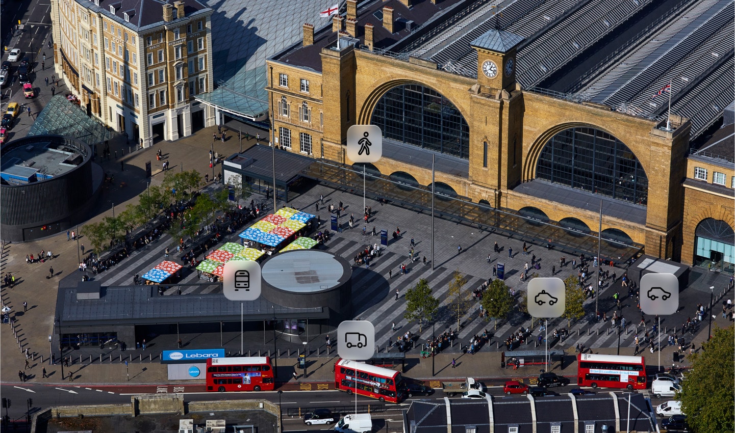
While many of the initiatives to fix traffic and improve our cities sound like they’re anti-car, they are not. The perfect city is not anti-car or anti-bike, it’s pro-people — people drive, people walk, people cycle. The perfect city promotes all movement options offering a range of convenient, efficient and sustainable choices for getting around. This allows, and empowers, citizens to make good choices for how they get around.
Roads then should be designed to balance all modes of transport, ensuring that each maximizes its benefits and plays its own unique role in an integrated system. Instead of an overwhelming dominance of personal vehicles, streets accommodate multiple forms of movement:
• Bike lanes: Safe, continuous, and separated bike lanes run parallel to major streets, making cycling a fast and attractive alternative to driving. Bike parking should be provided close to destinations, capitalizing on the space efficiency of two wheeled transport.
• Pedestrian zones: Pedestrianized zones in city centers, especially around schools, parks and commercial districts, encourage foot traffic and foster vibrant public spaces connection and community.
• Smart public transport lanes: Dedicated lanes for buses and trams ensure they move freely even during peak hours, making them a reliable option for daily commuting — one that’s more attractive than driving These lanes can also serve as dynamic, multi-purpose spaces that accommodate different modes at different times of the day to improve flow and ensure direct access for emergency services.
• Optimized traffic management: Adaptive traffic lights respond in real-time to congestion levels, balancing the needs of public transit, pedestrians and drivers to keep junctions flowing. Multi-purpose lanes shift direction depending on rush hour flows, easing bottlenecks without the need for additional road expansion.
• Low-traffic neighborhoods: Residential areas adopt a strategy where streets are designed primarily for people and residents rather than vehicles, leading to quieter, safer and more livable environments. This approach can also disincentivize “rat-running” for cars, whilst providing shortcuts for cyclists and pedestrians.
A smart city doesn’t just favor one mode of movement, it adapts based on prevailing situations. For instance, if 50 pedestrians wait to cross while two cars approach, or a bus carries more passengers than 10 cars the system adjusts to prioritize the most people. Sometimes traffic flow takes priority, other times pedestrian safety comes first. Speed limits adjust based on congestion and safety, reducing stop-and-go inefficiencies. Companies like FlowLabs are using TomTom Traffic Data to help cities around the world do just this. Thanks to real-time data, cities stay agile, efficient and safe .
A city built for quality of life
By rethinking mobility as a human-centered experience, cities of the future will not just be places to move through, but places to thrive in. The vision of TomTom is clear: a city designed for people, powered by smart choices, built to enhance quality of life for generations to come. A city that recognizes the path to betterment is never ending.
Dreaming of the city that we’d love to live in isn’t difficult, nor is identifying the problems that are making our cities bloated, slow and dulling their pulse. The challenge, as Ralf-Peter explains, is in making the change.
Changing human behavior isn’t easy, it takes time — generations of concerted, focused and unwavering effort in most cases. Even those people who campaign for more bike lanes might take years to actually use one and change their habits. But we shouldn’t let dynamics like these hold us back.
The future of urban mobility is not about forcing people to abandon their cars or preferences but about giving them better choices and empowering them to make those choices. Bringing this vision to life will take time, commitment and adaptation, but the benefits — a healthier environment, stronger communities and a better quality of life — are worth every effort.
People also read
)
Induced demand: The traffic paradox that we all need to know about
)
New York: The slowest moving city in the U.S.
)
London is the slowest-moving city in Europe again. Can the data show why?
)
Watch: How digital maps and the public sector are making Smart Cities a reality
* Required field. By submitting your contact details to TomTom, you agree that we can contact you about marketing offers, newsletters, or to invite you to webinars and events. We could further personalize the content that you receive via cookies. You can unsubscribe at any time by the link included in our emails. Review our privacy policy. You can also browse our newsletter archive here.