)
Today, at its investor meeting, TomTom made one of the most significant announcements in its 30-year history. The geolocation tech specialist and mapmaking company is launching a new map, mapping platform and ecosystem, which the company is collectively calling the TomTom Orbis Maps. TomTom says it will set a new standard for mapmaking, one designed to support a future of innovative location-based tech and will lay the foundation for industry-wide open collaboration.
Corinne Vigreux, Co-founder and CMO, says, “In a way, it’s like the start of TomTom 2.0. The company is coming out of stealth.” At the core, it’s the same company and culture, working in the same industry, but it’s casting off from its history as the storied maker of personal navigation devices (PNDs) and doubling down on its abilities and strengths as one of only a handful of global mapmakers.
As TomTom lifts the lid on its ambitious new map and development platform, it’s also sharing details of its attempt to create a dedicated location data ecosystem. It could become the world’s largest, most diverse and most valuable pool of geolocation data providers — something the industry has never seen before. The company expects it to create the environment needed to usher in a new wave of collaborative innovation in the industry.
“Our technology will be a driving force for accelerated innovation,” Harold Goddijn, TomTom CEO, said in the announcement. “The TomTom Orbis Maps supports our strategy to foster an ecosystem where the world comes together to create the smartest map on the planet.”
TomTom is succinct in what it believes its new Orbis Maps will offer in terms of output: “Broader geographical coverage, support for more data types and improved [reduced] update cycles.” The company will bring its own data together with data from new “super sources,” partners and open-source projects, such as OpenStreetMap, to deliver a new map with greater “coverage, detail and freshness.”
Today’s announcement is very much the first milestone in what will be a challenging but exciting journey for the company. A journey that it recognizes might never have a natural end.
“Alain De Taeye
TomTom Board Member
Over the next year, TomTom expects to onboard partners, build its pool of collaborative data providers and sources, ingest more data, expand geographical coverage, refine its APIs and SDKs and roll out its new hyper-detailed map. The company aims to begin rolling the new map out in the second quarter of 2023.
The goal is to create the world’s smartest maps. Why? Because not only does the world want it — the world needs it.
The world is changing and we need to work together to keep up
“The market for location technology is growing fast… resulting in an insatiable demand for accurate data,” Goddijn says.
Indeed, over the past decade the world has changed dramatically. New technology built around geospatial data has opened the door for new business models that challenge age-old industries and, in some cases, create entirely new ones.
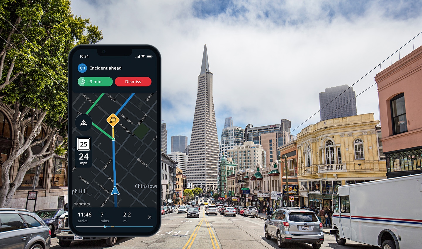
Continuously updated and detailed maps, location data, POI information, routing algorithms, estimated times of arrival (ETAs) and positioning systems are being combined to create powerful apps that are changing the way we (and our stuff) move and how we make sense of the world around us.
“Dr Tara Goddard
Planning and Urban Science Professor, Texas A&M University
Apps like Deliveroo, Just Eat and GrubHub allow us to order food and groceries on a whim and have them delivered to our doorstep. On-demand ride-hailing apps like Lyft, Uber and Bolt let us get a ride from exactly where we are to exactly where we want to go.
In other cases, the world is changing in ways that place growing demands on maps and location data. Nowadays, all social media apps have a location component so we can geotag our digital lives, and fitness and exercise apps, like Strava, augment how we interact with the world with virtual leaderboards based on GPS trace data.
The centuries-old insurance industry is being rethought too. In many cases today, car insurance premiums are calculated based on criteria that have almost nothing to do with how you drive — like credit score, income and education. Insurtech startups, like Loop, use location data to calculate fairer, usage-based insurance premiums for drivers.
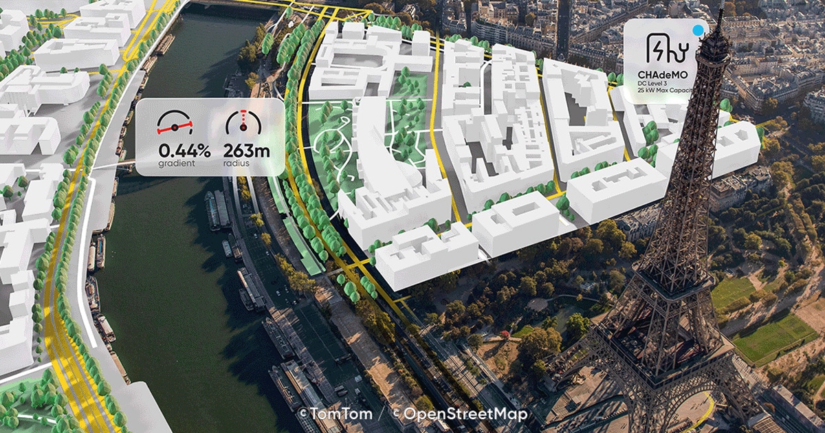
 Digital maps and location data power all kinds of technologies today. From the obvious uses like fleet, logistics and delivery to more unconventional uses like in insurance claims and electric vehicle charging
Moving beyond apps, the automotive industry is undergoing a dramatic shift to electric power and high-level advanced driver assistance systems (ADAS). It’s changing how cars drive and forcing carmakers to rethink their in-vehicle experiences, digital cockpits and how complex information about hazard warnings, vehicle range and state of charge should be communicated to the driver.
With EVs also comes changes in infrastructure. The introduction of charging stations is presenting challenges in how we think about refueling, paying for charging and finding a compatible and functioning charger. Mapping and location data are going to play a crucial role in addressing these challenges — with freshness and accuracy of that data being key.
A growing market
Today, TomTom estimates that around 20% of online searches require location data to be satisfied. As people, businesses and services become more reliant on location data and as all of the industries mentioned above grow, so will this figure.
“Johan Land
Chief Product Officer
Fortune Business Insights, a Pune, India-based market research consultancy, suggests the growth will be huge, projecting the global location tech market will reach a value of $66.61 billion by 2028. By comparison, in 2018, the market was valued at $16.14 billion.
“The demands being made of the map are only getting bigger. Most companies need a map tailored to their specific use cases, but their options are sub-optimal,” Michael Harrell, VP Software Engineering TomTom Maps, tells me.
Current map options are closed and proprietary, which restricts innovation and slows the development of new apps, features, use cases and technologies, Harrell explains. Often, companies must bend to the rules of the mapmaker, rather than the map being adaptable and open to the needs of the company building with it.
The world lacks a truly open and collaborative mapping ecosystem, one that doesn’t follow a one-size-fits-all model but is flexible so that businesses can build according to their needs. One that fosters collaboration, data sharing and open innovation. If the growing demands of the world are to be met, developers need better mapping. They need a better map.
The next chapter of TomTom
This is where the TomTom Orbis Maps comes in. Essentially, it’s made up of a few things: a platform for building with maps and location data, an ecosystem to support partners and share data and, of course, a new map and associated database.
It’s far from this simple, but forced to summarize, Harrell says, “TomTom is trying to create an open data solution and wants to co-collaborate with some of the biggest companies in the industry to do so.”
It’s an approach the industry has never seen. One that will build an ecosystem that ultimately “drives collaboration to building a better map,” which addresses the perennial challenges the industry faces, Harrell explains.
TomTom will do this by taking data from a variety of what it calls super sources. Eric Bowman, TomTom’s Chief Technology Officer, says super sources are those that bring masses of data and offer a high level of accuracy in a cost-effective manner compared to conventional data collection methods, like using MoMa cars.
These super sources include open-source data (such as OpenStreetMap), probe data, sensor derived observations (SDO) and data from a pool of important partners, which include some of the biggest names in the tech industry.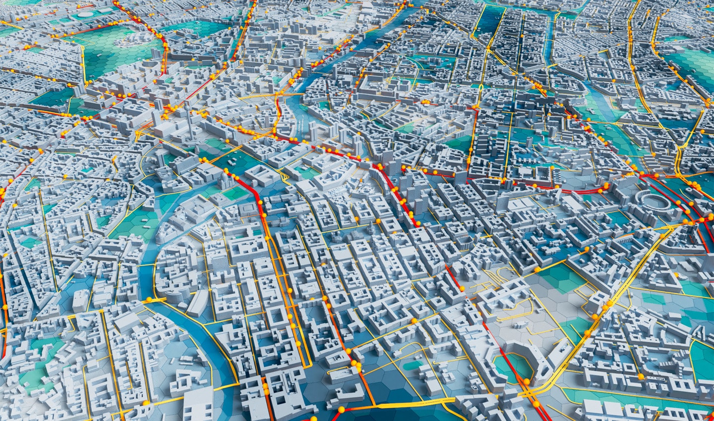 Maps are more than pictures. They are data. Maps today are detailed, complex and full of information. They’re built using information from sources all over the planet and allow us to map road networks, traffic, POIs and more in real time.
TomTom will then put all this location data through its mapmaking process to identify where changes need to be made to its map. It ingests, validates, standardizes and then outputs the map data in useful, enterprise-grade formats that can be used by all manner of businesses from the lone developer and startup to global organizations.
“Our new Orbis Maps is designed to bring [the] world’s [sources] together in a consistent way to power the most demanding applications,” Goddijn explains.
This collaboratively sourced map data becomes part of the TomTom base map, which everyone in the data pool will build on. This base map includes all the basic geometry — like roads and building footprints — that you need to start building on top of to create a use case-specific map.
“We are opening our technology to others to layer their own data against a consistent base map, which can easily be integrated,” Goddijn adds.
Generally speaking, business-critical edits and data will be ringfenced and kept exclusive for the business that made them, though — unless there’re open-source rules that need to be satisfied. Think of it this way: a ride-hailing company will share updates that it has identified a new road. But it won’t share the intelligence it has, that the new road is a popular pick-up location from Monday to Friday between five and six o’clock in the afternoon.
A company isn’t sacrificing its “piece of the pie” by sharing the location information it gathers. It’s making the whole pie much bigger.
The objective is to create the most detailed, accurate and robust record of ground truth and to then share that openly with everyone that’s part of the data pool. Companies will no longer have to commit significant resources to or worry about the complexities of making their own map. They will leave that to TomTom, so they can focus on building their innovations on top of it.
A faster, richer, more accurate map
Building a world map in this way will accelerate how quickly changes in the real world are reflected in the map. It’ll also greatly accelerate the volume of changes made. Map updates will be faster, more relevant and more accurate.
“Johan Land
Chief Product Officer
A lot of this will happen in an automated fashion too. Traditionally, mapmaking has been a labor-intensive process and required a significant amount of human intervention. While that can be an accurate way of mapping, it’s not very fast.
With its new map, TomTom is using AI and machine-learning techniques to speed up the process and make a much greater volume of changes in a much smaller period of time. With the masses of data used, the quality of the new map will be a step above what’s currently available on the market.
TomTom expects this to improve its competitive position, so much so, its new Orbis Maps should support new markets and use cases. There’s a clear sense of excitement with this announcement, with many at TomTom dreaming of what might be possible – drawing parallels with how we never saw Uber coming when the Internet and smartphone were invented.
TomTom’s intentions are to make a map so robust it can support and be the proving ground for these newly imagined technologies. In the words of TomTom Co-founder and CMO, Corinne Vigreux, it will be “the smartest, the most accurate and the most useful map on the planet.”
The thing that started it all
If you look back at TomTom’s history, the company’s renewed direction makes a lot of sense.
Many of us know TomTom for its PNDs, the devices that found home on hundreds of millions of car and truck dashboards over the past few decades. The devices made finding a destination, planning a route and navigating there an elementary part of driving — something that required no prior planning. TomTom’s PNDs created and defined a category. Since their release, TomTom has sold more than 100 million devices. And through this, the company has helped democratize navigation and empower people all over the world to travel with greater ease and safety.
They changed the way we drive and what we expect in our vehicles, forever. The PND even made it into Time magazine’s list of the 50 most influential gadgets of all time.
But zoom out, and we see that navigation was always just a surface-level use case of a much more powerful technology beneath. Maps have been helping us navigate for centuries. But nowadays, navigation is just one of the many things that digital maps and location data can power.
“Drs. Reinder Storm
Curator of the Amsterdam Map Collection at the Allard Pierson Museum, speaking about some of the most highly regarded maps from the 1500-1700s.
Over the years, TomTom improved the PND to bring drivers more useful features, such as live traffic, hazard warnings and phone integration. In the mid-2000s, TomTom launched its MapShare Reporter, which crowdsourced more than 5 million map edits, to improve the detail of its map.
Eventually the tech that powered the PND found its way into the dashboard of vehicles all over the world, and TomTom continued making maps and crunching location data. There are now more than 600 million vehicles, devices and apps around the world that include some of TomTom’s tech.
But, beneath it all, the PND wasn’t just a device that helped drivers get to where they needed to go more easily, it was the thing that pushed TomTom to build better maps – to hone how it gathers and processes location data to make smart and useful maps.
The techniques TomTom used to make maps for the PND and other automotive applications laid the blueprint for where the company is heading. As TomTom’s mapmaking processes continue to improve over the next year, we’ll likely see some of the biggest breakthroughs yet.
The next step
The technical infrastructure behind modern digital maps is incredibly complex. With its new Orbis Maps, TomTom is rebuilding it all so that it’s better suited to the most demanding geolocation applications.
Applications that rely on TomTom’s tech today are so deeply enmeshed with it that upgrading to the new platform will take time. It’s not simply a case of flicking a switch to turn off the old platform and flicking another to turn on the new one.
However, TomTom is already working with partners to test and develop its new map and platform. The full details on the first round of partners will follow over the coming months.
There’s also significant talk about how the company will use OSM data. It’s clear TomTom is treading cautiously and respectfully here. Speaking to those working on this project, it’s apparent the company sees itself closer to the enthusiast mapmakers that make open map data what it is, rather than the Big Tech companies that often make use of it. Much of the strategy for the TomTom Orbis Maps is built around collaboration and it’s employing that principle as it approaches open mapping communities too.
We’ll dive deeper into how TomTom will use OSM data soon, so stay tuned.
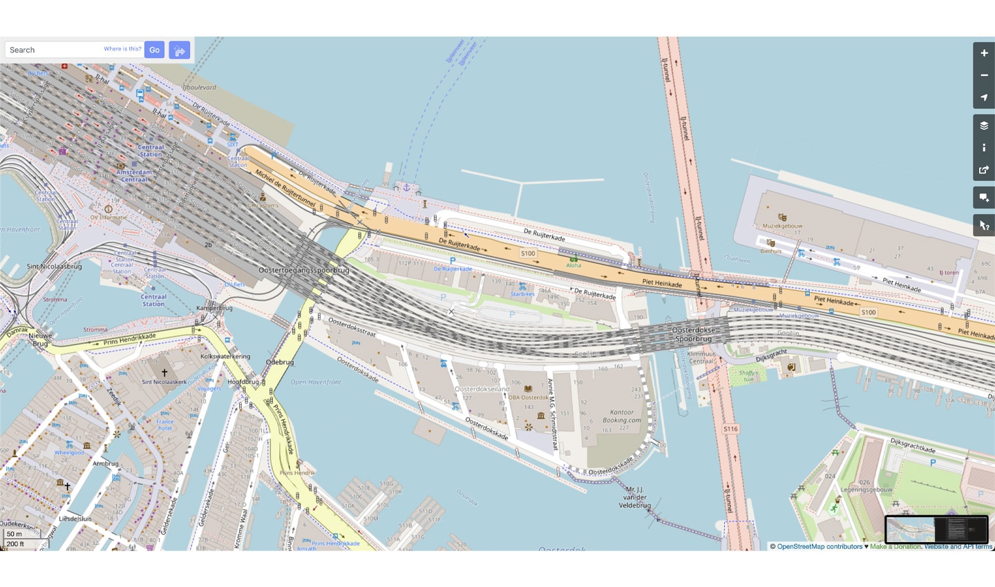 OpenStreetMap is an open-source map. It’s incredibly detailed, created by millions of passionate and dedicated hobbyist mapmakers. Pictured above is the part of Amsterdam where TomTom is based. Look at the detail of street names, ferry crossings, bridges, stores and bike lanes.
Even though TomTom is already working with partners on it, we’ll be well into next year before we see a full working release. Rome wasn’t built in a day, neither is the smartest map on the planet, but expect to see something by summer of next year.
As for now, strap in. There will be plenty more announcements over the next year as the map grows and partners join TomTom on its quest to make the smartest map on the planet.
The journey to redefine the standard of mapping is just getting started.
People also read
)
Automotive Hall of Fame awards TomTom CEO first mobility innovator prize
)
More than 20 years of mobile mapping, here’s how it began
)
Navigation: How did we get here and where are we heading next?
)
Keeping maps fresh: The life of a TomTom mapping car driver
* Required field. By submitting your contact details to TomTom, you agree that we can contact you about marketing offers, newsletters, or to invite you to webinars and events. We could further personalize the content that you receive via cookies. You can unsubscribe at any time by the link included in our emails. Review our privacy policy. You can also browse our newsletter archive here.