)
When it comes to mapping our world’s roads, TomTom is a pioneer and one of the most experienced firms in the industry. 20 years ago, its mobile mapping team in Lodz, Poland started a journey that continues to be a cornerstone of TomTom’s business today.
To keep its maps as fresh as possible, TomTom uses an array of sources, including government information, survey vehicles and community input.
But there’s one source that stands unique in its accuracy, reliability and value to the company: mobile mapping vans, or MoMas for short. Thanks to MoMa vans, the company’s maps continue to become ever more detailed and refined.
To learn more about the company’s mobile mapping journey, I spoke with Krzysztof Miksa, who is TomTom’s director of engineering in autonomous driving, and Marcin Lechowicz, who is director of maps. They also happen to be two members of the team that developed and built TomTom’s first mobile mapping vehicle.
The journey begins
That story began in 2001 when an unassuming Peugeot Partner van, equipped with all manner of sensors and GPS hardware, rolled out for the first time in Lodz. Its job was to gather thousands of data points every second which could then be used to build some of the most detailed digital maps of the time.Before we get to that, let’s go a little further back in time.
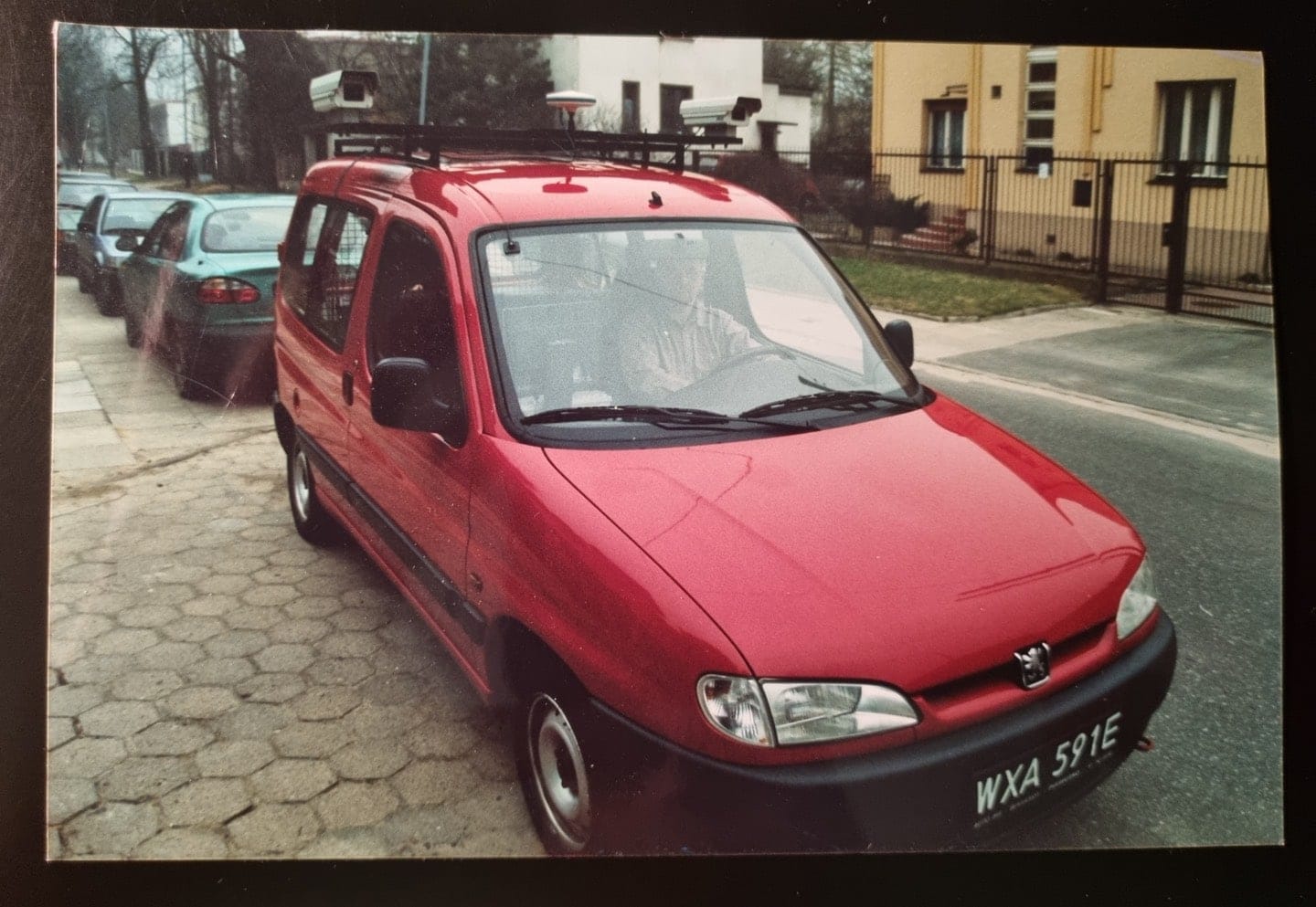
The Peugeot Partner had two digital cameras mounted to its roof operating in a stereo configuration.
Before joining and bringing their MoMa tech to TomTom, Miksa, Lechowicz and their colleagues began developing their MoMa vehicle while at Poland’s state cartography agency, the PPWK.
Miksa, Lechowicz and many of their colleagues from that time are now part of TomTom and their office in Lodz is now the center of the company’s MoMa operations. That Peugeot Partner van very much became one of TomTom’s first MoMa vehicles.
Building the first MoMa vehicles
To give the back story, Netherlands-based mapping company Tele Atlas was the first company to put a mobile mapping van on the road back in the early 1980s. TomTom acquired Tele Atlas in 2008, taking on board its expertise and technology. With the two companies combined, TomTom now has more years of mapping experience than any other location technology specialist.
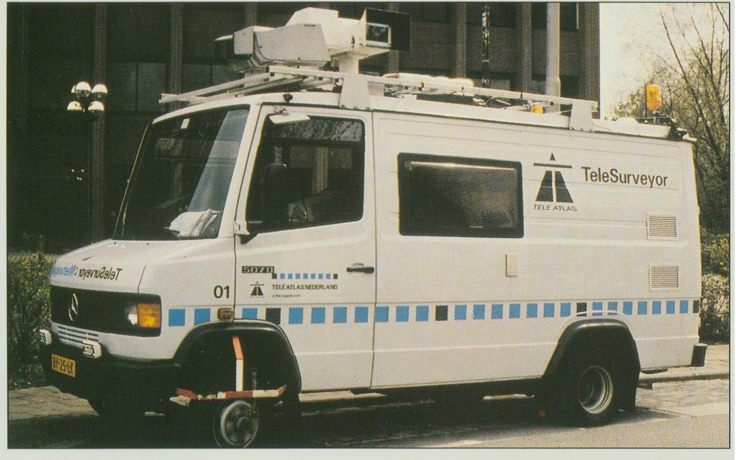
The Tele Atlas TeleSurveyor. The first mobile surveying vehicle was developed in the 1980s. Tele Atlas is also now part of TomTom, bringing its experience and tech to the company.
Indeed, when the last millennium rolled around, mobile surveying vehicles had already been gathering basic data on our cities and roads for over a decade. However, the technology they used made the process slow and labor intensive.
As computer technologies developed and GPS signals were opened to the public, the PPWK and TomTom recognized an opportunity to bring even more detail to digital maps. Using the new technology, they set out to take mobile mapping to the next level.
“The former CEO of the company [PPWK] challenged me with a task to create a prototype of the first mobile mapping vehicle in about four months,” Miksa told me. “We simply did it.”
Miksa makes it sound matter of fact, but it wasn’t a simple case of replicating and improving technology that was already out there. Mobile mapping (MoMa) was the next evolution and it required specialist engineering.
“Localization technology was quite restricted and very expensive,” Miksa added. Importing components and parts for the vehicle wasn’t easy either.
Back then, there wasn’t anything like the specialized componentry that engineers have access to today. Essentially, Miksa, Lechowicz and their colleagues had to build the MoMa van from scratch using hardware intended for other uses.
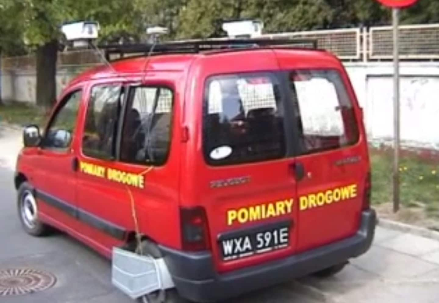
The Peugeot Partner van developed by the team in Poland. It paved the way for two decades of mobile mapping that followed its creation.
Given how specialist the MoMa van was for its day, you’d think it was built in a lab. But the truth is quite the opposite. Like many startups, the team developed and built the MoMa van from a rented house, assembling the van in its garage.
According to Lechowicz, it was a unique and interesting setting, but it had a family atmosphere, which no doubt helped nurture the collaboration required to build a vehicle which combined technologies from computing, mapping, automotive and transport industries.
It starts with hardware
There were two cameras set up in stereo mounted on the van’s roof to capture images of the road. These images would go on to inform map makers of road features such as layouts, markings and signage. They were quite basic, “less than a few megapixels” Lechowicz says, but were one of the most important components, nonetheless.
Inside the car, it was more advanced. There was a GPS unit, odometer, and gyroscope. These sensors generated data about roads such as location, distance and direction of travel.
Another important part of the setup was what captured and stored that data so it could be processed and eventually be turned into digital maps.
At the time, there was no specialist equipment designed to perform this task, so the team turned to factory grade servers. These computers, designed to operate constantly and withstand vibration and adverse conditions, were well suited to being strapped in the back of a van to record road data.
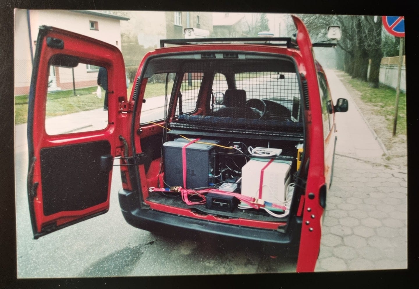
Data was gathered and recorded on server hardware. Each camera had its own computer system, which were in turn connected over a dedicated local area network.
The van needed three of them. Each camera had its own server to record and store the images it captured. The third server “managed all of the other sensor data and synchronized all the signals,” Lechowicz tells me.
“A local area network within the car connected all the computers and synchronized the signals between them,” he added.
The MoMa van’s first project was to map 1,500 km of the roads around Lodz. Miksa, Lechowicz and their colleagues had to prove the tech they’d built worked in the real world.
Without issue, it completed the task in about one month. Had the team been able to drive non-stop they could have covered that distance in around 60 hours. However, in the city, data collection speeds were low, and the team had to manage some technological limitations.
Even though the vans were collecting just single gigabytes of data a day, it was enough to max out a standard hard drive of the time in a matter of hours.
The team was left with no other option but to stop every few hours and transfer the data between tape drives – a process which took about an hour. This data was then transported, by hand, to the team’s office in Lodz, where it was ingested for processing.
Modern MoMa vans collect around 1.5 terabytes of data each day – that’s not far off the total capacity of the average home computer. While storage capacity isn’t as much of an issue anymore, hard drives still must be removed from the vans, delivered to the office in Lodz and downloaded to TomTom’s network directly. There’s no wireless technology that could transmit that amount of data quick or securely enough.
Lechowicz muses that perhaps after 5G, there might be the technology capable of this, but we’re not there yet.
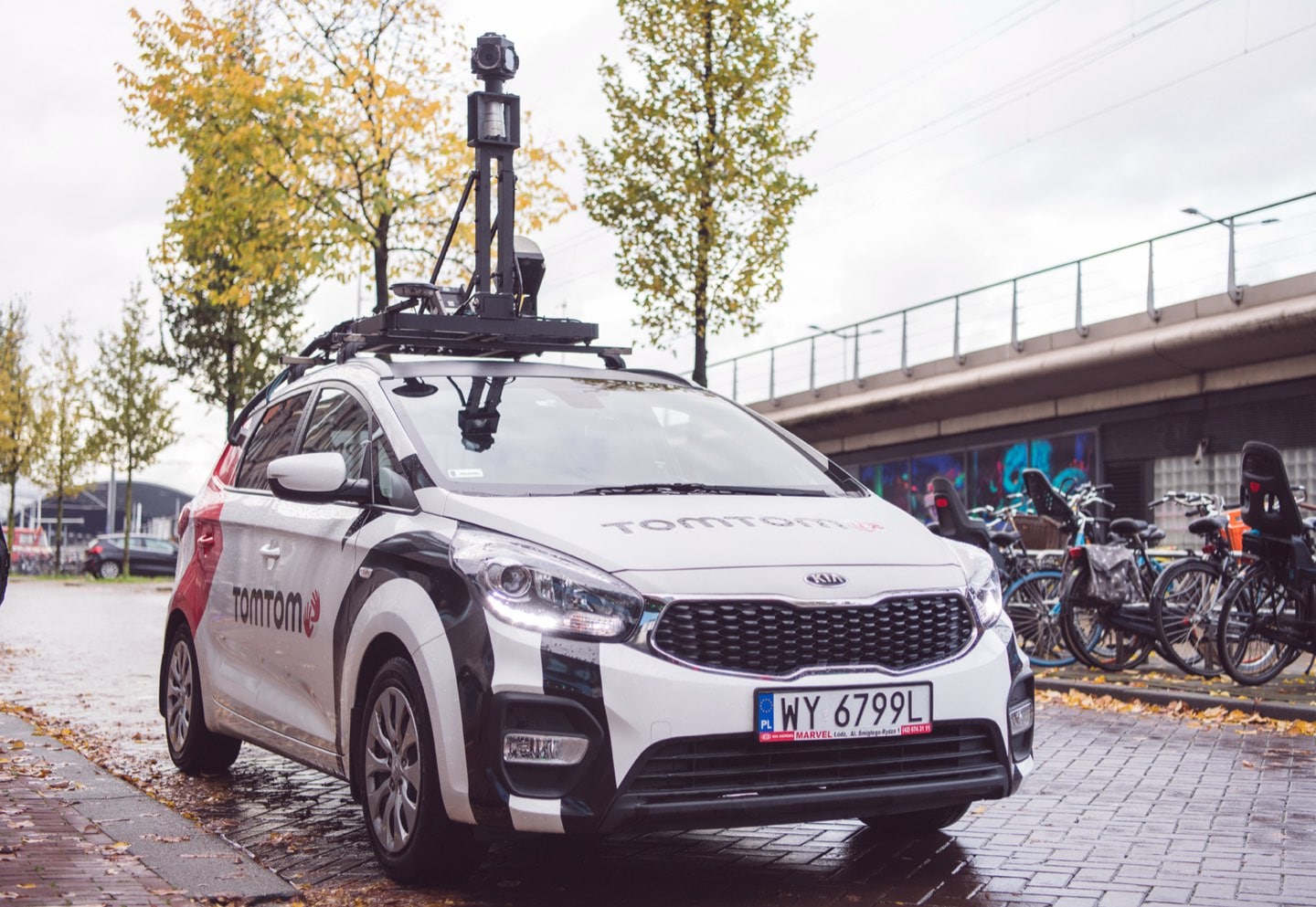
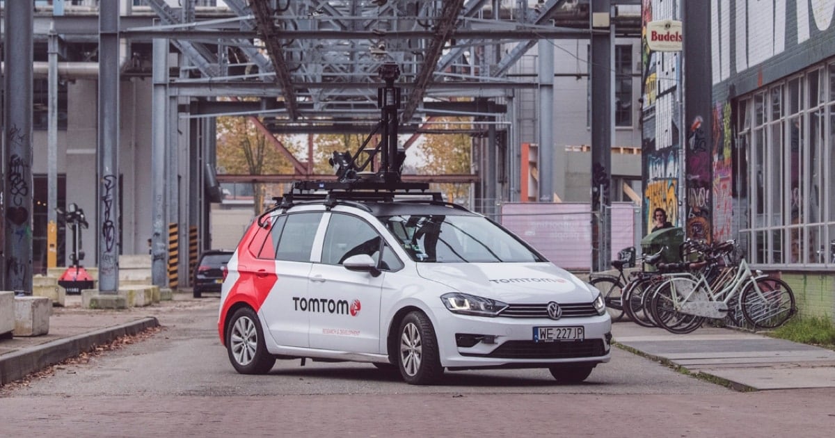
Modern MoMa vehicles feature many more sensors than the Peugeot Partner and collect data at a much higher resolution. All that means more gigabytes are being gathered every day.
It’s all about the data
This isn’t too much of an issue when local roads are being mapped by just one vehicle, but when the operation began to expand and go global, the MoMa team faced a unique logistical challenge. Getting the data back to Poland was one thing but building more mobile mapping vans in locations that had to be mapped was another.
By 2005, the team had moved on from prototyping the MoMa van and were well into the next stage of design and production.
From rented garages, the team built 10 more MoMa vehicles ready to map the United States over a six-month period, completing the task in 2006. Mapping the U.S. highway network proved to a huge audience, how effective and efficient MoMa vans are.
As more mobile mapping vehicles were rolled out, keeping track of them and the data they gathered became increasingly difficult. There are now MoMa vehicles on every continent, supported by a global team of around 1,000 people, including map makers, data processors, developers, engineers and dev ops.
Miksa is keen to reinforce, as important as the MoMa van is to digital mapping, the data it collects and how this is interpreted is the important part — it’s where the real magic happens.
From raw data to useable knowledge
Over the years, the MoMa team have developed numerous systems which track where vehicles are, what routes they are driving, what data they should be collecting and what is captured. When the data is collected it’s validated for quality to ensure it’s useable and as expected.
“After data collection, tools check the correctness of positioning files, image quality and automatic marking of captured routes,” Lechowicz says. When this is complete, the data can then be interpreted and built into maps.
The team also developed a tool to automatically extract road signs from the images captured by the MoMa vans. This technology has enabled advanced driver assistance systems (ADAS) like intelligent speed assistance, where drivers are informed of speed limits even when there are no signs in sight. It also allows navigation systems to point out when it’s illegal to perform a U-turn or drive down a one-way street.
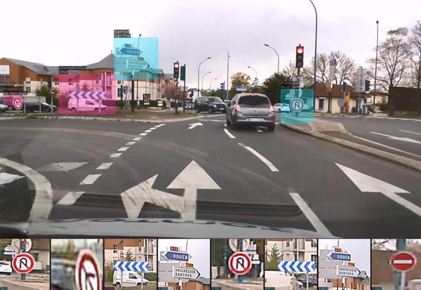
Using AI and machine learning, the MoMa team has developed a system which can regocnize, extract and categorize road signs automatically.
Sensor and MoMa evolution
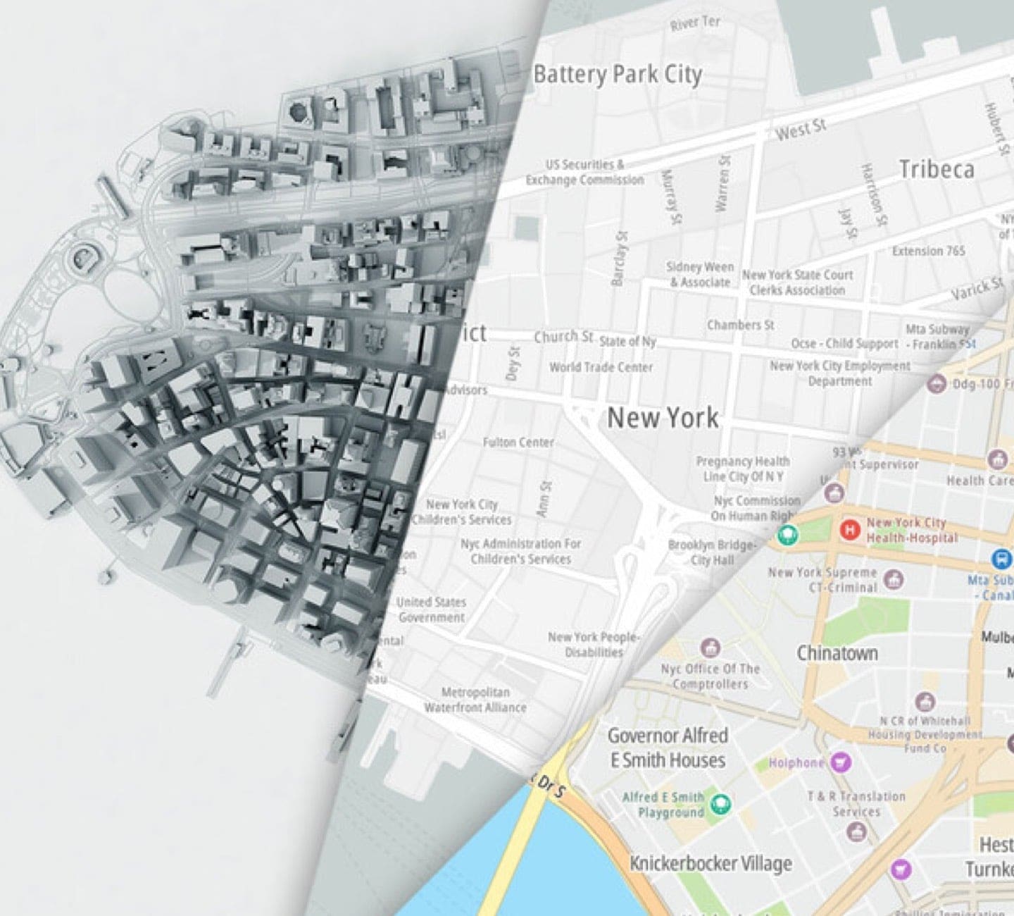
Indeed, creating highly detailed maps is not just about collecting GPS data to draw roads, it’s also about gathering as much knowledge and understanding about those roads as possible.
The MoMa team has constantly pursued ways to make maps more detailed. With that they’ve developed the vans’ sensors to extract more knowledge from the world.
Image capture has moved on from low resolution stereo cameras to a 360-degree high-resolution Ladybug that gives a complete view of the world around. Every kilometer the Ladybug captures 3.8 billion pixels of image data.
More sensors mean more detail. As MoMa van sensors evolve, TomTom can add more detail and accuracy to maps.
MoMa cars are also equipped with LiDAR, a sensor array that collects 700,000 data points every second and allows a three-dimensional point map of the world to be constructed with millimeter accuracy. With this, maps can feature more detail on distance and positioning of road objects such as signs, roundabouts and traffic islands, than what a camera alone can provide.
Gyroscopes now operate, not just in X and Y axes but also, with a Z axis. This means that MoMa cars can now map the gradient and curvature of roads. This tech underpins the intelligent cruise control systems used in haulage trucks.
However, there is a new class of sensor that’s helping mobile mappers work more efficiently, and it’s not found in MoMa cars.
What’s next for Mobile Mapping
There are millions of vehicles and devices around the world that use TomTom technologies – they could be in-car navigation and traffic systems, personal navigation devices or smartphone apps. Each of these has the power to privately and securely ping data about where it is and what road it’s on to the company. The data gathered from these sources are called sensor derived observations, or SDOs for short.
In any 24-hour period, TomTom receives enough data to remap the world’s major cities and roads many times over. That’s not something that needs doing every day, however, these observations can be used to identify new roads or critical changes to infrastructure.
As Miksa explains, in some instances TomTom “will update based on the SDO and will perform quality checks.” When quality checks are needed, that’s when the MoMa van is deployed.
In these instances, the MoMa van will investigate the infrastructure that the SDOs suggest is new, mapping the area in detail. It will also gather data the SDOs can’t, such as gradient, signage and road markings. This can then be added to the TomTom map and issued as part of its weekly update.
“They [the SDOs] are a reference,” Miksa says. “It is where we could benchmark with the MoMa van.”
With millions of sensors able to inform map changes, it might sound like the days of MoMa vans are numbered, but Miksa is quite adamant that won’t be the case. “It’s all about the data,” and the reliability of that data, he says.
Indeed, to achieve its goal of making maps at least 95% accurate, TomTom will need MoMa vans for a long time to come.
The trusted MoMa van is the best tool to validate what is being witnessed in the real world, with the required level of detail.
The next chapter
Speaking to Miksa and Lechowicz, it’s clear that, MoMa vans will be busy over the next 20 years. They won’t be decommissioned as other data sources become more common. Their role is likely to shift from a primary source of map data to one that verifies, validates and qualifies the truth of other sources.
The task that MoMa vans perform for TomTom is too specialized for them to be usurped by other sensors just yet.
Throughout conversation with Miksa and Lechowicz, they make their work sound matter of fact, but the task these vehicles have undertaken can’t be understated. And on their 20th anniversary, their contribution is certainly something to be celebrated.
Over the past two decades, TomTom’s MoMa vans have been responsible for mapping most of the built world with over 95% accuracy and doing it all to within two centimeters of detail.
The MoMa vans have covered millions of kilometers, collected many thousands of terabytes of data and interpreted 100 million types of road sign, so that drivers are provided with the most accurate maps possible and cars that get safer every year.
MoMa vans are responsible for mapping most of the world's roads over the past 20 years.
MoMa vans continue to be the best and most evolved tool when it comes to creating, updating and maintaining highly detailed digital maps. As they begin their next chapter, we can be sure they’ll continue to evolve as they help take TomTom’s maps forward even further in the future to make driving easier and safer.
People also read
)
Behind the map: how we keep our maps up to date
)
How on-demand, mobility and logistics leaders make TomTom maps better
)
How monitoring facilitates accurate and efficient map delivery
* Required field. By submitting your contact details to TomTom, you agree that we can contact you about marketing offers, newsletters, or to invite you to webinars and events. We could further personalize the content that you receive via cookies. You can unsubscribe at any time by the link included in our emails. Review our privacy policy. You can also browse our newsletter archive here.