


)
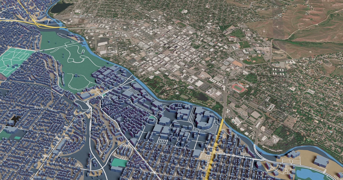
TomTom Orbis is the ever-growing mapping platform, collaborative, open and continuing to scale across a wide range of industries. Recent developments build on this, making Orbis even more powerful and accessible across workflows. As organizations increasingly rely on location intelligence, Orbis is putting TomTom at the center of building the future of location-based tech – used by both machines and humans.
Location data has been part of everyday digital systems for years. What’s changing fast is the scale, complexity and expectation that comes with this tech, as AI-driven organizations work with larger datasets and rely on location intelligence more deeply across analytics and applications. Orbis is meeting the reality. Developed in collaboration with the Overture Maps Foundation, an open mapping initiative backed by Meta, Microsoft and Amazon, it brings different data sources together into a global, continuously updated map designed for modern applications. TomTom’s strict validation protocols and diligent data maintenance are making Orbis a reliable ground truth data layer for AI innovation that requires accuracy. Taking it a step further, the new updates and tools we’ve built are designed to work in the age of AI. Making Orbis data accessible and AI consumable allows agents to access validated data that grounds their results in reality, reducing hallucinations and performing with accuracy – a promise that has been the cornerstone for Orbis. Traffic density across a continent
Making location intelligence accessible
Compared to roughly a year ago, TomTom has expanded Orbis both in scope and the capabilities built around it — extending how Orbis’ location data can be accessed and used in practice.
A series of developments help organizations overcome three key challenges: processing growing volumes of location data, connecting datasets from different sources and building applications from that data. The latest Orbis updates address each area, focusing on data formats, interoperability services and a series of APIs. While each delivers value on its own, together they make it easier to move location data between analytics environments, integration pipelines and applications. This streamlines workflows while opening new use cases and supporting customers across industries.Ready to build with Orbis? Read more on our developer blogpost to get started.
An easy-to-consume data format: Orbis OGP
Different formats package data for different uses. Orbis has already been offering PBF for open-source tooling and back-end systems, and FGDB for GIS workflows like ArcGIS. Now Orbis OGP supports delivery using GeoParquet — a cloud-native, standardized way to store and query geospatial data. The format is designed for complex ecosystems, ideal for cloud analytics, interoperability and large-scale data processing. Directly consumable by AI systems, organizations can integrate it into analytics pipelines and processes alongside other datasets.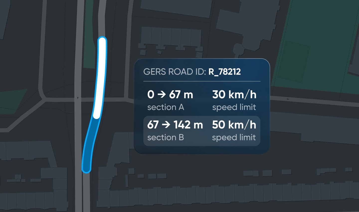 Instead of breaking a road into segments to account for changes in speed limit, TomTom GEM uses linear referencing to treat each road as a single entity, with attributes like speed limits overlaying it.Aligning with the Overture data model, OGP incorporates stable Global Entity Reference System (GERS) IDs — unique, persistent identifiers assigned to each real-world entity on a map. These identifiers optimize interoperability by reducing the costs that would otherwise come with combining datasets, which brings us to our next topic.
 Aligning datasets with TomTom GEM
Aligning different location datasets presents a practical challenge, especially as the volume and variety of data increases. The common problem is that different sources normally describe the same real-world road, building or place using different identifiers. Organizations then need to manually combine different sources in a process of data matching and merging, called conflation.
With TomTom’s Global Entity Matcher (GEM), Orbis significantly reduces the conflation effort by aligning different datasets with one shared reference system, all mapped to stable GERS IDs. TomTom GEM does the heavy lifting, automatically matching an organization’s datasets to a shared reference system. Once matched, enrichment and adding new datasets becomes much simpler. Data also integrates directly with Orbis, so it’s updated continuously and can be reused across multiple applications.
Cutting out manual conflation workflows, GEM redesigns modern interoperability across datasets, making it faster, more predictable and scalable in practice.[If you want to experience how TomTom GEM works for yourself, take a look on TomTom's product discovery tool. Just click here.]
From data to applications: Introducing Orbis APIs
For developers to build on Orbis, TomTom is opening new ways to access location services and map data.A set of six APIs covers routing, map display, traffic, geocoding, places search and reverse geocoding. Together, they form a complete, modular, API-first location platform built on open standards — ready for modern web, mobile and back-end applications.
This development reflects a broader shift toward service-based architectures. Rather than embedding a map as a fixed component, developers can access specific location-based capabilities through standardized interfaces and combine them as needed.Developer tools like TomTom’s Maps SDK for JavaScript support a host of development environments, while the TomTom MCP Server brings the full API portfolio into AI Agents and LLM-based interfaces through a single integration.
 In practice, Orbis’ API layer translates underlying ground truth data into building blocks for end-user experiences. It connects directly to the data and interoperability layers, enabling applications to benefit from the same structure, identifiers and updates that underpin the broader system.
 Expanding the map: Ground truth in location intelligence
As Orbis continues to evolve, its role is expanding. As a modern, open, AI-ready location data platform, it broadens how organizations can use location intelligence across workflows and use cases. By making Orbis easier to consume, integrate and build on, TomTom is making reliable location data more accessible at scale. This is critical for AI, where the system is only as good as the data it’s built on. For use cases like automated driving, a trusted understanding of what exists where, from roads and lanes to speed limits and places, is essential. Orbis is delivering a continuously validated view of the physical world, establishing a ground truth for AI and beyond. With these developments, TomTom’s location intelligence is opening new possibilities across industries.* Required field. By submitting your contact details to TomTom, you agree that we can contact you about marketing offers, newsletters, or to invite you to webinars and events. We could further personalize the content that you receive via cookies. You can unsubscribe at any time by the link included in our emails. Review our privacy policy. You can also browse our newsletter archive here.