)

Retail is being reshaped by digital commerce, but for brands with a physical footprint, location is still one of the most strategic and costly decisions they make. Choosing the right site isn’t just about foot traffic anymore. It’s about access, timing, visibility and long-term viability. As cities change, commutes shift and consumer routines evolve, location decisions have become more difficult and even more crucial for businesses.
Retailers today are grappling with two key challenges: Where to expand or reduce stores based on real-world behavior and how to reach and serve customers more effectively in and around those locations.
These questions are pressing for a wide range of companies. Take a global coffee chain that must balance saturation with service, opening stores close enough to capture demand, but far enough apart to avoid cannibalization. Or a petrochemical company which isn’t just looking at traditional fuel stations but also finding optimal zones to install EV chargers based on dwell time, traffic flows and travel patterns.
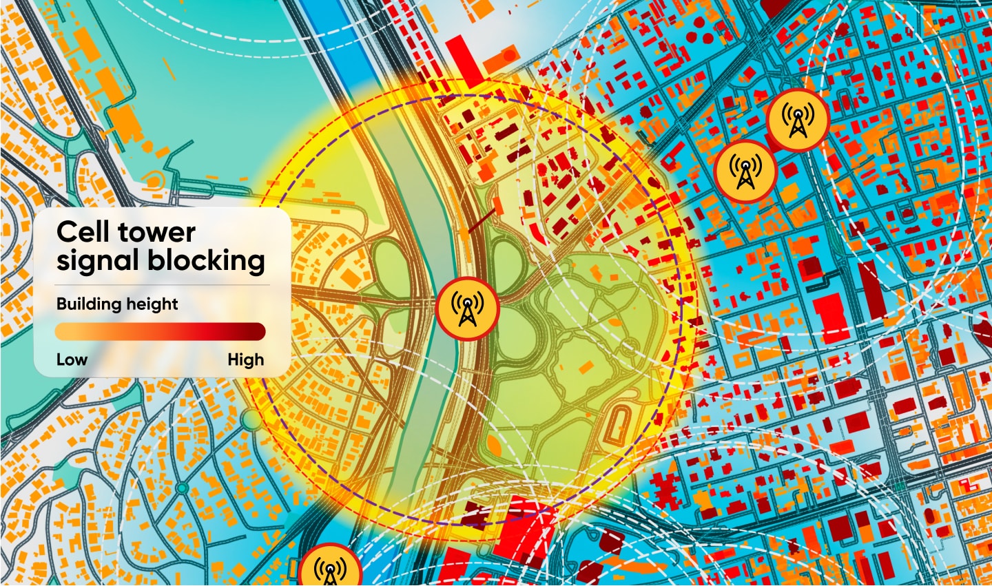
In the telecommunications sector, network operators need to pinpoint locations for new towers based on where people live, travel and work, not just where signal coverage looks thin on a map. As for media agencies and brand advertisers, the focus is increasingly on how to place billboards and street-level media where the right audiences will actually see them. That means understanding not just population density but mobility patterns where people move, but at what times and with what intent.
Quick-service restaurant brands and fast-growing dark store players that deliver in minutes face similar challenges. For them, coverage isn’t just about presence, it’s about delivery zones, urban accessibility and the travel-time dynamics that define customer expectations.
Even high-end retailers and automotive brands rely on location insights to guide showroom placement or campaign targeting. A premium electronics store or dealership might fail not because of product, but because the location doesn’t align with the income, mobility or lifestyle patterns of the audience it wants to serve.
Across these sectors, the core challenge is the same: how to make smarter, more confident decisions about where to invest, how to operate, and who to target—in ways that account for real-world complexity.
Traditional site selection methods—based on census data, intuition or real estate trends—no longer cut it. What retailers need now is visibility into how people move through cities, how those patterns change throughout the day and week, and how location affects visibility, accessibility and ultimately, performance.
Understanding movement beyond maps
Retailers have long relied on population data to determine viable zones. But population density doesn’t tell the full story. A location surrounded by potential customers may still underperform if people aren’t moving past it, can’t easily access it or are commuting in a different direction.
This is where mobility data, information that captures how people travel, when and along which routes, starts to matter. Traffic volumes, travel speeds and peak flow hours reveal how a space functions in the real world, not just on paper. In areas where congestion slows access, or routes are changing due to infrastructure projects, retail viability can change almost overnight.
Some companies have begun using drive-time polygons, or isochrones, to replace static radius circles when evaluating new locations. Instead of mapping everything within one or two kilometers, they look at what can realistically be reached in ten or fifteen minutes—based on actual road conditions. This provides a more accurate view of the store’s true catchment area, especially in cities where travel time doesn’t always reflect distance.
From analysis to action: optimizing performance
Location intelligence doesn’t end with picking a new site. It plays a role in day-to-day performance management, especially when retailers oversee dozens or even hundreds of stores. The same data that helps identify opportunity areas can also signal when existing stores are underperforming, which is often due to external changes that store teams can’t see at a glance.
This is where network optimization becomes a key use case. A retail brand might discover that two locations are pulling from overlapping customer flows, suggesting one could be consolidated. Alternatively, a drop in foot traffic might align with changes in road access or the arrival of a competing business nearby.
When retailers can overlay traffic volumes, origin-destination data and POI (point of interest) patterns, they gain context. They can adjust store hours, update staffing levels, or run targeted promotions that align with how people are currently moving through the area.
These decisions don’t just improve operations; they protect margins. They also help retailers act faster. In a landscape where conditions change rapidly, reacting with weeks or months of delay can mean missed targets or lost customers.
Smarter marketing through spatial awareness
Location analytics is also reshaping how retail brands approach customer engagement. Out-of-home advertising, for example, used to be placed where it looked prominent, on high streets or near shopping districts. But now, media buyers can use origin-destination (OD) data to identify the actual paths people take each day. That makes billboard placement far more strategic where a message is more likely to be seen if it sits along a known travel corridor for a target demographic.
By combining mobility insights with consumer segments, retailers can also improve local campaign targeting. Partnerships such as TomTom and Claritas make this possible by enabling overlays of geospatial and lifestyle data, helping brands identify which zones contain their most valuable audiences and what messaging is most likely to connect.

Location data is also being used to key in to digital strategy. Knowing where your customers live, work and travel can improve geo-targeted campaigns, store locator accuracy and even the structure of loyalty programs tied to in-store visits.
Data integration that actually scales
One of the biggest challenges in using external data is maintaining consistency across platforms and datasets. That’s why more retailers are looking for data providers that offer stable geographic identifiers and systems built for enterprise-scale integration.
TomTom’s use of GERs IDs (geographic entity reference identifiers), for example, allows businesses to link map data with sales, CRM and operational datasets without needing to remap or reprocess information every time the map updates or a boundary changes. This simplifies dashboarding, forecasting and long-term planning.
Retail teams that can trust their location data to remain stable over time are more confident in the tools they build on top of it, whether that’s for field team routing, territory design or automated site scoring.
Retail isn’t the only industry navigating these questions
The need for spatial insight extends far beyond retail stores and showrooms. Healthcare providers use similar logic to place new clinics and pharmacies. EV infrastructure companies look at traffic, dwell time and journey patterns to decide where chargers make the most sense. Telecoms analyze customer movement to justify tower investment.
Even logistics and service delivery companies are now relying on real-world mobility data to define routes, avoid delays and reach customers within narrower time windows.
This broader adoption signals something important: location is no longer a specialty function. It’s becoming a core business capability.
Location as business strategy
As retail continues to evolve, so too must the way retailers think about location. It’s not just about where you are, it’s about where your customers are, how they move and what that means for your ability to serve them.
In a crowded, fast-moving market, physical presence remains one of the most powerful tools retailers have. But without the right data to support location decisions, even the best strategy can falter. Today, smart retail isn’t just digital. It’s spatial.
People also read
)
Is your neighborhood restaurant driving up your premium? How location data shapes insurance pricing
)
How can a map be ‘built for business’, what does that mean?
)
Watch: How digital maps and the public sector are making Smart Cities a reality
)
Technology to reshape road safety for everyone
* Required field. By submitting your contact details to TomTom, you agree that we can contact you about marketing offers, newsletters, or to invite you to webinars and events. We could further personalize the content that you receive via cookies. You can unsubscribe at any time by the link included in our emails. Review our privacy policy. You can also browse our newsletter archive here.