)

No matter how much experience we have flying, air travel will always be one of the most stressful means of travel. If clearing security, making it to your connecting flight in time and getting to and from airports weren’t enough, having to successfully locate the ride-hailing pick-up point in a new airport and find the cab you ordered add to the pains of the modern traveler.
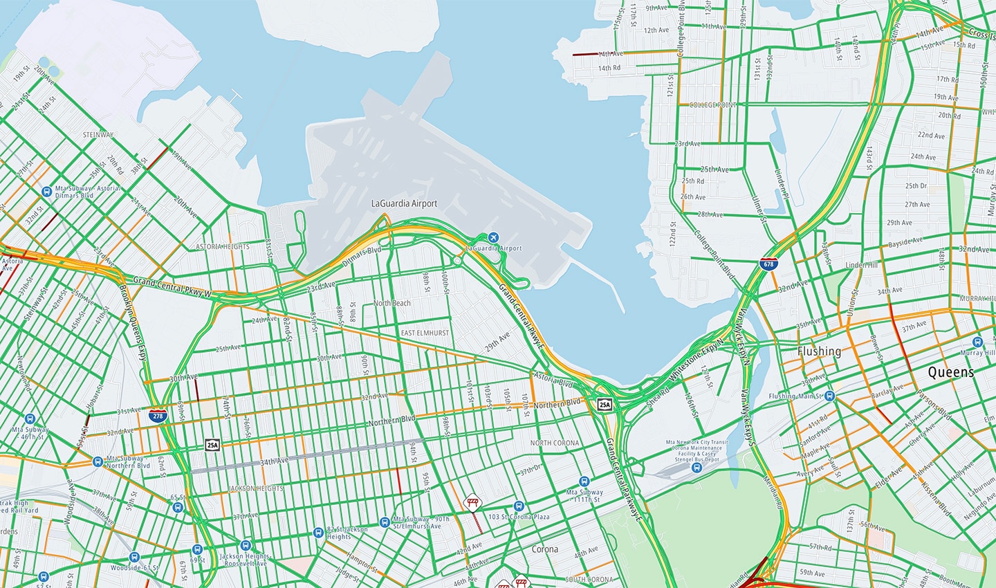
Accurate digital maps and navigation for areas in and around airports are incredibly important when it comes to making the airport experience stress free not just for passengers, but also for the many people whose livelihood Is connected to airports, including ride-hailing drivers.
 In the absence of up-to-date digital maps, locating the ride-hailing pick-up point and finding the cab you ordered in a new airport can be a harrowing experience.
Unlike old fashioned taxi ranks, airport authorities constantly change ride-hailing pickup points to manage congestion — making locating passengers a regular challenge that costs everyone precious time and money.
It's surprising how often this can happen. The pick-up spot could be in a different location every week. The best solution is an up-to-date map that can keep up with these changes. TomTom was first alerted about the difficulties these constant changes caused by its ride-hailing partners as part of the company’s Community and Partnerships (C&P) programme.
Around the same time, the world was entering strict lockdowns to curb the spread of the COVID-19 pandemic, and air travel was at an all-time low. Airports around the world saw this as an opportunity to ramp up outdoor construction projects, so they would be ready for the return of travelers. In all of this, TomTom spotted an opportunity too.
 As air travel plummeted during the COVID-19 pandemic, airports around the world ramped up outdoor construction projects.
“It seemed like the perfect time for us to review the most-traveled airports in the world and make sure the maps were accurate and depicted the correct pickup and drop-off points for ride hailing,” says Shaundrea Kenyon, Director of the Community and Partnerships team in TomTom’s Maps unit.
“Doing this would help us better the user experience and reduce travel stress that we knew people would have coming out of the pandemic.”
Keeping up with changes
The wide range of sources TomTom uses to stay abreast of changes that need to be mapped starts with its arsenal of sourcing staff and continues in the hands of highly trained GIS analysts and editors. These regional specialists possess language skills, knowledge of public and government data sources, and a roster of local contacts to help them keep on top of infrastructure changes in their region. They also have established relationships with airport authorities who understand the importance of map changes.
“When a new terminal is in the works, or ride-sharing pick-up points are being changed, they reach out to us and inform us of these developments. In airports like New York City’s LaGuardia or Boston’s Logan International Airport, we’ve even been on rides-along with them to make map updates,” says Dominic Danieli, who recently joined the Community and Partnerships team after over 20 years of working as a sourcing specialist for TomTom.
Unsurprisingly, the Internet serves as a great resource too. Airport authorities often post information directly to their official websites — from construction plans to interactive maps highlighting parking lot changes, new points of interest (POIs) etc. TomTom’s map editors also scrape other parts of the Internet — digital media, social networking websites among others – for leads they can use to make changes to the map.
 Floating car data from TomTom navigation apps and devices is extremely reliable when it comes to identifying changes in road layout.
Another reliable source is the vast catalogue of TomTom probe data, along with sensor-derived images from vehicles and devices using TomTom technology. When combined, all this data can help paint a highly accurate picture of where drivers are going, in which direction and at what average speed. When the position of a source shifts, or lots of cars start going down a road they weren’t before, or a previously one-way road becomes bi-directional (or vice versa), it’s usually an indicator of construction or changes in the road layout that need to be updated on the map
Add to that the constant feedback and updates on ground truth from ride-hailing partners, and TomTom mapmakers are in a pretty good place when it comes to keeping maps of airports up to date. When needed, they are even able to ensure that major changes can be reflected on the map ahead of time.
Making maps that reflect ground truth
Once TomTom has identified the inconsistencies between what the airport looks like at a given moment in time and what it looks like on the map, these errors can be rectified. Just like keeping track of changes, edits to the map can be made in multiple ways, depending on the magnitude of the change.
A simple change such as adding a one-way or a turn restriction can be made by map editors who use either TomTom’s professional map editing tool Cartopia or its community tool Vertex. A more complex change, such as updating the major roadways in an airport or the opening of a new terminal, would go through PreActuality, which allows map editors to capture ground truth as well as plans for the future.
“If we’re mapping a project that’s in progress using Pre-actuality, we can add a road that will open on say December 1, and apply a time restriction that ensures that road only becomes accessible via the map on said date,” explains Kenyon.
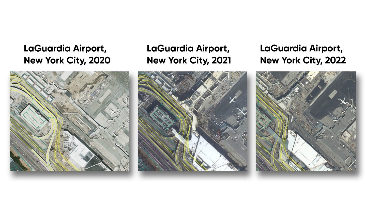 TomTom mapmakers use a wide range of sources and multiple map editing tools to ensure digital maps keep up with constant changes and additions to major airports, such as in the case of LaGuardia Airport, New York City.
This is also useful because the frequency of map delivery differs based on customers and partners. By logging a future change in Pre-actuality, TomTom ensures even businesses with longer intervals between each map update have access to fresh map data.
Lastly, map changes can also be suggested by partners such as ride-hailing drivers who interact with roads every day and are often the first to be affected by these changes. They can add changes to the map for review using either Vertex or MapShare Reporter, an online application built for this very purpose. These changes are then verified by editors and updated onto the map.
The roadblocks along the way
Despite this multi-point approach, keeping up with all the ways in which airports are constantly changing can be challenging.
As TomTom Senior Project Manager David Salmon puts it, mapping airports is different from mapping a public road network.
“In any private property, the relevant authorities can implement restrictions and changes much more easily than on public property.”
Airport authorities can often deviate from their original construction plans without notice — when things take longer or shorter than expected or projects are hit by funding cuts. TomTom’s map editors need to adapt to these situations quickly and decide whether to update the map, or simply add a temporary road closure.
It can also be difficult to receive updates from airport authorities in time. Keeping mapmaking companies in the know about their plans is obviously not their major concern, and is usually preceded by managing passenger flow, finishing construction in time among other tasks.
“That’s where our ride-hailing partners come in,” says Salmon. “They’re going to be impacted by these changes before anyone else, and so, they make sure to inform us so we can update our maps.”
With map editors placing larger emphasis on airports over time, however, many airport authorities are beginning to see the impact of accurate maps in the form of reduced traffic congestion and fewer complaints from passengers. This has resulted in better feedback and an increased willingness to work with TomTom.
“They're starting to be more proactive and give us a better lead time on changes. Earlier, we’d find out about a change the day it was taking place, now we get to know a couple of weeks in advance,” says Danieli.
People also read
)
Navigation nightmare: How TomTom mapped an airport in three days
)
The Boise boom: How mapmakers keep on top of boomtowns
)
Super sources will power the 'freshest map on the planet.' But what are they?
)
The world needs a better map: TomTom is making it with its new Orbis Maps and ecosystem
* Required field. By submitting your contact details to TomTom, you agree that we can contact you about marketing offers, newsletters, or to invite you to webinars and events. We could further personalize the content that you receive via cookies. You can unsubscribe at any time by the link included in our emails. Review our privacy policy. You can also browse our newsletter archive here.