)
Meet Carl, a TomTom Mapping Car Driver. If you’ve ever wondered how we keep our map data up to date, then you need to meet Carl Polgar. Carl has been driving mobile mapping cars at TomTom for the past five years.
Based out of Northern California, he has helped to extensively map North America. His job is imperative to collect information on the changing nature of cities, terrain and roads across this vast area – to keep TomTom’s maps verified and up to date.
I sat down with Carl to learn more about his role at TomTom and what it’s like to explore so much of the world in a TomTom Mobile Mapping (MoMa) car. All photographs are taken by him from his journeys!
Where are you right now?
I’m in San Juan, Puerto Rico, working on transporting our vehicle back to the mainland U.S. I’ve been island-hopping… and even got to skip winter this year!
Given that most of TomTom’s products are software and data-based, this doesn’t seem like a usual job at the company at all. How did you get involved in this role and how did it start?
I was working for ZenRen, a company which does POI (point-of-interest) verification. I had been doing that for four years, so I already had a mapping background on my resume. Then I just happened upon this opportunity to become a driver for TomTom. It was really a matter of good luck and good timing!
I’ve been based out of Sacramento for the past two years – during my first three years, I went wherever in the U.S. and Canada. I’ve been overseeing remapping regular road maintenance in the state of California. As we also need to map other U.S. territories, especially after a lot of large natural changes to the areas, I’ve been to the Virgin Islands and Puerto Rico as well.
What systems are you keeping track of while you’re on the road?
Our cars have a computer server in the back, and a laptop stand on the passenger side. And so, this gives me my route on the computer – where I have to drive. I keep an eye on that as safely as possible. I try to plan out my day beforehand, so that I have an idea of routes I need to take and places that I need to cover.
If it’s someplace familiar like Sacramento, where I know the road, it’s not hard to keep track of everything. Mainly, it’s following along, making sure I’m mapping where I’m supposed to be, keeping an eye on the road, and picking podcasts to stay entertained!
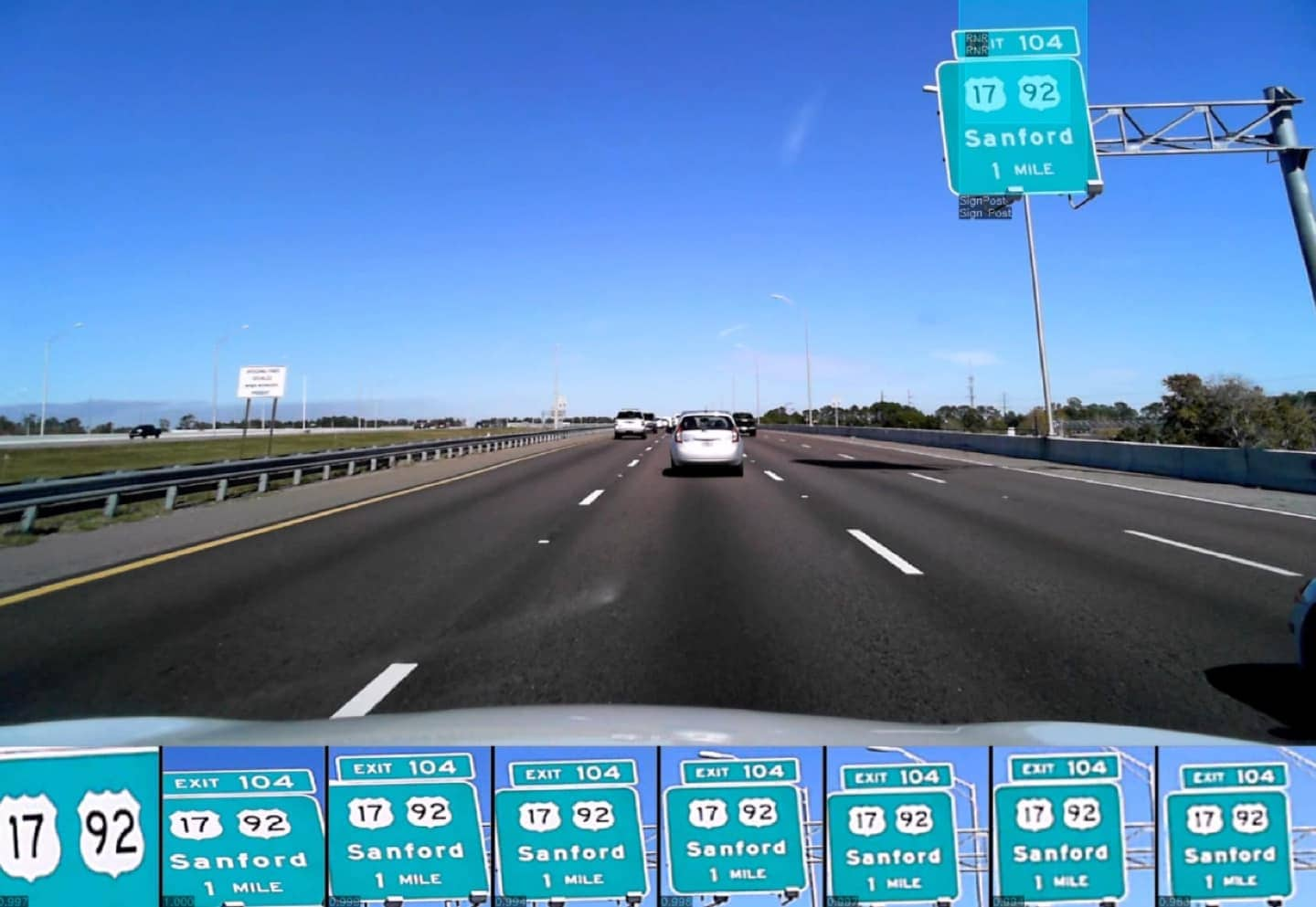
While this is a fairly typical view for the driver of a MoMa car, drivers like Carl often get to see more exciting and interesting scenes too.
How far, or how many hours, do you drive in a day?
As drivers, we work based on daylight. I can work up to an hour after sunset and an hour before sunrise. In winter that’s not much – maybe 8:00am to 3:30pm, depending on where you are. Summer is when most of us are excited to get on the road, as we can drive for as many as twelve hours at a time.
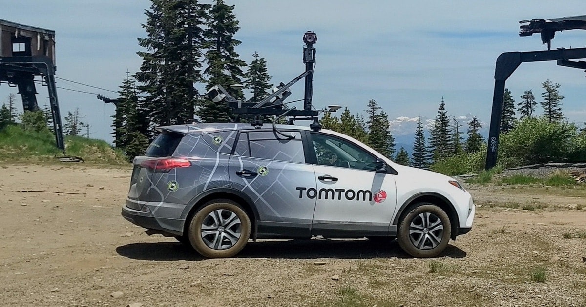
The car is equipped with lasers and cameras. While lasers can function regardless of light level, cameras need daylight for the picture quality to not be affected.
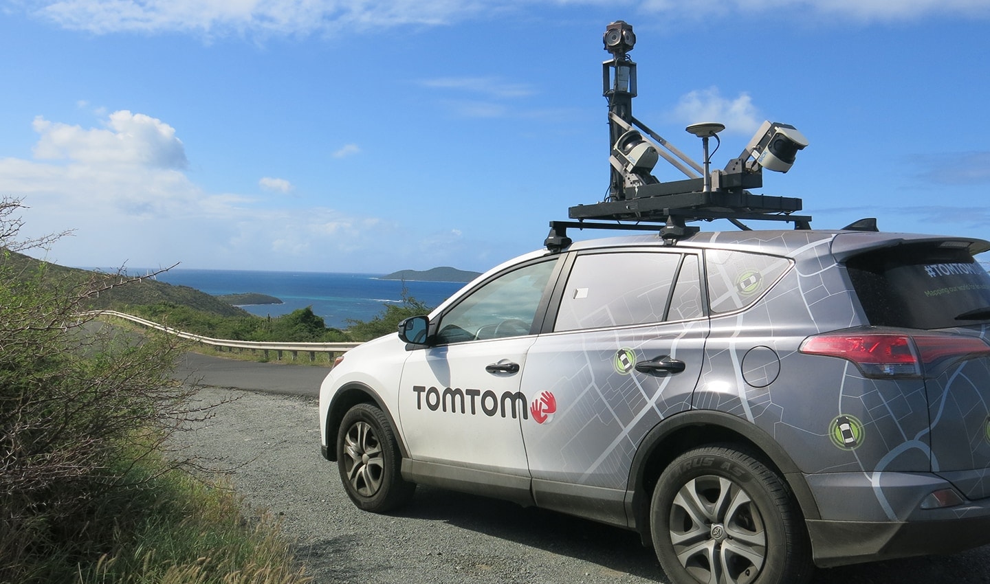
These important pictures are used for addressing, getting information on businesses, overpasses, and other features valuable not only for routing but also for trucking. One thing I’ve learned is that street signs are not always accurate! The combination of the lasers and the camera records depth. The cameras are positioned at the top of the car using 6 lenses taking 360 photos, including one camera pointed directly upwards, one picture every 8-10 meters.
We’re often approached as a mapping solution because TomTom has a successful record regarding privacy. Where do you see privacy coming into play in your area of work, if at all?
Sure. The camera data collected from our drives never goes public – so concerns about faces, finger wavers, or people flipping me off showing up on a public street view are not a concern for us.
Editor’s note: While this is a colorful description of the process, it is true that the photos taken from our mapping cars are not publicly available and are stored securely with restricted access, as part of a commitment to privacy. The camera data is used only for our own optimization of our maps over time.
Not all roads are created equal. What can make a drive challenging? The terrain, road styles, locale, events? What is the most disruptive?
There are the typical challenges, like Bay Area traffic — autonomous driving is tested there for a reason… if a car can drive itself there, it can probably survive anywhere — and there are some pretty interesting ones.
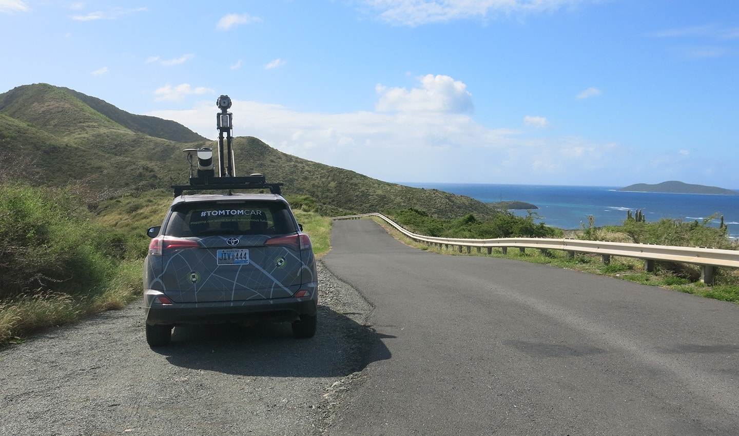
This is just one of the many stunning views that Carl has seen over his years as a TomTom MoMa driver.
A few years ago, in Puerto Rico, I was driving one of the main roads around the island. The maps here have changed considerably because of the hurricane and then the construction to rebuild.
My first day, I selected a mountain road to drive, drove south for 13 miles, and was 1km away from the mapped road connection when the road ended with a gigantic hole in the ground! I had no plan B, and since the roads were so disconnected, I had to go all the way back 13 miles. And so, being aware of your surroundings is important – and can make the drive extra trippy, especially if there’s a big hole in the ground!
I honestly don’t know how I’d react to a giant gaping hole in the road! While we’re speaking about experiences, could you tell me about a time where you most enjoyed the sights you saw while driving?
Not one time, but all the time. The Canadian Rockies are stunning. I’m able to find places even people who live in the areas I’m driving in don’t know about!
Every time I’ve been in Puerto Rico or the Virgin Islands, I get to drive around the entire space, on back roads, where people of all backgrounds live. Most people visit somewhere like Puerto Rico and only go to the downtown and where hotels and big sites are, and leave. I get to see everything.
From doing special mapping in California, I’ve also been able to see amazing sites on plenty of days, like the 101 between San Jose and San Francisco and Santa Barbara.
How does the driving affect your lifestyle? What is it like to be driving as your full-time job, without anyone else?
At the beginning of every year, I ask myself, how much longer do I want to do this? Then, I start driving and realize I can’t leave it.
There’s a certain amount of social sacrifice, of course – I have friends going out back home in Sacramento and plenty of times I can’t be there when I wish I could. I’ve had amazing experiences, though, just driving, and seen amazing things – the travel is part of the lifestyle.
We’re also able to take a good break by being able to fly home every 6 weeks, which helps a lot, and makes us able to stay close with friends, family, and home life.
Do you ever receive comments on the car? Any of our usual “Oh, I had a TomTom!”?
I do get comments on the car! It’s been great to notice that I have only ever had people happy to see the car and to see that TomTom is around and still driving. Specifically, in rural places, and areas affected by natural disasters such as Puerto Rico, people who see me stopping to refuel the mapping car are excited to know that we go and re-map areas after major events – it gives the impression that we really care about these out-of-the-way areas enough to make sure they’re mapped correctly.
Of course, in the United States, it’s extremely common to have people mention the classic “I used to have a TomTom! Will it still work?”, but in areas such as the Virgin Islands, they are less familiar with the company but still eager to ask questions, which is fun and surprising.
In what ways do you see developers around the world benefiting the most from the data collected by our mapping cars?
Of course, we’re providing buckets of map data for people to take what they need from and use our huge amounts of mapping information to answer any questions they have.
As a TomTom mapping car driver, Carl has experienced some of the world’s most picturesque roads. In some cases, he drives routes that even the locals don’t know about.
Do you feel autonomous vehicles threaten your role in the future? How do you think your role would change?
Ha – they still need someone to turn the car on and off, and fill it with gas… don’t they? This placates me. That’s what I think of.
If it eventually came to that, I’d give it a shot – I’d become an autonomous vehicle driver, supervisor or whatever that role is. I think it’s still going to be a while before there’s not someone in that car, in dense areas specifically.
At the moment, you can also think of what we’re doing as mapping the roads that an AV will eventually follow, which is detailed work. For example, we need to remap new streets that have become transit only, in places like SF and New York, so that AV cars know not to get in that lane.
It’s also important to remember that for us, driving the mapping car isn’t always an easy project. When we ship the car to the Virgin Islands and other similar areas, someone has to be there to pick up the car, register it, and coordinate the shipping and licensing logistics both ways of the journey.
Lastly – what’s the most rewarding part of the journey for you?
It’s two-fold – at a work level, I think I’m doing some good in the world. Here in Puerto Rico, people are happy to see me and that we’re going to remote areas where so much has changed.
On a personal level, I get to go deep into unknown areas and see things most people won’t see in their lifetime. Here in the Southwestern las Marias mountains, when you get up here, you can see the whole island and the Caribbean. I’ve stopped for cows and sheep on the road near Pinnacle National Park and stopped for iguanas and horses on the road on the islands.
“Carl Polgar
Mobile Mapping Car Driver
People also read
)
Can traffic data help us find a way out of the lockdown?
)
How we make our HD maps
)
Behind the map: how we keep our maps up to date
* Required field. By submitting your contact details to TomTom, you agree that we can contact you about marketing offers, newsletters, or to invite you to webinars and events. We could further personalize the content that you receive via cookies. You can unsubscribe at any time by the link included in our emails. Review our privacy policy. You can also browse our newsletter archive here.