)
Providing drivers with the best route possible is no simple task. Routing algorithms that take care of directing a driver from A to B rely on immense amounts of map data that needs to be up to date, accurate and contextual. As one instance in Finland shows, if map data isn’t up to scratch, drivers can be put in unnecessary danger.
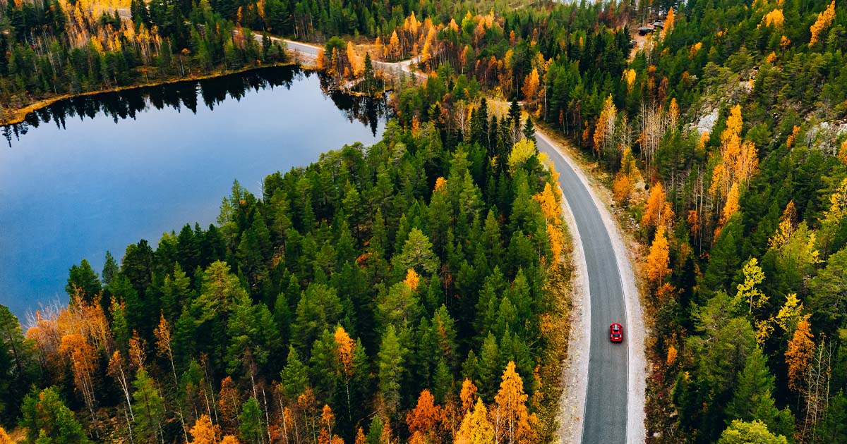
Koli National Park sits in Southeast Finland. It covers a 12 square mile area that watches over the northern part of the country’s Lakeland. In summer, the green hues of the forest and blue shimmers of the lakes dominate views around Koli drawing visitors from far and wide. But as the season changes and winter closes in, the softness of summer departs, leaving the trees golden, amber and orange — ready for the season’s inevitable snowfall.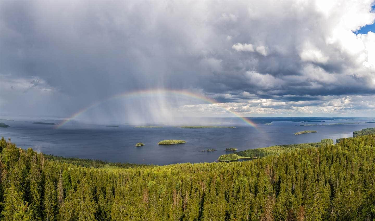
A panorama view of Pielinen Lake in Koli, Finland.
When the snow comes, roads to Koli become treacherous. During winter, daylight is significantly reduced adding further difficulty to driving. For Koli, daylight lasts for just six hours in December.
Navigating to the national park becomes not just a matter of getting there on time, but a matter of getting there in one piece. In many cases, navigation systems don’t consider how dangerous roads can be in adverse weather and for inexperienced drivers when they suggest a specific route, putting drivers in unnecessary danger.
Earlier this week, Miika Mäkelä, who works in TomTom’s map sourcing team, came across an instance in Koli where a number of popular routing and navigation services were sending drivers down a particularly dangerous route instead of safer available alternatives.
“During winter it can be hard to access [Koli] due to poor roads in the area. The shortest [default] route in ideal situations will be the fastest, but in winter, the curvy unpaved road can be tricky to drive,” Mäkelä says.
As part of his role at TomTom, Mäkelä follows discussions from a variety of sources to spot edge cases in map data that could lead to undesirable routing or navigation. In this case, after following a discussion on a message board, an employee of the local road authority that covers the Koli National Park area in Finland tipped him off to the fact that routing engines from major mapmakers and navigation companies were sending drivers down the alarming route.
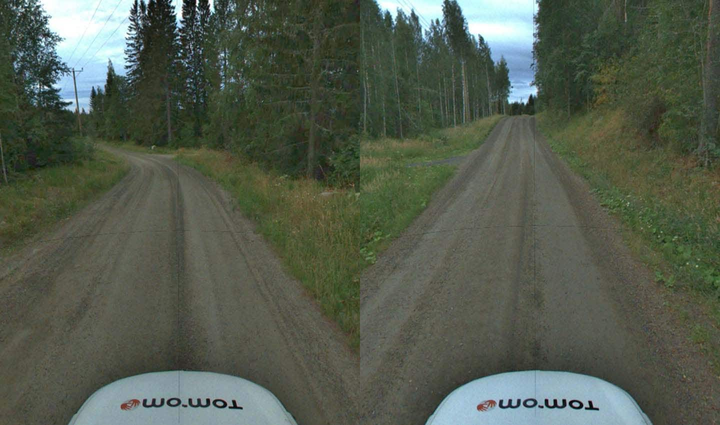
The unpaved road to Koli National Park, it’s a beautiful scenic drive, but one for skilled and experienced drivers.
Diving into the problem, Mäkelä found that two widely used routing engines chose the shortest and quickest (which is also the most dangerous) route to Koli, directing drivers off the main road (Highway 6) and onto a shorter but unpaved road (5040) by default. Road 5040 is more of a forest access road made up of loose gravel and sand. It’s slippery enough in summer, but in winter it’s an accident waiting to happen for inexperienced drivers.
On the other hand, “The main road to the hotel at the park is paved and well-maintained year-round – but slightly longer,” Mäkelä adds. Naturally, the local road authority is keen to ensure that location technology companies route drivers down the safer, albeit slightly longer route, by default.
Based on the Mobile Mapping images above and below, it’s clear which road most drivers would class as the safest.
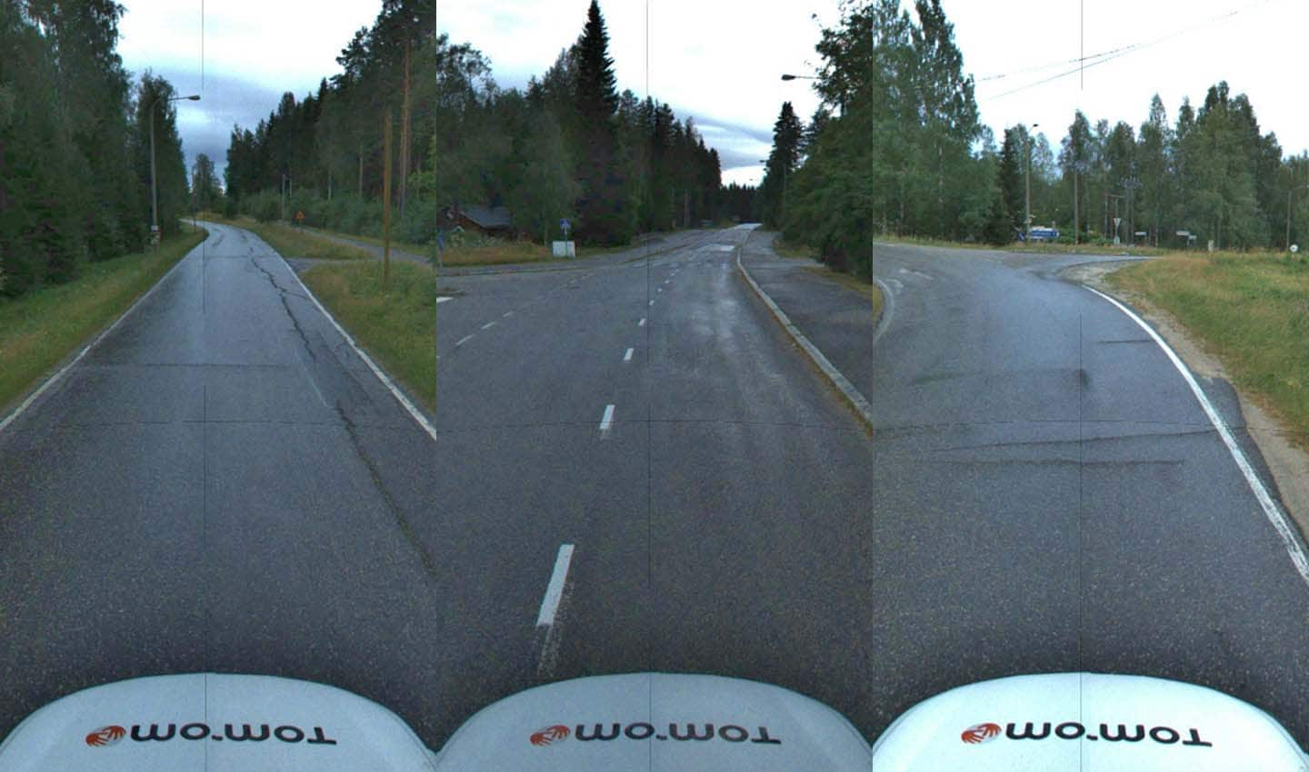
The paved route to Koli National Park, while still susceptible to adverse weather is safer thanks to its highly maintained surface.
Investigating how TomTom routes drivers to Koli National Park, Mäkelä was pleased to find that the company already suggests the safer route by default. The longer, safer route has an estimated travel time of 23 minutes, while the shorter more dangerous route takes 21 minutes. With only two minutes in it, why any system suggests the more dangerous route is a puzzle for navigation developers and map makers.
In this instance, TomTom seems to have solved that puzzle. “We [TomTom] navigate by default on the safest route to Koli even though the route options identifies that the short cut is slightly faster,” Mäkelä tells me. [Click here to see the route for yourself].
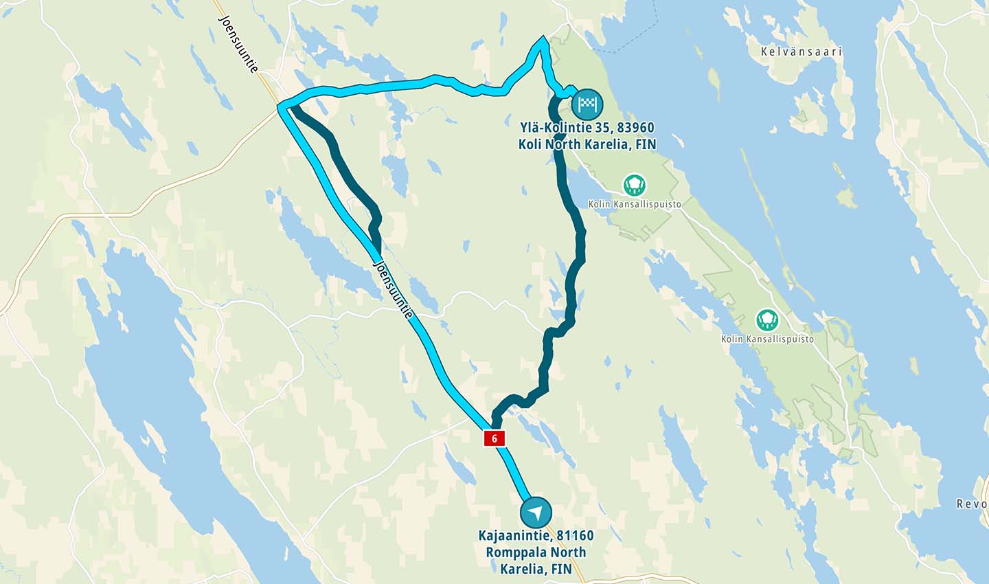
TomTom’s routing engine sends drivers along the safer, paved highway. The darker, shorter route is what other routing algorithms suggest by default.
If we zoom out for additional context about this area on top of what we know based on map data, MoMa data and satellite imagery, it becomes even clearer which route should be suggested by default. The unpaved road has many unique characteristics, such as its surface and its turns, which need to be taken into account.
Indeed, driving instructions on the national park’s website specifically suggest against using the unpaved road as well, giving the advice:
Rantatie (Road 5046) and Jerontie (Road 15735) are narrow, winding and hilly sand roads. These roads are challenging especially during winter, but also other seasons are challenging especially for big vehicles, such as caravans. During the winter, these roads can be challenging and studded tyres are always recommended. It is always best to arrive to Koli National Park via Kolintie (Road 504), which is asphalted. Navigators often recommend to use Jerontie and Rantatie, but it is better to drive through Neste Kolinportti and Kolintie (Road 504).
So why does TomTom default to the safer route?
Now, I can’t share the specifics on the answer to that question, it’s sensitive information. But what I can tell you is that TomTom’s routing defaults to the safer road as a result of how it classifies roads, the contextual data the company has on roads and how it interprets that contextual data.
TomTom’s routing and location technology recognizes that the shorter route to Koli National Park is on winding unpaved roads, made up of sand and gravel, and it takes that into consideration when computing a route for a driver. It places significant importance on this information.
Felix Dombek, a TomTom routing developer, tells me that the routing engine heavily penalizes the unsafe road to Koli because it’s unpaved. Navigation developer Carsten Gutwenger is quick to reiterate this point.
“In this case, we prefer the longer route since the shorter one is unpaved for a very long stretch. Unpaved roads get quite a big penalty by default, which does not affect the travel time but the ‘cost’ of the route. Unpaved roads are usually not the ones you want to drive, therefore we [TomTom] penalize those.”
Even though the unpaved route is shorter, it’s still not considered “better” than the longer paved route when all things are considered. If map data didn’t include this contextual data about the specific road, the unpaved road would most likely be the default route suggestion.
“This is a very good example showing that travel time is not everything you need to consider when proposing a route,” Gutwenger adds.
That’s not to say drivers should never take the unpaved road. By all accounts it’s beautiful, it cuts right through the forest revealing breathtaking views behind every bend. The important thing here is what the most recommended route is; what route will drivers who are not familiar with the area be told to take.
Drivers trust their sat nav devices. What’s more, drivers expect their sat navs to suggest the best route, and that — alongside suggesting the fastest most economical route — includes not compromising safety. Routing algorithms need to consider, and prioritize, the fact that drivers using them are most likely not familiar with the roads they’re using the device to navigate on. After all, that’s why they defer to the sat nav. Locals like Mäkelä know which road is safer and which isn’t thanks to their experience driving in this kind of terrain.
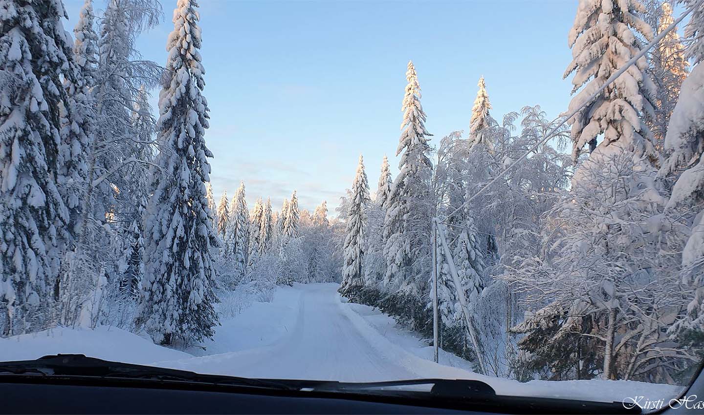
After snowfall the road is a winter wonderland, but significantly more dangerous than in summer. Credit: Suakkuna Blogspot, Kirsti Hassinen, 2019
The power of local knowledge
Drivers coming foul and experiencing difficulty as a result of blindly following their navigation devices is not a new phenomenon in Finland. In the winter months, it’s quite common for drivers to lose grip and control and end up in a ditch, as this local news report shows.
In November last year, Finnish authorities, the Lapland Rescue Department no less, issued warnings telling drivers to avoid a particular route after a popular mapping app sent drivers down what it described as a “strange” route.
The suggested route was on narrow and poorly maintained gravel roads, just like the one we see on the way to Koli National Park. Local experts say there’s virtually no difference in travel time using the safer, paved roads, even though the route is 15 kilometers longer. It seems the routing apps favor the short distance and don’t consider the potential impact of the road’s surface.
This kind of routing issue is an ever-changing puzzle for map makers and navigation developers. These kind of routing anomalies are a challenge for all companies in this space and making sure the safest route is offered is something that takes continual work, and there will always be cases where this happens.
“The database is big and for sure issues [like the road to Koli] are found all the time,” Mäkelä tells me. What matters is having the technology and processes in place to rectify the situation when sub-optimal routes become the default, he adds.
In this instance, TomTom had everything in order thanks to its approach to map making and routing. “We have dedicated regional experts scattered globally to proactively find these issues by reading news stories, following chats and so on,” Mäkelä says.
It’s not just a case of finding a road, mapping its turns, classifying it and absorbing it into a routing algorithm. What truly matters is the deeper context about that road, context which often can’t be extracted without a conscious effort or further investigation.
As Mäkelä highlights, “For the [TomTom] routing algorithm to work this well, the map attributes need to be correct. To get them correct can sometimes be a lot of detective work. Our success is for sure a combination of many things done right.”
People also read
)
What’s hot in automotive tech at CES 2022
)
Meet the devs that coded their way out of the coronavirus chip shortage
)
More than 20 years of mobile mapping, here’s how it began
* Required field. By submitting your contact details to TomTom, you agree that we can contact you about marketing offers, newsletters, or to invite you to webinars and events. We could further personalize the content that you receive via cookies. You can unsubscribe at any time by the link included in our emails. Review our privacy policy. You can also browse our newsletter archive here.