)
Close your eyes and think of a map... What’s the first thing that comes to mind? Is it an unwieldy paper map that unfolds to lay bare the truths of a certain area? Maybe you think of a hand-drawn map of a fantasy universe constructed to tell a story? Or do you picture a modern digital map with points of interest, zoom functions and colored lines pointing out a clear route for you to follow? The word map means different things to different people, and as mapping technology evolves so does the definition of what a map is.
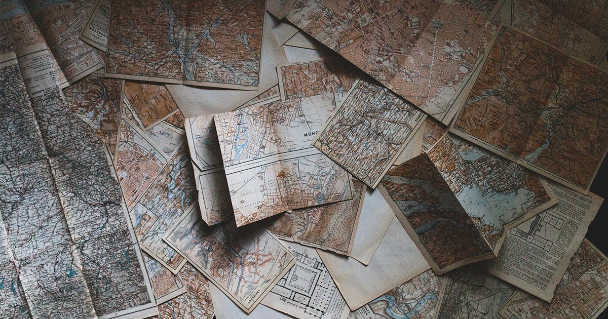
Before I delved into the fascinating world of digital maps and geolocation data, I would always picture an atlas. As a child, I’d spend hours turning the pages and spotting faraway places on the maps, tracing where they were in relation to me and dreaming of going there someday. Relief maps were my favorite — they wouldn’t just show the position of places, but also the elevation, making mountains extend off the page, until I could touch the peak with my finger.
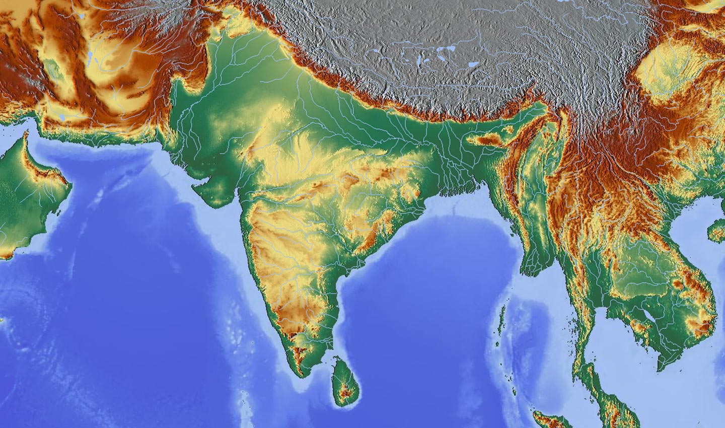 Above is a relief map of part of Asia. The colors represent topographical features with high elevation. The darker the color the higher it is. With shading, it makes it look as if mountain ranges extend off the page. Creative commons. Source: https://commons.wikimedia.org/wiki/File:South_Asia_relief_map_blank.png
Andy Marchant, TomTom Head of Portfolio Marketing, cut his teeth at Ordnance Survey, the national mapping agency in the United Kingdom known for its folding paper maps. But when he thinks of the word “map,” he thinks more abstract, picturing a usually iconic map, such as the London Tube map.
He’s quick to add, “But what we really mean when we say map today is data.”
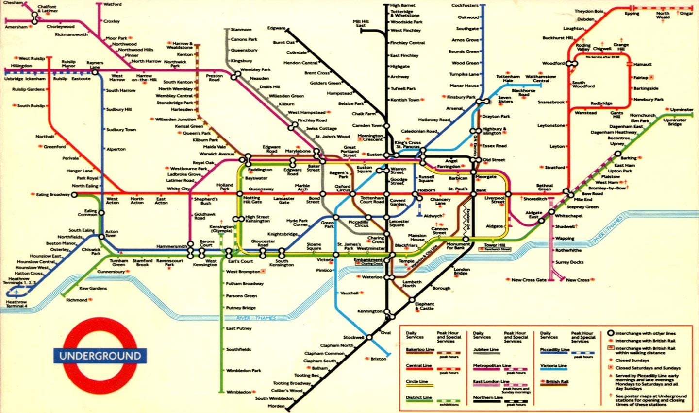 London Underground “Tube” Maps are one of the most iconic maps, and they draw into question how representative of reality do maps need to be to be useful? The above map is from the early 1990s, but before 1935 they were overlaid on street maps. As the London Underground network expanded it made more sense to display the network as an organized schematic rather than based on geography. Source, creative commons, with attribution: https://www.flickr.com/photos/24736216@N07/6515917871Today, digital maps relay much more information and context than just geographical topology. Pick a spot on a digital map and you can find the opening hours of a museum, the menu of a restaurant or even how much traffic there is on a particular road.
In a growing number of cases, humans don’t even interact with or see the map visualized. Instead, they view the digital interpretation of information derived from maps, location data and geographical context. Think about when your favorite streaming platform shows you movies available in your location, or a dating app tells you a potential match is only 400 meters away — these use cases further challenge the purpose and meaning of what a map is and should do.
How it began: Where did the word map come from?
Even though cartography has been around for a lot longer, according to Jerry Brotton in his book Great Maps: The World’s Masterpieces Explored and Explained, the word “map” was first used in the 16th century.
Rightly so, the book defines “maps” broadly, saying they are “a graphic representation that presents a spatial understanding of things, concepts, or events in the human world.”
Importantly, this definition doesn’t attach a specific scientific or geographical context to maps, highlighting how wide a range of uses can coexist atop maps as a singular concept. Maps can be navigational, they can be celestial, artistic, astrological, political or technological. They can be useful to and mean many things to many people.
Queer people use maps to identify safe spaces, electric vehicles analyze map data to understand how far they can drive without needing to charge and routing algorithms actively consider traffic ahead to provide drivers the best route.
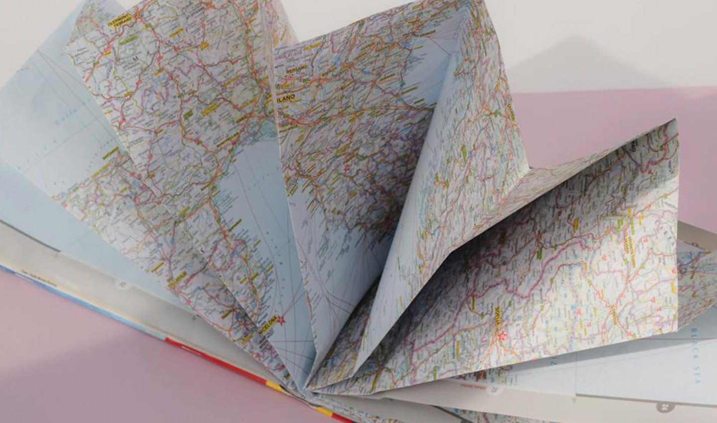 Folded paper maps provide readers with a transportable map that can cover a large geographic area — even if they are a bit unwiedly at times.Maps aren't just used by individuals; they’re also used by businesses and organizations serving both individuals and other businesses. So, if we want to go one step further than Brotton, we could say maps should also be defined by how they are used and the purpose they seek to fulfil, and that they are not just representative, but dynamically so.
“What a map means to me is different from what a map means to you. A map for a logistics company is different to what a map is to an environmental science company,” says Salim Baidoun, Global Community Engagement Manager at TomTom and self-confessed map nerd.
“It’s a borderless word and maps are increasingly powerful and broad. I always say it helps to be more specific when you’re talking about maps,” Salim adds.
(Map) data is the new oil
Over the past few decades, the number of use cases for geospatial data has risen tremendously. And with that, the nature of what “map” means, is evolving.
TomTom estimates that more than 20% of online searches today rely on location data to provide an accurate result. The company expects this number to grow, too.
A 2017 article from Wired reported that between 2007 and 2015, the number of students earning master’s degrees in cartography shot up by more than 40% on average. Demand for cartographers is projected to grow nearly 30% by the end of 2024.
As the company credited with making personal navigation “A Thing,” TomTom has found itself at the center of this evolution.
“Johan Land
TomTom’s Chief Product Officer
While navigation remains one of the most pertinent use cases, thanks to their breadth of data, maps power a lot more today. At the same time, the mapmaking industry is constantly having to stay ahead of growing demands. Mapmaking is hard —and the amount of data and investment required to meet those demands is no longer feasible for individual businesses.
What’s more, the proprietary nature of most commercial mapping solutions means the tech can’t always be used widely or easily, hindering industry-wide innovation. Inventors that want to apply maps to new contexts, historically, have needed to undertake a lot of work to build their map stack, add their own data, design it and publish it to their application.
But these problems are not without solutions. As TomTom's VP of Product for Maps, Willem Strijbosch says, “Open data has become so good over the past 15 years that we can build on top of it, and that it is key to moving the industry forward.”
The breadth, value and vast opportunity in open data further emphasizes that maps are not just visual things, they are important collections of data. What many of us imagine when we think of a map — its visualization — is just one other, albeit very important, part of what maps are today.
Maps of the future
The industry has gone from hand-drawn 2D maps that are someone’s interpretation of an area to accurately surveyed 3D maps that allow you to see your surroundings in many dimensions. And according to Marchant, we're now entering the era of the 4D map.
“The fourth dimension in mapping is the added context. So, you can not only navigate to a restaurant, but also see its opening hours, the menu and even how busy it is at a given point in time,” he says.
While maps themselves will have another dimension of context, maps will also be contextually aware of what their user needs from them.
Land notes, “The futuristic maps that we’re making today have a tremendous amount of information, but you will experience them in the geography and the context that’s relevant to you. If I’m walking, I don’t need to worry about the speed limit, and so, it won’t be shown, only relevant information will be highlighted to me.”
Appreciating modern maps
Thinking of maps as a visualization or representation of space, paper or digital, is perhaps a narrow perspective and fails to appreciate their modern, data-driven and fast-growing scope. When asked to imagine a map, we might think of paper maps, but we can also think of something that’s boundless, highly detailed, versatile and digital, that expands and contracts to fit its purpose and form.
Whether it’s a map carved in stone from thousands of years ago, a paper map or a HD Map that guides an autonomous truck to a successful delivery, maps have long evolved alongside humans. As they continue to evolve into the most expansive, most accurate they’ve ever been, it’s our job to appreciate all that they're becoming.
People also read
)
Maps are the unsung hero of modern tech
)
Fresh, open, flexible and futureproof — TomTom Orbis Maps is the new standard in mapmaking
)
Maps only matter if they matter to you
)
Why are there so few global mapmakers?
* Required field. By submitting your contact details to TomTom, you agree that we can contact you about marketing offers, newsletters, or to invite you to webinars and events. We could further personalize the content that you receive via cookies. You can unsubscribe at any time by the link included in our emails. Review our privacy policy. You can also browse our newsletter archive here.