Coronavirus on the map: How TomTom digitizes temporary road changes
&w=256&q=90)
Every year, road networks change by as much as 15%. To deal with this impressive volume, mapmakers like TomTom have systems in place to ensure that these changes are reflected in the map as quickly as possible. What happens when, in addition to these, a global pandemic sets a whole new host of changes into motion?
Co-authored by Esther Tol, Product Manager Traffic Analytics and Matthew Byrne, Quality Specialist Content Operations.
At TomTom, we make over two billion map changes every single month. We do this to ensure that all 71 million kilometers of roads across 164 countries covered by our maps reflect reality as accurately as possible.
Want to know how we make TomTom Maps?
Read this article to find out.
Coronavirus: rethinking traffic
As the coronavirus pandemic evolved, borders closed and some crossings became restricted, causing a whole set of new road changes in a very short amount of time. Travel restrictions began with “red zones” in Italy and quickly became prevalent across many countries, in Europe and worldwide.
Even now, as travel restrictions have been relaxed or lifted, we continue to see changes. Local, regional and national authorities are introducing a variety of measures that impact road regulations. These new measures can be temporary or permanent. For example, many cities have adjusted some roads to only allow bicycles.
In this context, it is important that these ever-changing road conditions are reflected in the maps drivers use, so they can navigate safely and without stress.
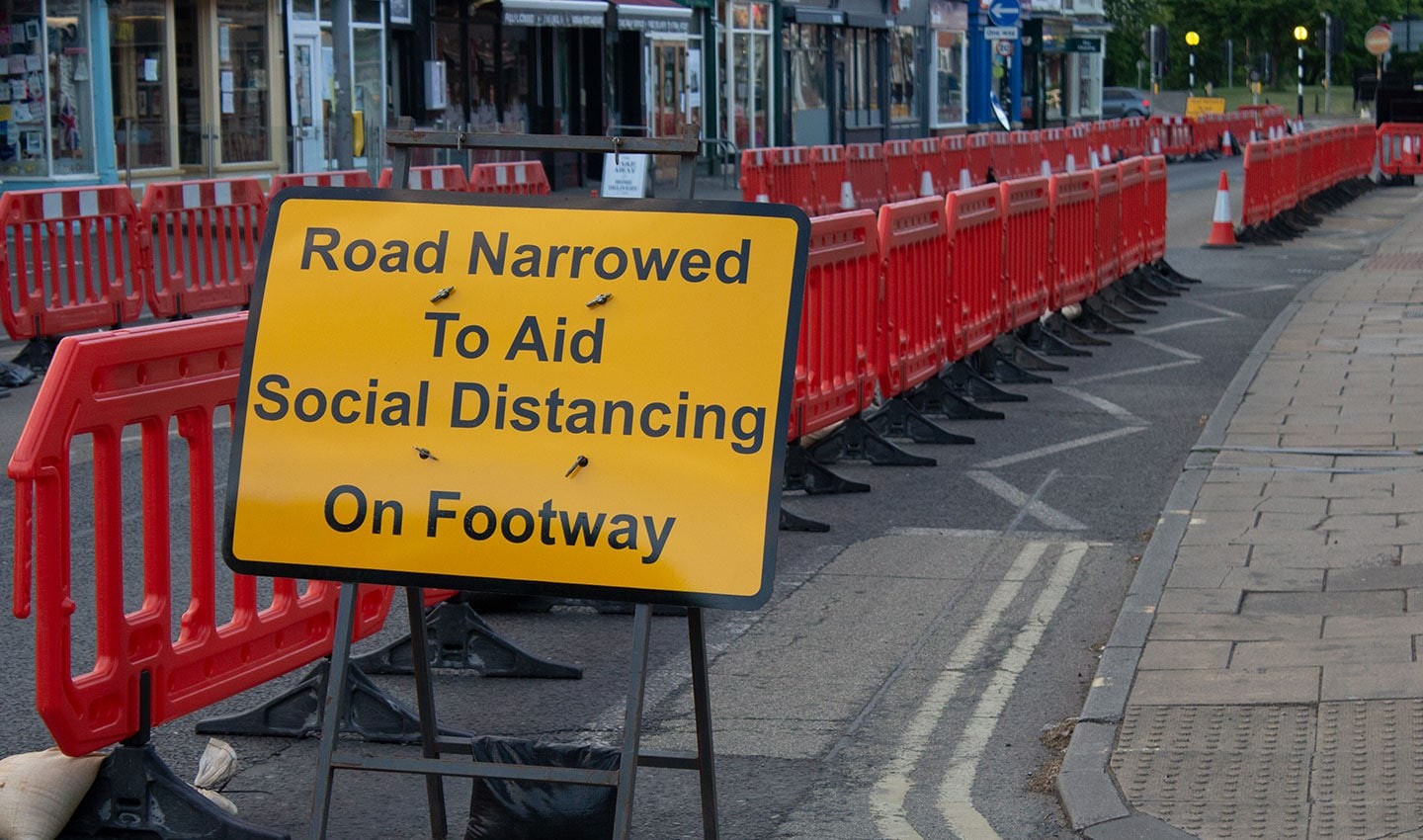
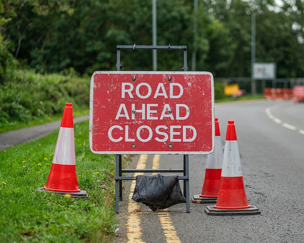
A sign in the UK informs citizens that a road is half closed to allow enough social distancing space for pedestrians.
Staying ahead of the coronavirus with TomTom Traffic
TomTom Real-Time Traffic is a market-leading service that includes information about temporary road conditions and incidents. More than 600 million drivers use it to get to their destination quickly and comfortably. During a global crisis like COVID-19, traffic data becomes even more important. Residents rely on navigation devices with traffic information and turn to them, now more than ever, for their safety.
TomTom’s promise is to provide the most up-to-date and accurate traffic data for our applications and devices, in order to determine the best route for any journey in the context of COVID-19. This information also needs to be displayed in a safe and clear manner on all of TomTom’s managed applications and devices, from navigation devices and Maps APIs to apps like TomTom AmiGO and TomTom GO Navigation.
So how do we ensure that the correct traffic information is displayed at the right time and in a useful way across all platforms? Let’s take a closer look at the team that makes it happen.
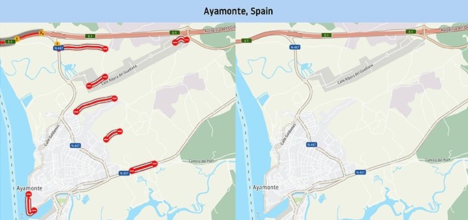
The city of Ayamonte in Spain, before and after being blocked off completely except for one restricted access via E-1.
Around the clock: monitoring and recording traffic regulations
The TomTom Traffic Content Operations team monitors the outbreak in real time, covering temporary traffic regulations enacted around the world. The goal is to ensure that the most recent data presented to the public finds its way into TomTom’s maps.
To achieve this, quality specialists span five offices in three continents to provide consistent 24-hour coverage and make immediate changes to the map, no matter the time zone.
The five stages of COVID-19 road change updates
The TomTom team monitors regulations and connects with authorities.
Changes are detected and validated in the TomTom Traffic Fusion Engine.
An incident feed is available in TomTom Traffic.
Changes are visible across TomTom navigation devices, APIs and apps.
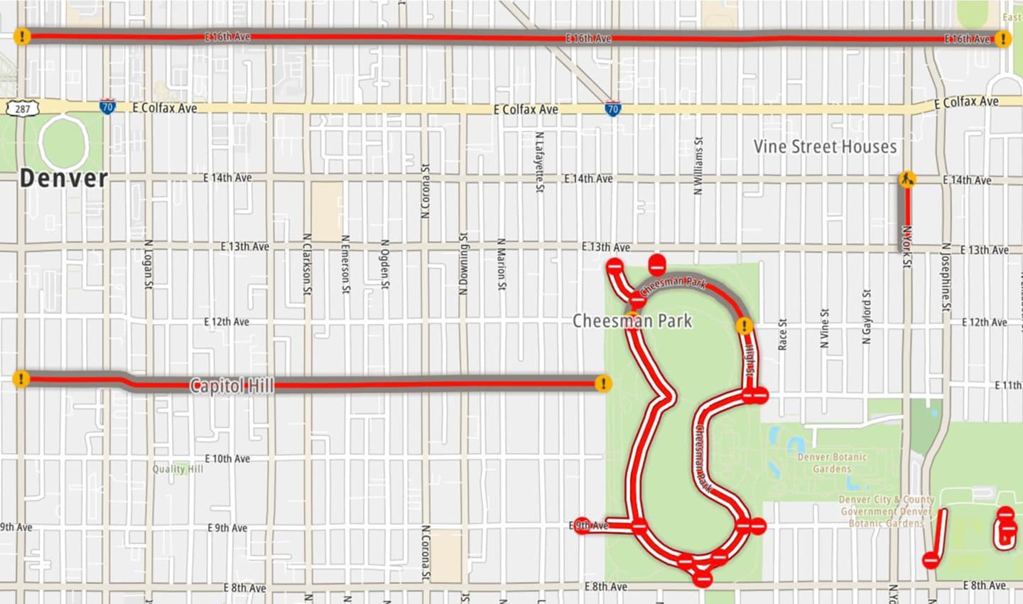
Image of two different classifications in Denver, Colorado. The white lines represent full closures, while the grey and red lines represent restrictions.
An eye for detail: accuracy and road restriction classification
No matter how constant the stream of new road updates seems, the stakes are high for these changes to be entered in real time and with great accuracy.
For example, even a handful of incorrect border closures between Italy and Switzerland in the region surrounding Milan could create a several-hour detour into the Alps for delivery drivers carrying essential goods.
On our watch, we are determined not to let this happen.
As soon as the first coronavirus regulations came into effect in early 2020, our team closed borders, reflected closures in public spaces like parks and beaches, and introduced conditional closures related to local programs. Through these programs, local governments closed roads for unessential traffic, giving pedestrians the space needed to maintain a safe social distance from one another.
One example is the set of ‘slow streets’ restrictions in Oakland and Alameda, California. In this case, it would be easy to mistake these road restrictions for full road closures and reflect them as such on the map. However, doing so would not accurately reflect reality, where vehicular traffic is still allowed to pass for essential reasons, such as deliveries or emergencies. In these municipalities, the TomTom map showed ‘slow streets’ for what they were, instead of full road closures.
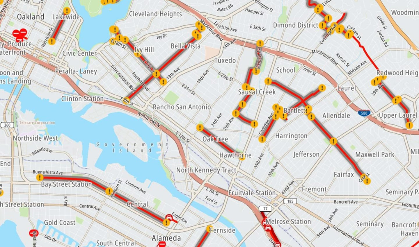 'Slow streets’ in Oakland and Alameda, California.
When it comes to accuracy, the level of restriction is a crucial detail. When speaking of a global pandemic, incorrect closure messages could have severe repercussions for travel and safety. With coronavirus restrictions, the chance of situations where mobility becomes nearly impossible is high. These restrictions are usually numerous and geographically grouped. Temporary road closures might become permanent. Roads with heavy traffic might become pedestrian zones. Speed limits will change and restrictions on vehicle types will come into effect.
To manage the rapid pace of change in these regulations – whether they are new, existing, temporary or permanent – we are committed to continuing to update our systems.
Safe travel during and after the pandemic is at the top of TomTom’s priorities, as shown by the accurate and comprehensive road closure data we provide to our end users.
Want to use TomTom traffic data to inform your mobility decisions during and after the pandemic?
Whether you are a transportation planner, road authority, business or driver, learn how TomTom’s full range of road analytics products can help.
People also read
)
What can traffic data tell us about the impact of the coronavirus?
)
Can traffic data help us find a way out of the lockdown?
* Required field. By submitting your contact details to TomTom, you agree that we can contact you about marketing offers, newsletters, or to invite you to webinars and events. We could further personalize the content that you receive via cookies. You can unsubscribe at any time by the link included in our emails. Review our privacy policy.