How to optimize fleet routing and improve ETAs
&w=256&q=90)
The world has undergone many changes these past few months. The narrative is shifting as what it means to be mobile and to manage mobility from a business perspective evolves. With a pressing need for delivery systems, connectedness through safe transportation and security during a time of uncertainty, we’ve seen the need for reliable, scalable and flexible fleet management software on the rise at TomTom.
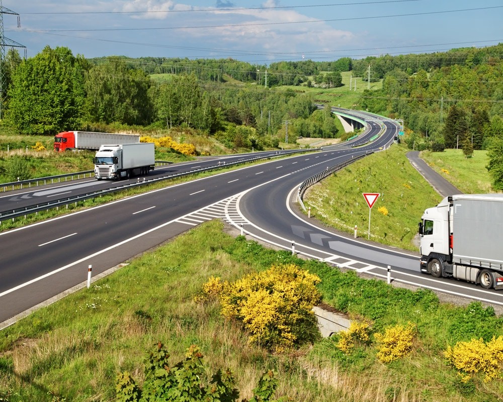
The massive increase of deliveries dispatched has produced a sudden rise in volume, straining even the largest systems in the industry. How can fleet managers plan and schedule package deliveries, route vehicles successfully and track vehicles and packages from start to finish? The key lies in implementing an efficient delivery route planning.
Effective package deliveries
We’ll walk you through each technical process involved in optimizing the process of transporting a package from its origin point to its customer, organizing everything from consistent location points within system storage to road hazards, load types in transport, traffic considerations and the last steps before final delivery.
With our extensive Maps APIs, fleet managers can easily oversee the implementation of fleet management systems through every step of the transportation process and beyond. So, using TomTom data, let’s see how a fleet manager would optimize moving that package to its destination.
Fleet planning and scheduling
When a customer makes an order, the address and each item's location need to be defined. Systems are organized differently, some using primarily coordinates, and some using addresses to keep track of locations. Working with different setups is key to being able to shift between the two.
TomTom’s Geocoding and Reverse Geocoding from the Search API can be used to transform addresses into latitude-longitude coordinates and vice versa dependent on system needs, to create readable formats for different systems that will begin plotting routes for delivery. It can also create an opportunity for differentiation, to make sure all addresses line up with their equivalent map coordinates, as some addresses of course exist in multiple places or might be input incorrectly.
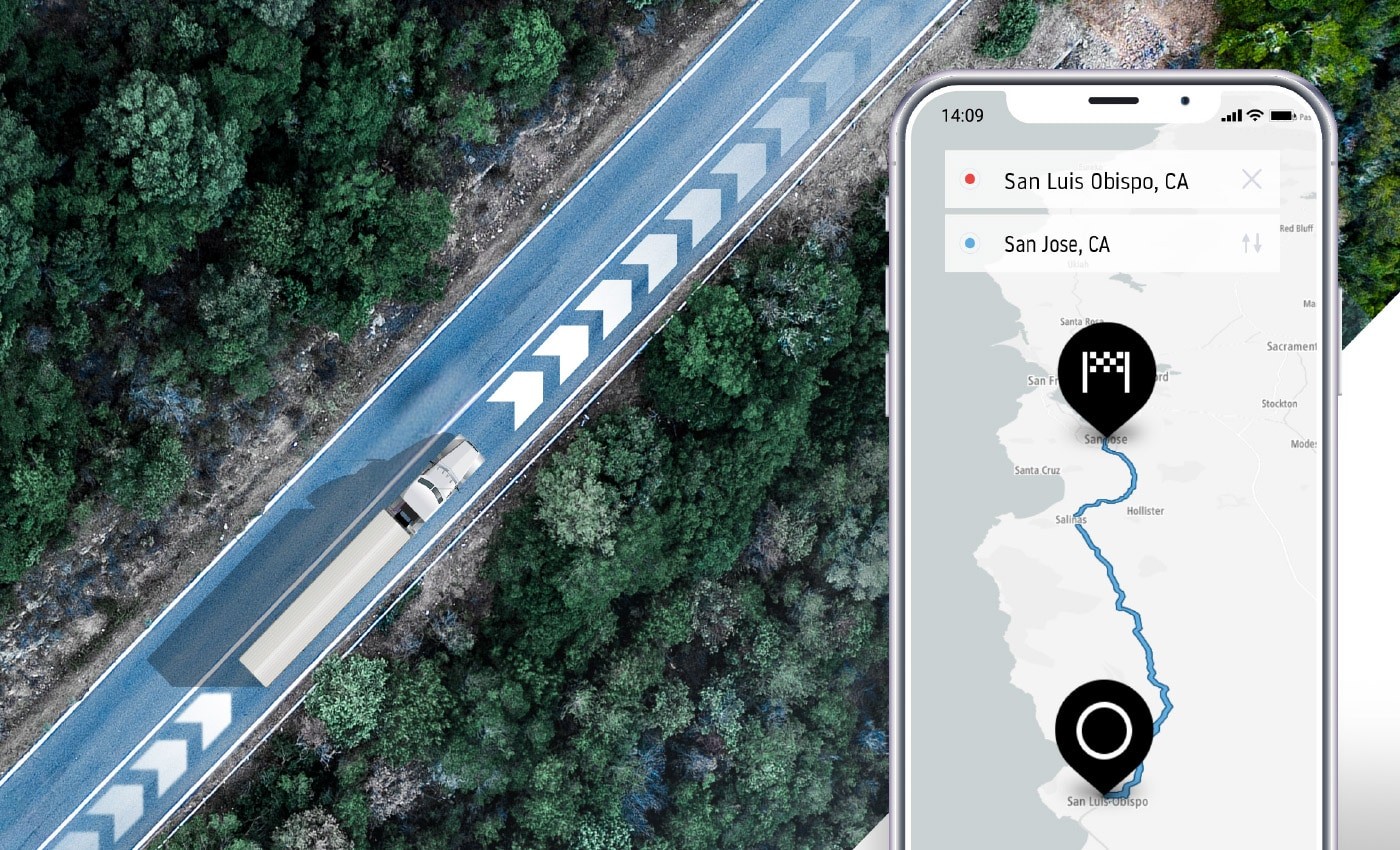
Using driving data for accurate estimated times of arrival
After there’s a steady link between the proper address and its coordinates, route optimization can have its early start by examining average speeds on travels paths, accomplished with TomTom Speed Profiles. This sets up the system to schedule accordingly in tandem with other aspects of routing, such as hazard considerations, traffic, and road closures, so that routes may be designated by speed within a given system for a baseline organization.
Speed profiles use millions of aggregated GPS measurements to help further predict roadway slowdowns and result in greater ETA accuracy. Using speed profiles is another way to further enhance the way routes are pre-planned, along with trip groupings, timetables, and the estimated travel time with traffic. In a nutshell, this means that speed profiles work with the mountain of data already layered to ensure the package is placed on the right truck going the right way to ensure that the package will arrive when the customer expects it.
These designations of addresses and paths of travel comprise an initial, significant step in the “pre-planning” process that helps set up the trip’s routing.
From truck routing to tracking assets and vehicles, managing fuel consumption and getting packages to the right door on time, TomTom is the number one provider of mapping services to the fleet management and logistics industry.
Delivery route planning
Numerous factors play into finding the best final route for a fleet’s delivery routing: traffic conditions, multiple start and end points, and details such as weight, cargo, and height. Here, we’ll go over some features and APIs that can help fleet managers stand out from the competition when it comes to finding and optimizing the best possible route.
Traffic is a huge piece of the routing puzzle. This is where predictive traffic as well as specific parameters of our Routing API give teams the ability to pre-plan routes by using traffic history to specify optimal leaving times depending on location, and to build a route using minute-to-minute traffic condition updates. At this stage, our Matrix Routing helps calculate distances and travel times from multiple start and end points, and Batch Routing can be used for multiple routes at one time.
Our Traffic API itself can be integrated via two main views – the Traffic Incidents layer and Traffic Flow layer, respectively. The incident layer alone shows a map view with traffic accidents and road closures, while the flow layer displays the full directional flow and traffic speed of cars on the road. This key information eliminates the final variables in the delivery system, making it possible to go that extra step when communicating with users by streamlining delay alerts due to accidents and blocked roads, and to optimize same-day delivery windows.
When traffic and leaving times are included, it’s also important to factor in the weight, cargo, and height of fleet vehicles using the Common Routing API Parameters, which makes allowances for the needs of Trucks and commercial vehicles on the road. As expected, no package is transported alone, and so it may be paired on board a shipping truck with goods that require different routes based on hazardous loads. Even something as typical as certain batteries for hobby electronics projects and certain aerosols require hazard shipping standards.
Additionally, smaller and larger trucks are deployed depending on volume headed to the current location. With these API parameters designed for truck height, teams are able to plan routes that include only tunnels high enough and roads wide and strong enough by government ordinance to accompany the vehicles.
“Olivia Vahsen
Developer Advocate, TomTom
Fleet Tracking while en route and delivery
Finally, the last step of building a route plan involves setting restrictions on areas where the vehicle should not be traveling, and getting alerts if boundaries are crossed. The AvoidAreas parameter of the Routing API in tandem with the Geofencing API can perform both of these actions. This works not only for restricted areas, but can also detect border crossings. The AvoidAreas parameter can be incorporated with the route type preference setting as a subtype of the Routing API, which moves the planning stage of fleet routes into the tracking stage of assets and the routes created.
The Geofencing API can share information with the Location History API to then store the position of a tracked asset in a readable format and continually monitor for security, and enable alerts via the Notifications API to give real-time updates as to the status of a vehicle to ease communication with both drivers and customers. This includes near-delivery status updates as the customer can potentially track their package when it nears their address for drop off.
Planning for delivery trucks of all types, shapes, sizes, and fuel types
Now that the package has been accounted for in terms of traffic delays, accidents, border crossings, cargo size, and hazardous load status all at once, it’s best to expand the definition of fleets to include a key player: EV trucks. As many areas look to reduce their footprint and stop contributing to pollution in dense urban zones, truck drivers and customers face a new pause when it comes to presenting and expecting proper planning when delivering with EVs which need charging. Truck route planning can be particularly complicated as it can be very different from other vehicle planning in regards to roads, traffic and restrictions.
With the popularity of these electric fleet vehicles on the rise, truck fleet management can be a bit more complex as new types of electric delivery trucks join the road each year. Luckily, this is solved when ETA accuracy and trip planning work hand in hand with a specific vehicle’s reachable range. In 2020, fuel consumption can vary widely not only based on the load, size, and age or make of a truck or fleet car, but also on electric versus combustion engines. In parts of Europe, EV charging stations now have a very high density per 100 km, and in many cases electric cars serve a lower fuel price point overall for fleet managers.
Leaving and arrival times have a complete picture when Long Distance EV Routing under the Extended Routing API is used to compute maximum travel distances for vehicles without combustion engines. This enables drivers to plan proper stops and optimize time along the route; no one wants a delayed package because a truck needed to stop for fuel, electric or gas. This means that stops are pre-planned and can be incorporated in the same way as other factors to contribute to the most accurate ETA for customers.
Explore our developer resources to learn more about how TomTom can streamline your fleet’s mapping.
The future of fleet management and ADAS Mobility
This conversation over the future of delivery systems began by talking about route and movement planning. Now, by analyzing the history of a routed asset to create a more complete use case frame, we can look toward the future of fleet – leveraging advanced systems to strengthen the future of fleet management. As experienced across the fleet industry, now more than ever the world relies on the organization of delivery systems and quick progress to build safer, faster and more reliable tracking methods for the delivery chain.
Even with route pre-planning via predictive traffic and customized planning for height and weight, there are still random conditions and other impacts on the driver’s real and present view of the road that are left up to some chance. The innovative ADAS, or advanced driver-assistance systems, offers intelligent speed assistance and more advanced navigation and routing for trucks, integrating curvatures and gradients to secure the safety of routes in real time to keep drivers, packages, trucks and customers on the same page.
As fleets grow and change, they will become more complex. Fleet management companies need the software to anchor them in innovation and safety, as they go electric and as drivers become accustomed to more embedded safety systems to prevent accidents and modulate travel to weather conditions and unpredictable accidents on large highways the world over.
Building a suite of tools to back up valuable assets to stay mobile is key, and it starts with planning and tracking technology that leave less to chance and more in the hands of fleet managers.
How ETAs work – and how to make them work for you
Take a deep dive into the world of ETAs and learn how to power arrival times with precision.
People also read
)
How IFS optimizes planning and scheduling using TomTom location insights
)
How Sygic navigation solutions use TomTom map and traffic data to show drivers the way
)
How ADAS helps truck drivers stay safe and drive efficiently
* Required field. By submitting your contact details to TomTom, you agree that we can contact you about marketing offers, newsletters, or to invite you to webinars and events. We could further personalize the content that you receive via cookies. You can unsubscribe at any time by the link included in our emails. Review our privacy policy.