Measuring road traffic density: what you need to know
&w=256&q=90)
In today’s connected and competitive world, innovation is a prerequisite to business success. A tall order, that businesses worldwide strive to meet so that they get to live another day.
As the marketplace shifts at an incredible speed, business intelligence powered by data – complete and accurate – is becoming mission-critical.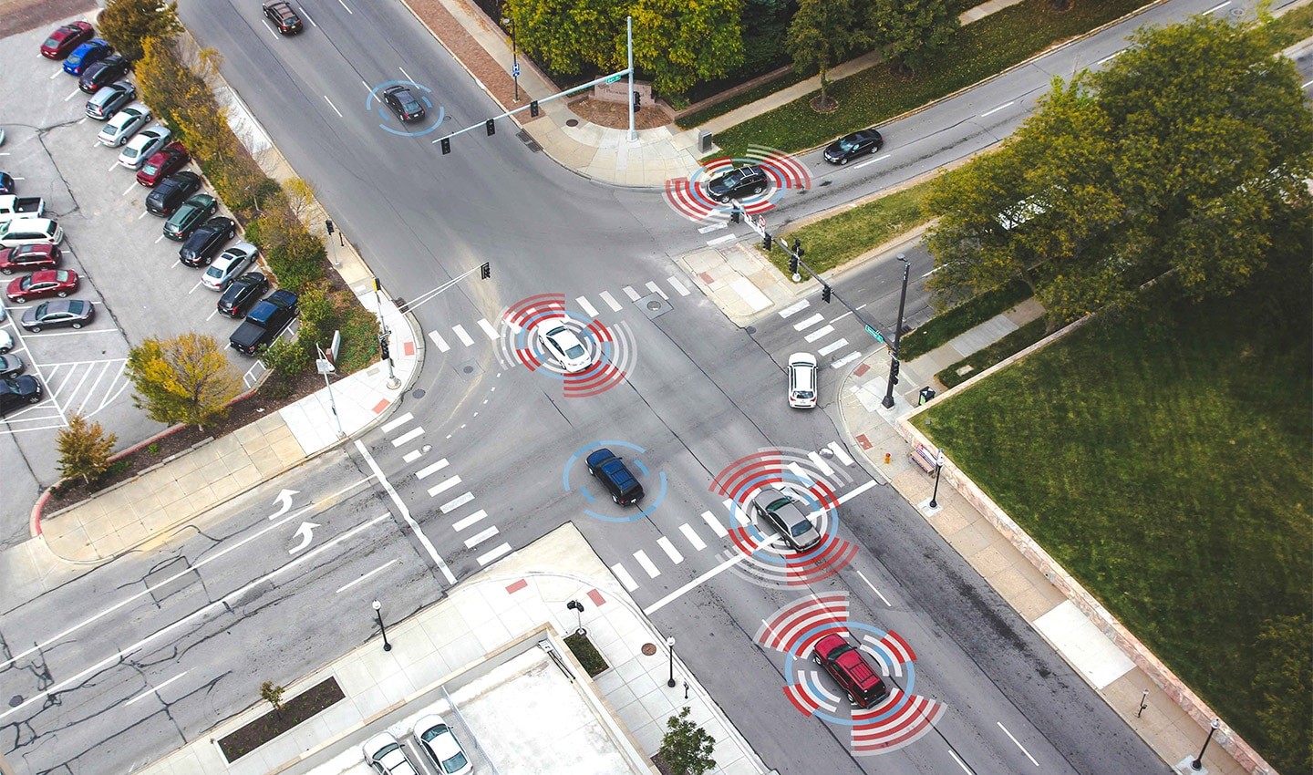
However, not all data is created equal. It is location data that ranks highest in a research conducted by the Dresner Advisory Services. Their 2018 Location Intelligence Market study revealed that 70% of the telecommunication companies surveyed and 66% of enterprises ranked location intelligence as either critical or very important for their business success.
With this in mind, what is it that makes location intelligence so valuable to businesses?
Leveraging the power of traffic and location data
With a rapidly growing IoT sector and ever-growing visualization of things, the importance of location intelligence has been steadily increasing in past years.
Its uses are varied and versatile, from searching and visualizing addresses and geocoding to combining it with other data sources in business intelligence to create more powerful insights.
The Geographical Information Systems (GIS) sector has caught onto this and is making excellent use of available information. Companies like ESRI, Pitney Bowes and Carto are leading the way in putting location intelligence at the core of their business.
Driven by cloud technology, the GIS industry is growing at a staggering rate of more than 10% each year. This is increasing both the amount of spatial data available and the use of remote sensing methods such as lidar technology, a remote sensing method that uses light in the form of a pulsed laser to measure ranges (variable distances).
When location is critical to your business success, how do you make sure to find that sweet spot?
Find the perfect spot
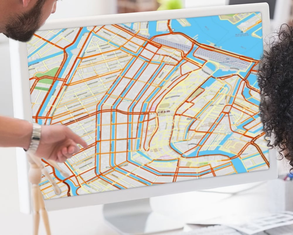
TomTom Traffic Density gives businesses the most realistic view of traffic hot spots. Its traffic data based on 600 million connected sources can be used to support business intelligence and geo-marketing activities for a range of industries, including insurance, real estate and advertising.
Planning your next store location? Traffic Density lets you find the perfect spot.
It does so by providing unique insight on typical TomTom Traffic counts for the complete road network, per direction for every hour and day of the week. The product enables the comparison of road elements within an area of interest and helps identify traffic-dense locations and hot spots.
Want to learn more?
Download the Traffic Density product sheet.
Better traffic insights, faster
In the end, it all comes down to faster and more informed decision making. For German location management firm Nexiga, TomTom Traffic Density is about better location planning. CEO Dirk Schneider says: "To be able to visualize the speed and the density of traffic makes a big difference to Nexiga’s business and puts the company and its customers in a position of clear competitive advantage."
“With advanced location-based tools like TomTom Traffic Density, all businesses can now find an edge to stay ahead and deliver a better experience to their users.Dirk Schneider
CEO, Nexiga
People also read
)
Behind the map: how we keep our maps up to date
)
Why machine learning development should always be Agile
)
The TomTom Traffic Index: An objective measure of urban traffic congestion
* Required field. By submitting your contact details to TomTom, you agree that we can contact you about marketing offers, newsletters, or to invite you to webinars and events. We could further personalize the content that you receive via cookies. You can unsubscribe at any time by the link included in our emails. Review our privacy policy.