The history of navigation and what’s next
&w=256&q=90)
Navigation has come a long way – from directing ships with compasses to traditional cartography to embedded navigation systems in vehicles, we are constantly evolving methods for finding our way.
Early navigation relied on simple observation. Without any technology to guide them, sailors had to stick to the only tool they had – the naked eye. By keeping close watch of clouds during the day and stars at night, they could approximate their location. Navigation tools evolved with astronomy, and reliance grew on constellations and star charts. Then came the compass in the 11th century – the first made of a magnetized ore of iron. Thanks to the Earth’s magnetic poles, sailors no longer had to look to the skies to know where they were.
Eventually there was a shift from seeking guidance from maps of the stars to maps of the earth. One of the most important innovations known to humanity, mapmaking, evolved from simple country maps to sophisticated road maps using satellite imagery and aerial photography. Paper maps became an in-car staple, but not a cure-all, as they were quickly outdated. Enter location technology.
The digital revolution for automotive navigation systems
While traditional maps still play an important role, innovations in location technology – including digital maps and GPS systems – have drastically changed the way we move, making it easier to plan trips and enjoy safer driving.
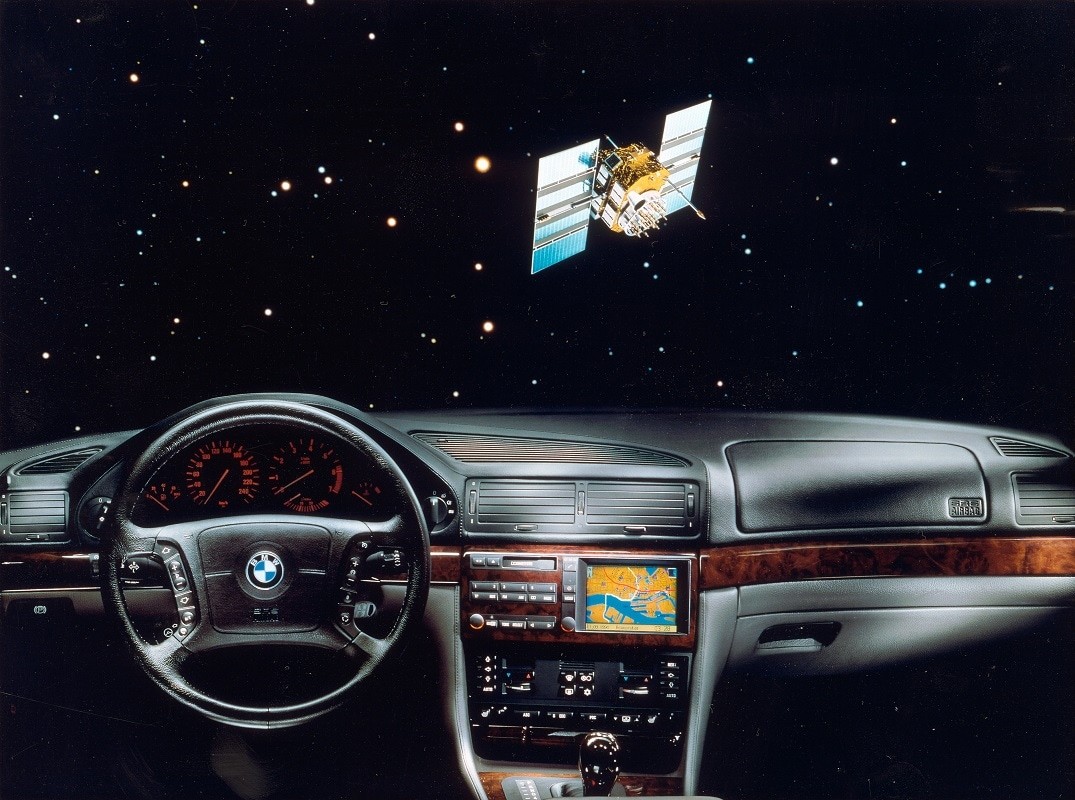
Delivery of digital maps began in 1984 with Tele Atlas, together with the University of Ghent. Tele Atlas’s map services were initially delivered through CDs, DVDs and in-dash navigation systems. The following year, Philips entered the realm of auto navigation with its embedded navigation system, Carin. At the time, GPS signals were scrambled by the US Army, making the public signal unreliable for road navigation. Early pioneers had to be creative: They used sensors in the car to determine relative positioning. Looking at the rotation of the wheels and position of the steering wheel, they were able to measure distance and direction.
With gains being made in navigation, the then mayor of Paris, the late Jacques Chirac, asked Carin’s development team to demonstrate their system. For the next two weeks, the team drove a small bus around the city. Overcoming real life scenarios - like the magnetic interference of the subway on the electronic compass - gave rise to new improvements, research and findings in location technology.
The game changer
Navigation continued to advance. In 1994, TomTom was making various navigation applications for minicomputers, aka, PDAs. Our main focus then was route planning – our most popular offering. We developed a bundle of software, maps and a GPS receiver that drivers could connect to their PDA. The user experience was a success – but it was not ready for the masses. By combining a touchscreen, GPS receiver, maps and software in one portable navigation device (PND), navigation became accessible for everyone and TomTom became synonymous with navigation.
Going from point A to B was now sorted, saving a lot of marriages along the way. The next step was to make every driver a local driver. With connected devices and real-time traffic across all roads, drivers gained control behind the wheel. The days of community input and floating car data had arrived – with TomTom HD Traffic leading the way.
While portable navigation was able to keep up with consumer demands, the embedded navigation system struggled, with map updates being particularly difficult. Portable devices were updated easily and inexpensively via the computer. In-dash systems moved from CDs and DVDs to memory cards and USB sticks, but the user experience was lacking.
Connectivity proved to be even trickier. The question was: should it be an embedded SIM card or tethering via the user’s phone? The former offered a seamless user experience, but was costly for the carmaker given the long lifespan of a car. The latter was attractive for carmakers’ procurement managers, but a nightmare for brand managers as it was complex from a user perspective.
In this day and age, embedded navigation systems are a must-have for many.
How people navigate today
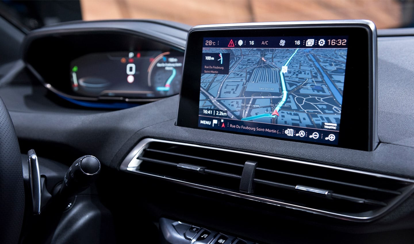
Today, embedded navigation systems are a must-have for many – and they are still advancing. Besides making driving more efficient, embedded navigation is proven to increase safety.
According to CARE, the EU road accident database, accident rates dropped the moment these systems became mainstream. Driving automation is taking these safety gains even further, relying on advanced driver-assistance systems (ADAS) maps that help the driver or the vehicle to look ahead and around the corner.
With maps that are updated over the air based on driving behavior and real-time traffic data, drivers have instant access to dynamic, constantly up-to-date information. It's no longer about getting from point A to point B – now it's which route is the fastest, safest and most efficient.
Today's navigation and mapping are also able to take different vehicle types - like commercial trucks with special heavy vehicle routing algorithms and motorbikes with winding route options - into account for route planning.
Navigation for tomorrow
One of the biggest catalysts to change the way we navigate is the smartphone. These ubiquitous devices bring an experience in the car that is still hard to match for carmakers: easy online search, always-on, up-to-date navigation and quick route calculation.
But this is just the start. Imagine a world where car and digital lives are connected. Where your car knows your destination as soon as you get into the driver’s seat, and can suggest the fastest, most efficient or scenic route based on personal preferences.
During the trip, you do not have to worry about charging your phone or it sliding off the dashboard. Large screens behind the steering wheel or projected on the windshield clearly show the way. And if equipped with a passenger display, other riders can search for restaurants along the route and send them to the driver’s display. Data from the fuel tank or battery pack combines directions to the lowest fuel prices or available fast chargers.
Upon arrival, suggestions for free parking spots with matching electric charging point appear. And payment for the parking and charge is done automatically.
Bringing that vision into tomorrow’s vehicles
So, what’s next for navigation? The safest, most efficient technology already exists. Can we keep topping ourselves? We believe the answer to that question is “yes” and we work every day to make driving even safer and more efficient. Integrating smartphone-like features into embedded navigation systems is a logical next step. This would make features like those described above accessible for everyone. Customizing and adapting to drivers’ needs is key to improving navigation: This is what moves us at TomTom.
Interested in how TomTom technologies can take navigation further? Contact us today.
People also read
)
From good to great: the next step in embedded navigation
)
The future of mobility is connected
)
Behind the map: how we keep our maps up to date
* Required field. By submitting your contact details to TomTom, you agree that we can contact you about marketing offers, newsletters, or to invite you to webinars and events. We could further personalize the content that you receive via cookies. You can unsubscribe at any time by the link included in our emails. Review our privacy policy.